Yellowstone Expedition of 1873

Last updated
Yellowstone Expedition of 1873
Part of the Sioux Wars
DateJune 20 – September 23, 1873
Location
Result United States Victory
Belligerents
Lakota Sioux Flag of the United States (1867-1877).svg  United States
Commanders and leaders
Sitting Bull
Crazy Horse
Gall
Rain in the Face
Flag of the United States (1863-1865).svg David S. Stanley
Flag of the United States (1863-1865).svg George A. Custer
Strength
~1000 Warriors 1,530 Soldiers
353 Civilians
Casualties and losses
4 killed, 12 wounded 11 killed, 4 wounded, 5 horses killed, ~90 mules killed

The Yellowstone Expedition of 1873 was an expedition of the United States Army in the summer of 1873 in Dakota Territory and Montana Territory, to survey a route for the Northern Pacific Railroad along the Yellowstone River. The expedition was under the overall command of Colonel David S. Stanley, with Lieutenant Colonel George A. Custer second in command. [1]

Contents

Participants

U.S. Army forces

Custer and units of the 7th Cavalry were part of the military column commanded by Colonel David S. Stanley accompanying the 1873 Northern Pacific Railway survey party surveying the north side of the Yellowstone River west of the Powder River in eastern Montana. Stanley's column consisted of a 1,530 man force of cavalry, infantry, and two artillery pieces (3" rifled Rodman guns), and 60 days' rations. It traveled out of Dakota Territory in June, 1873 with the 1,530 soldiers, 275 mule-drawn wagons, 353 civilians involved in the survey, and 27 Indian and mixed-blood scouts supporting the column. [2]

Native American forces

The Native American forces that fought against the expedition in Montana Territory were from the village of Sitting Bull, estimated at anywhere from 400 to 500 lodges with over 1000 Warriors. [3] It included Hunkpapa Sioux under Gall accompanied by the warchief Rain in the Face, Oglala Sioux under Crazy Horse, and Miniconjou and Cheyenne.

The Expedition Begins

The main expedition was ready and started from Fort Rice, Dakota Territory on June 20, 1873. The surveying party and six companies under Major E. F. Townsend, 9th Infantry had started four days earlier from Fort Abraham Lincoln on the Missouri River, being directed to travel west until the main command might overtake them. In the first seventeen days of marching it rained fourteen days, in some instances with three or four heavy rain-falls in twenty-four hours. After taking a day to cross the main command over the Heart River, Colonel Stanley received a report from Mr. Risser, the chief engineer, and Major Townsend, that on June 24, the surveying party and its escort had "been overtaken by a most furious hail-storm...in which men had barely escaped with their lives, and the animals stampeding on the march had broken up their wagons to such an extent as to completely cripple both engineers and escort." Stanley sent the remainder of the 7th Cavalry and the mechanic outfit ahead to the surveyors to help repair the damages, while the infantry stayed with the heavy wagon train. By July 1, the infantry and wagon train had crossed over the Muddy River, which was flooded approximately 60 feet wide, via a makeshift pontoon bridge of overturned wagon beds, designed by the chief commissary officer, Lieutenant P. H. Ray of the 8th Infantry. At this time Stanley sent 47 wagons back to Fort Rice for additional supplies. On July 5, the infantry escorting the wagons had caught up with the surveying party under Mr. Rosser, Major Townsend's Infantry detachment, and the 7th Cavalry under Lieutenant Colonel George A. Custer. The expedition pushed on, crossing the flooded Little Missouri River, and entering into Montana Territory, reaching the Yellowstone River, on July 13, 1873. Custer and two squadrons of cavalry then going across a rough trail, reached the mouth of Glendive Creek on the Yellowstone, there meeting the steamboat Key West, which had established a supply depot at that point. After Stanley reached the depot, he left two 7th Cavalry companies and one 17th Infantry company to guard it, and on July 26, had the Key West ferry troops and wagons over to the north bank of the Yellowstone. After traveling west, on August 1, Stanley's column met the Steamship Josephine under Captain Grant Marsh eight miles above the mouth of the Powder River. Captain William Ludlow of the engineers had brought the boat up with a supply of forage and some necessary clothing. That night the expedition had the first evidence of the presence of Indians, the camp guards firing on several during the night, and the trail of ten being plainly seen going up the valley the next morning, August 2. In marching up the left bank of the Yellowstone, an escort of one company of infantry and one of the 7th Cavalry took care of the surveying party, which aimed to follow the valley, while the wagon train had to take many detours, leaving the valley and crossing the plateaus where the river ran close the bluffs. [4]

Battle of Honsinger Bluff

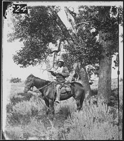
On Sunday, August 4, 1873, Stanley's column camped near the mouth of Sunday Creek, a tributary to the Yellowstone on the northeasterly end of Yellowstone Hill in present-day Custer County, Montana. Early on the morning of August 4, 1873 the column moved up the northwest side of the hill along the south fork of Sunday Creek. Captain George W. Yates with a company of the 7th Cavalry accompanied the surveyors along the southeast side of the hill along the Yellowstone River. George Custer, with Companies A and B of the 7th Cavalry under the command of Captain Myles Moylan scouted to the west ahead of Stanley's column. Custer's group consisted of 86 enlisted men, 4 officers, and Indian scouts. Custer's brother, First Lieutenant Thomas Custer, and his brother-in-law, First Lieutenant James Calhoun, accompanied him. [5]

Shots were exchanged with Sioux Warriors near the Yellowstone River early in the battle, and George Custer's men formed a skirmish line. A volley from the line distracted the pursuing Indians enough to halt the warriors' charge. Custer had Captain Moylan pull back his Company A to a wooded area previously occupied by Company A. [6] After reaching the wooded area, the cavalrymen dismounted, forming a semicircular perimeter along a former channel of the Yellowstone River. The usual configuration for dismounted cavalry was every fourth man holding horses, however, due to the length of the semicircular perimeter, only every eighth man was detailed to hold horses. [7] The bank of the dry channel served as a natural parapet.

The warrior's siege on the detachment of the 7th Cavalry continued for about three hours in reported 110 °F (43 °C) heat, when Custer's mounted soldiers burst from their wooded river position in a charge that scattered the Lakota Sioux forces, who fled upriver with Custer's men in pursuit. The soldiers pursued them for nearly four miles but were never able to close on them sufficiently to engage them. [8]

Battle of Pease Bottom

The Yellowstone Expedition continued west on the Yellowstone River throughout August, surveying along the way. On August 11, a sharp skirmish with Sitting Bull's warriors near the mouth of the Bighorn River at what later became known as Pease Bottom resulted in the death of Private John H. Tuttle and the critically wounding of First Lieutenant Charles Braden, both of the 7th Cavalry. Braden's thigh was shattered by an Indian bullet and the officer remained on permanent sick leave until his retirement from the army in 1878.

The Expedition Continues

After scouting along the Musselshell River, Colonel David S. Stanley and the Yellowstone Expedition made its ways back down the Yellowstone River and returned to Dakota Territory in late 1873, with the expedition ending on September 23, 1873.

Expedition Casualties

Colonel Staneley's expedition suffered 11 men killed, and 1 man wounded. Names of four of the killed: John Honsinger, 7th Cavalry senior veterinarian surgeon; Augustus Baliran, 7th Cavalry sutler; Private John Ball, 7th Cavalry; Private John H. Tuttle, Company E, 7th Cavalry; One of the wounded; First Lieutenant Charles Braden, 7th Cavalry. [9]

Native American casualties while fighting the Expedition were estimated to number 5 killed, with numerous other warriors and horses wounded. [10]

Aftermath

Lieutenant Colonel George A. Custer, Captain Thomas W. Custer, Captain George W. M. Yates, First Lieutenant James Calhoun, and Second Lieutenant Henry M. Harrington, 7th Cavalry officers accompanying the Yellowstone expedition were all killed during the Battle of the Little Bighorn, Montana on June 25, 1876. Captain Myles Moylan and Second Lieutenant Charles Varnum were also present but survived the battle. Moylan, four years later, was awarded the Congressional Medal of Honor for conspicuous bravery at the Battle of Bear Paw, Montana, on September 30, 1877, against the Nez Perce under Chief Joseph near present-day Havre, Montana. [11] Sitting Bull, Gall, Crazy Horse and Rain in the Face who all participated in the fighting against the Yellowstone Expedition of 1873 also participated in the Battle of the Little Big Horn.

The campaign resulted in the encirclement of the Sioux Lands reserved by the 1868 Treaty of Fort Laramie, putting the Lakota, Cheyenne, and Arapahoe in an unfavorable position for the upcoming Great Sioux War.

Order of battle

United States Army

-Totaling:

Native Americans

Officers Accompanying the Expedition

Literary references

Henry Wadsworth Longfellow's poem "Revenge of Rain in the Face" describes the clash that occurred between Rain in the Face and Captain Thomas Custer as a result of the Expedition.

See also

Related Research Articles

<span class="mw-page-title-main">7th Cavalry Regiment</span> United States Army cavalry regiment

The 7th Cavalry Regiment is a United States Army cavalry regiment formed in 1866. Its official nickname is "Garryowen", after the Irish air "Garryowen" that was adopted as its march tune. The regiment participated in some of the largest battles of the Indian Wars, including its famous defeat at the Battle of Little Bighorn, where its commander Lieutenant Colonel George A. Custer was killed.

<span class="mw-page-title-main">Yellowstone River</span> River in the western United States

The Yellowstone River is a tributary of the Missouri River, approximately 692 miles (1,114 km) long, in the Western United States. Considered the principal tributary of upper Missouri, via its own tributaries it drains an area with headwaters across the mountains and high plains of southern Montana and northern Wyoming, and stretching east from the Rocky Mountains in the vicinity of Yellowstone National Park. It flows northeast to its confluence with the Missouri River on the North Dakota side of the border, about 25 miles west of present-day Williston.

<span class="mw-page-title-main">Powder River Expedition (1865)</span>

The Powder River Expedition of 1865 also known as the Powder River War or Powder River Invasion, was a large and far-flung military operation of the United States Army against the Lakota Sioux, Cheyenne, and Arapaho Indians in Montana Territory and Dakota Territory. Although soldiers destroyed one Arapaho village and established Fort Connor to protect gold miners on the Bozeman Trail, the expedition is considered a failure because it failed to defeat or intimidate the Indians.

Henry Moore Harrington was a military officer in the 7th United States Cavalry Regiment who went missing in action during the Battle of Little Big Horn in Montana Territory.

<span class="mw-page-title-main">Battle of Powder River</span> 1876 battle of the Big Horn Expedition

The Battle of Powder River, also known as the Reynolds Battle, occurred on March 17, 1876, in Montana Territory, United States, as part of the Big Horn Expedition. The attack on a Northern Cheyenne and Oglala Lakota Indian encampment by Colonel Joseph J. Reynolds initiated the Great Sioux War of 1876. Although destroying a large amount of Indian property, the attack was poorly carried out and solidified Northern Cheyenne and Lakota Sioux resistance to the U.S. attempt to force them to sell the Black Hills and live on a reservation.

<span class="mw-page-title-main">Fort Keogh</span> United States Army outpost in eastern Montana

Fort Keogh is a former United States Army post located at the western edge of modern Miles City, in the U.S. state of Montana. It is situated on the south bank of the Yellowstone River, at the mouth of the Tongue River.

<span class="mw-page-title-main">Fort Reno (Wyoming)</span> United States historic place

Fort Reno also known as Fort Connor or Old Fort Reno, was a wooden fort established on August 15, 1865 by the United States Army in Dakota Territory in present-day Johnson County, Wyoming. The fort was built to protect travelers on the Bozeman Trail from Native American tribes.

The Black Hills Expedition was a United States Army expedition in 1874 led by Lieutenant Colonel George Armstrong Custer that set out on July 2, 1874, from Fort Abraham Lincoln, Dakota Territory, which is south of modern day Mandan, North Dakota, with orders to travel to the previously uncharted Black Hills of South Dakota. Its mission was to look for suitable locations for a fort, find a route to the southwest, and to investigate the possibility of gold mining. Custer and his unit, the 7th Cavalry, arrived in the Black Hills on July 22, 1874, with orders to return by August 30. The expedition set up a camp at the site of the future town of Custer; while Custer and the military units searched for a suitable location for a fort, civilians searched for gold, and it is disputed whether or not any substantial amount was found. Nonetheless, this prompted a mass gold rush which in turn antagonised the Sioux Indians who had been promised protection of their sacred land through Treaties made by the US government, and who were later to kill Custer at the Battle of the Little Big Horn in the Great Sioux War of 1876–1877 between themselves and the United States.

<span class="mw-page-title-main">Montana Territory in the American Civil War</span> Civil War role of the future U.S. state of Montana

The area that eventually became the U.S. state of Montana played little direct role in the American Civil War. The closest the Confederate States Army ever came to the area was New Mexico and eastern Kansas, each over a thousand miles away. There was not even an organized territory using "Montana" until the Montana Territory was created on May 26, 1864, three years after the Battle of Fort Sumter. In 1861, the area was divided between the Dakota Territory and the Washington Territory, and in 1863, it was part of the Idaho Territory.

The Battle of Honsinger Bluff was a conflict between the United States Army and the Sioux people on August 4, 1873 along the Yellowstone River near present-day Miles City, Montana. This was U.S. territory acquired from the Crows in 1868. The main combatants were units of the U.S. 7th Cavalry under Lt. Col. George Armstrong Custer, and Native Americans from the village of the Hunkpapa medicine man, Sitting Bull, many of whom would clash with Custer again approximately three years later at the Battle of the Little Big Horn in the Crow Indian Reservation.

Fort Custer was established during the Indian wars in the Department of Dakota by the U.S. Army to subjugate the Sioux, Cheyenne and Crow Indians near present-day Hardin, Montana. The post was named for General George Armstrong Custer who died at the Battle of the Little Big Horn.

<span class="mw-page-title-main">Thomas Mower McDougall</span> United States Army officer (1845–1909)

Thomas Mower McDougall was an officer in the United States Army. The salient point in his military career occurred when he took part in the Battle of the Little Bighorn, surviving because he and his unit was not with George Armstrong Custer and the main body of the 7th Cavalry Regiment. Early on the day of battle, McDougall's Company B was assigned to escort the regiment's pack train, but the mules were not used to carrying packs and lagged far behind the other three detachments under Custer, Reno, and Benteen as they went into combat. After viewing the Indian village, and being surprised by its size, Custer sent two urgent orders to bring the mules with the ammunition packs to his detachment of five companies, but by the time these messengers reached Captain McDougall the distance between the pack train and Custer made this order difficult if not impossible to comply with, though a debate on this topic remains to this day.

<span class="mw-page-title-main">Crow scouts</span> Military unit

Crow Scouts worked with the United States Army in several conflicts, the first in 1876 during the Great Sioux War. Because the Crow Nation was at that time at peace with the United States, the army was able to enlist Crow warriors to help them in their encroachment against the Native Americans with whom they were at war. In 1873, the Crow called for U.S. military actions against the Lakota people they reported were trespassing into the newly designated Crow reservation territories.

This is a timeline of pre-statehood Montana history comprising substantial events in the history of the area that would become the State of Montana prior to November 8, 1889. This area existed as Montana Territory from May 28, 1864, until November 8, 1889, when it was admitted to the Union as the State of Montana.

<i>Far West</i> (steamship)

Far West was a shallow draft sternwheel steamboat plying the upper Missouri and Yellowstone Rivers in the Dakota and Montana Territories, in the years from 1870 to 1883. By being involved in historic events in the Indian Wars of the western frontier, the Far West became an iconic symbol of the shallow draft steamboat plying the upper Missouri and Yellowstone Rivers in the era before railroads dominated transport in these areas.

The Big Horn Expedition, or Bighorn Expedition, was a military operation of the United States Army against the Lakota Sioux and Cheyenne Indians in Wyoming Territory and Montana Territory. Although soldiers destroyed one Northern Cheyenne and Oglala Lakota village at the Battle of Powder River, the expedition solidified Lakota Sioux and Northern Cheyenne resistance against the United States attempt to force them to sell the Black Hills and live on a reservation, beginning the Great Sioux War of 1876.

<span class="mw-page-title-main">Myles Moylan</span> American Army officer (1838–1909)

Myles Moylan was a United States Army officer with an extensive military career, which included the battle of Gettysburg, and the battle of the Little Bighorn. He was awarded the Medal of Honor for his gallantry in leadership at the Battle of Bear Paw. He also participated in the Washita Massacre and Wounded Knee Massacre.

The Battle of Pease Bottom, also called the Battle of the Bighorn River was a conflict between the United States Army and the Sioux on August 11, 1873, along the Yellowstone River opposite the mouth of the Bighorn River near present-day Custer, Montana. The main combatants were units of the 7th U.S. Cavalry under Lieutenant Colonel George Armstrong Custer, and Native Americans from the village of the Hunkpapa medicine man, Sitting Bull, many of whom would clash with Custer again approximately three years later at the Battle of the Little Big Horn in the Crow Indian Reservation.

John A. Haydon was an American surveyor and civil engineer. As a self-taught civil engineer, Haydon made significant contributions to American railroading. Haydon's railroad career spanned the Baltimore and Ohio railroad expansion to the Ohio river in 1853 and several other railroads to the last transcontinental railroad, the Northern Pacific railway. Haydon led the 1872 Yellowstone River expedition, where he faced a Sioux Indian skirmish led by Sitting Bull, Red Cloud and Crazy Horse at the Battle of Pryor's Creek, Montana. He also served as a captain in the Confederate Army Corps of Engineers under Generals Tilghman and Beauregard; captured at the battle of Fort Henry, early in the Civil War in 1862, he was paroled at Aiken, South Carolina, in November 1862 to serve the rest of the war, including the Richmond–Petersburg Campaign. In the latter part of his life, he worked locating branch railroads such as the Pennsylvania railroad in Maryland and for the Western Maryland railroad.

<span class="mw-page-title-main">Arikara scouts</span> Military unit

Arikara scouts were enlisted men from the Arikara Nation serving in the U.S. Army at different frontier posts in present-day North Dakota from 1868 to 1881. The enlistment period was six months with re-enlistment possible. Each scout received a uniform, firearm and drew rations. Scout duties ranged from carrying mail between commands to tracking down traditional enemies perceived as hostile by the Army in far ranging military campaigns. Detailed to secure the horses in located enemy camps, the scouts were often the first to engage in battle. The Arikara took part when the Army protected survey crews in the Yellowstone area in the early 1870s. They participated in the Great Sioux War of 1876 and developed into Colonel George Armstrong Custer's "… most loyal and permanent scouts …".

References

  1. Lubetkin, M. John (2006). Jay Cooke's Gamble: The Northern Pacific Railroad, The Sioux, and the Panic of 1873. Norman, Oklahoma, USA: University of Oklahoma Press. ISBN   0-8061-3740-1.
  2. Lubetkin, M. John, Jay Cooke's Gamble: The Northern Pacific Railroad, The Sioux and the Panic of 1873, University of Oklahoma Press, Norman, OK, 2006 p.187
  3. Lubetkin, M. John, Clash on the Yellowstone, Research Review: The Journal of the Little Big Horn Associates, Vol. 17, No. 2, Summer, 2003, p. 17
  4. Stanley, David S. (1874). Report on the Yellowstone Expedition of 1873. Washington, D.C.: Government Printing Office.
  5. Lubetkin, Jay Cooke's Gamble, supra, at 242
  6. Lubetkin, Jay Cooke's Gamble, supra, at 246
  7. Lubetkin, Jay Cook's Gamble, supra at 246
  8. Lubetkin, Jay Cook's Gamble, supra at 247
  9. Brown, Mark H., Plainsmen of the Yellowstone, G.P. Putnam's Sons, New York 1961, p. 206
  10. Brown, supra at 206
  11. "Medal of Honor Recipients".

Further reading

Lubetkin, M. John, Jay Cooke's Gamble: The Northern Pacific Railroad, The Sioux, and the Panic of 1873, University of Oklahoma Press, Norman, Oklahoma 2006 ISBN   0-8061-3740-1