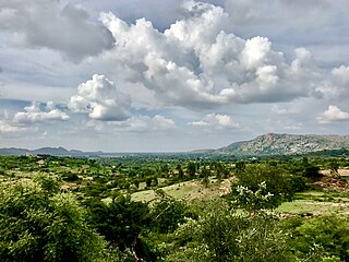
Malur is a town and taluk headquarters in Kolar district of the Indian state of Karnataka. It is 30 km from Kolar, the district headquarters, and about 25 km from Bangalore. It is accessible from Bangalore by road and railways. The Chennai Central-Bangalore City line passes through Malur, with trains to various parts of India, including Tirupati, Chennai, Kochi, Trivandrum, Patna and Calcutta.
Bangalore Rural district is one of the 31 districts in Karnataka, India. It was formed in 1986, when Bangalore District was divided into Bangalore Rural and Bangalore Urban. Presently in Bangalore Rural district, there are 4 talukas: Devanahalli, Nelamangala, Doddaballapura, Hoskote. It has 20 hoblies, 294 villages, 3 towns, 2 tier-three cities, administered by 66 Village Panchayats , 3Town Municipal Councils (Purasabes) and 2 City Municipal Councils (Nagarsabes).

Gottigere is a suburb in the southern periphery of Bangalore city, along Bannerghatta Road in the Indian state of Karnataka. It is surrounded by the famous NICE Road and smaller areas like Basavanapura and Kalena Agrahara. It has been named after "Gottigere lake" which is near NICE Road. This area has seen fast growth due to many IT companies establishment near Bannerghatta Road & Electronic city.

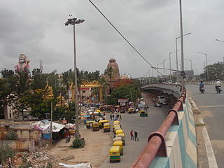
Hosakote is a taluk or city in Bangalore Rural District, India. Headquartered at the Hosakote town, it consists of five hoblis - Kasaba, Anugondanahalli, Jadigenahalli, Nandagudi and Sulibele. There are 294 villages in Hoskote taluk including the 5 hoblis. Also famous for Dum Biriyani's which is unique in taste.

Krishnarajapuram often abbreviated as K R Puram or K R Pura, is a neighborhood of in North-Eastern Bangalore, the capital of the Indian state of Karnataka. It is one of the zones of BBMP. It is located 15 km (9.3 mi) from Bangalore City railway station. The Old Madras Road passes through this locality. A lake called 'Vengayyana Lake' is in the heart of this area. The Yele Mallappa Shetty Lake near Medahalli, situated just outside the eastern limits of KR Pura, is one of the largest lakes in Bangalore.
Alahalli is a village in the southern state of Karnataka, India. It is located in the Bangalore South taluk of Bangalore Urban district in Karnataka.
Chikkabanavara is a town in Bengaluru, Karnataka, India. It is located in the Bangalore North taluk of Bangalore Urban district in Karnataka. It has one of the oldest surviving lakes in Bangalore. The lake is located at a distance of 1.5 km north of Chikkabanavara railway station on the Bangalore-Tumkur railway line.

Kaggalipura is a village along Kanakapura Road on the outskirts of Bangalore, in the southern state of Karnataka, India. Kaggalipura is located on the Bangalore-Coimbatore National Highway 948, around 20 km south of Bangalore. The village is named after the Kaggali tree, which grows in abundance locally. The village was established after clearing several Kaggali trees from the area, hence the name Kaggalipura.
Konappana Agrahara is a village in the southern state of Karnataka, India. It is located in the Bangalore South taluk of Bangalore Urban district in Karnataka. This area is within Electronic City and is adjacent to Infosys Limited and Hewlett Packard. As of 2001 India census, Konappana Agrahara had a population of 11038 with 6659 males and 4379 females.

Sarjapura is a small town situated in Bangalore, Karnataka, India. It is a hobli of Anekal taluk, Bangalore Urban district and is located towards the south-east of Bangalore. It is one of the industrial areas in Anekal taluk, with others being Attibele, Bommasandra, Chandapura, Electronic City and Jigani.
Thanisandra was a village in the southern state of Karnataka, India. It was located in the Bangalore East taluk of Bangalore Urban district in Karnataka. Thanisandra area is slated for development with the expansion of the main road as an alternative road to Bangalore International Airport.
Ullalu is a village in the southern state of Karnataka, India. It is located in the Bangalore North taluk of Bangalore Urban district in Karnataka. As of 2001 India census, Ullalu had a population of 6851 with 3539 males and 3312 females.
Abbigere is a village in the southern state of Karnataka, India. It is located in the Bangalore North taluk of Bangalore district in Karnataka.
Agara Bangalore is a panchayat village in the southern state of Karnataka, India. It is located in the Bangalore South taluk of Bangalore Urban district in Karnataka, on Outer Ring Road, near Koramangala and HSR Layout. The Agara Bus Stop connects Koramangla with ITPL, Varthur, etc. Agara is visited for its Oriyan temple, Agara Lake, Ayyappa Temple & Aanjaneya Temple. After winning the Sreerangapattana war, the British moved their army to Banaglore. In British times, it was one of the biggest army cantonments in south Asia. Madras Engineer Groups was operating from Agara.

Bangalore, officially Bengaluru, is the capital and largest city of the southern Indian state of Karnataka. It has a population of more than 8 million and a metropolitan population of around 15 million, making it India's third most populous city and fourth most populous urban agglomeration. It is the most populous city and largest urban agglomeration in South India, and is the 27th largest city in the world. Located on the Deccan Plateau, at a height of over 900 m (3,000 ft) above sea level, Bangalore has a pleasant climate throughout the year, with its parks and green spaces earning it the reputation of India's "Garden City". Its elevation is the highest among India's major cities.
Aladahalli is a village in the southern state of Karnataka, India. It is located in the Nelamangala taluk of Bangalore Rural district.
Halenahalli is a village in the southern state of Karnataka, India. It is located in the Nelamangala taluk of Bangalore Rural district.
Dasenahalli is a village in the southern state of Karnataka, India. It is located in the Nelamangala taluk of Bangalore Rural district.
Maddenahalli is a village in the southern state of Karnataka, India. It is located in the Nelamangala taluk of Bangalore Rural district.
Pemmanahalli is a village in the southern state of Karnataka, India. It is located in the Nelamangala taluk of Bangalore Rural district.

