Yunak, Bulgaria

Last updated
Yunak
Village
Country Flag of Bulgaria.svg  Bulgaria
Province Varna Province
Municipality Avren
Time zone EET (UTC+2)
  Summer (DST) EEST (UTC+3)

Yunak is a village in the municipality of Avren, in Varna Province, northeastern Bulgaria. [1]

Avren Municipality Municipality in Varna, Bulgaria

Avren Municipality is a seaside municipality (obshtina) in Varna Province, Northeastern Bulgaria. It is named after its administrative centre – the village of Avren.

Varna Province Province in Bulgaria

Varna Province is a province in eastern Bulgaria, onе of the 28 Bulgarian provinces. It comprises 12 municipalities with a population, in April 2016, of 494,216 inhabitants. The province is named after its administrative centre, Varna.

Bulgaria country in Southeast Europe

Bulgaria, officially the Republic of Bulgaria, is a country in Southeast Europe. It is bordered by Romania to the north, Serbia and North Macedonia to the west, Greece and Turkey to the south, and the Black Sea to the east. The capital and largest city is Sofia; other major cities are Plovdiv, Varna and Burgas. With a territory of 110,994 square kilometres (42,855 sq mi), Bulgaria is Europe's 16th-largest country.

Honours

Yunak Peak on Brabant Island, Antarctica is named after the village.

Yunak Peak

Yunak Peak is the ice-covered peak of elevation 600 m at the southeast extremity of Gutsal Ridge in Stribog Mountains on Brabant Island in the Palmer Archipelago, Antarctica. It has steep and partly ice-free southwest and south slopes, and surmounts Buls Bay to the southeast and Hippocrates Glacier to the west.

Brabant Island second largest island of the Palmer Archipelago within the British Antarctic Territory

Brabant Island is the second largest island of the Palmer Archipelago within the British Antarctic Territory, lying between Anvers Island and Liège Island. Brabant Island is 59 km (37 mi) long north-south, 30 km (19 mi) wide, and rises to 2,520 m (8,268 ft) in Mount Parry. The interior of the island is occupied by two mountain ranges, Solvay Mountains in its southern part and Stribog Mountains in its central and northern parts.

Related Research Articles

Eliseina is a village in Mezdra Municipality in Vratsa Province, northwestern Bulgaria. As of 2015 it has 390 inhabitants. The village is situated on the northern slopes of Stara Planina in a region rich in copper, lead and zinc deposits. There is a small copper smelter near the village.

Loznitsa Place in Razgrad, Bulgaria

Loznitsa is a small town in northeastern Bulgaria, part of Razgrad Province, located in the geographic region of Ludogorie. It is the administrative centre of the homonymous Loznitsa Municipality, which lies in the southernmost part of the Province. As of December 2009, the town has a population of 2,409 inhabitants.

Kriva bara, Montana Province Village in Montana, Bulgaria


Kriva bara is a village in northwestern Bulgaria. It is located in the Brusartsi Municipality of the Montana Province.

Lyulyakovo is a village in Ruen Municipality, in Burgas Province, in southeastern Bulgaria, which has a train stop on the Sindel (village)-Karnobat railway, served only by passenger trains.

Zvezda is a village in Ruen Municipality, in Burgas Province, in southeastern Bulgaria.

Fakiya is a village in Sredets Municipality, in Burgas Province, in southeastern Bulgaria.

Bobovets is a village in Balchik Municipality, Dobrich Province, northeastern Bulgaria.

Malka Smolnitsa is a village in the municipality of Dobrichka, in Dobrich Province, in northeastern Bulgaria.

Orlova mogila is a village in the municipality of Dobrichka, in Dobrich Province, in northeastern Bulgaria.

Smolnitsa is a village in the municipality of Dobrichka, in Dobrich Province, in northeastern Bulgaria.

Ograzhden is a village in the General Toshevo Municipality, Dobrich Province, northeastern Bulgaria.

Efreytor Bakalovo is a village in the municipality of Krushari, in Dobrich Province, in northeastern Bulgaria.

Kramolin is a village in the municipality of Sevlievo, in Gabrovo Province, in northern central Bulgaria.

Mladen (village) is a village in the municipality of Sevlievo, in Gabrovo Province, in northern central Bulgaria.

Oreshino is a village in the municipality of Ivaylovgrad, in Haskovo Province, in southern Bulgaria. It was known as "Kozluca" before 1934

Machali is a village in Belgaum district in Karnataka, India.

Dabravino is a village in the municipality of Avren, in Varna Province, Bulgaria.

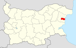
Kazashka Reka is a village in the municipality of Avren, in Varna Province, northeastern Bulgaria.

Yunak Stadium

Yunak Stadium, was a multi-use stadium in central Sofia, Bulgaria. It was located at the north-western corner of Knyaz Boris's Garden, on the southern bank of the Perlovska river. It was the largest stadium in Bulgaria until the middle of the 20th century, with a capacity of 35,000 spectators, and was initially used as the main stadium for Bulgaria national football team matches. The pitch was almost exactly square-shaped, with four straight rows of stands on all sides.

The 1949 Bulgarian Cup was the 9th season of the Bulgarian Cup. Levski Sofia won the competition, beating CSKA Sofia 2–1 in the 2nd replay after a 1–1 draw in the final and 2–2 draw in the 1st replay.

References

  1. Guide Bulgaria, Accessed 4 October 2011

Coordinates: 43°05′N27°36′E / 43.083°N 27.600°E / 43.083; 27.600

Geographic coordinate system Coordinate system

A geographic coordinate system is a coordinate system that enables every location on Earth to be specified by a set of numbers, letters or symbols. The coordinates are often chosen such that one of the numbers represents a vertical position and two or three of the numbers represent a horizontal position; alternatively, a geographic position may be expressed in a combined three-dimensional Cartesian vector. A common choice of coordinates is latitude, longitude and elevation. To specify a location on a plane requires a map projection.