Yurol railway station

Last updated

Yurol
General information
LocationElm Street, Cooroy
Australia
Owned by Queensland Rail
Line(s) North Coast
Distance134.49 kilometres from Central
Platforms1
Tracks2
Construction
Structure typeGround
Other information
Statusabandoned
History
Opened1912
Closed1963
Rebuilt1931 (major expansion)
Electrified1915 (Telegraph)
1925 (whole site) [1] [2]
Services
Preceding station QRLogoSmall.png Queensland Rail Following station
Cooroy
towards Brisbane
North Coast Line Pomona
towards Gympie North
Yurol railway station
Australia Queensland location map.svg
Red pog.svg
Location of Yurol railway station in Queensland
Australia location map.svg
Red pog.svg
Yurol railway station (Australia)
LocationElm Street, Cooroy, Shire of Noosa, Queensland, Australia
Coordinates 26°23′37″S152°53′11″E / 26.3937°S 152.8864°E / -26.3937; 152.8864
Design period1912
Built1912
Built forDepartment of Railways
ArchitectOffice of the Chief Engineer of Queensland Rail
Owner Queensland Government

Yurol railway station is a former railway station at on Elm Street, Cooroy, Shire of Noosa, Queensland, Australia. It is on the North Coast railway line serving the area of Yurol. It was designed by the Office of the Chief Engineer of Queensland Rail and upgraded by the Department of Railways including a siding and level crossing in 1915 following its original construction in 1912 with significant input from the Noosa Council. [3] [4] Originally called Thorley's Siding it was renamed to Yurol Siding in 1915 and was equipped with interlocking gear and used as a Telegraph station. [5]

Contents

History

Ordinally called Thorley's Siding from 1912, it was renamed to Yurol Siding in 1915. [5] The name 'Yurol' was approved by the Queensland Government on 23 May 1913 and means "Scrub Vine". [6] The permanently staffed facility was equipped with interlocking gear and used as a Telegraph station prior to the telegraph station being installed at the Cooroy railway station. [5]

On 25 November 1919, at 3:25am an empty goods carriage derailed with only a minor interruption to the mainline. [7]

In 1925, the disused night officers building at the North Arm train station was moved to Yurol for use by the rail gang that was preparing the site for electricity. [2]

On 9 October 1929, the Noosa Council insisted that the road connecting Cooroy to the new station not include a level crossing due to the dangers associated with them. However the Chief Engineer said as part of the works two roads would be constructed from the Six Mile Creek Bridge to the station and include a direct road between Cooroy and Pomona which is now Yurol Forest Drive. [4]

On 11 October 1929, a notice for the resumption of land was posted in the Noosa Advocate and Cooroora Advertiser regarding land resumptions for the new railway station at the existing Yurol Siding. [4] Yurol station was located approximately 3.5 kilometres north of the Cooroy railway station along the North Coast Line and serviced the area of Yurol, which is now an extension of greater Cooroy. The site location is the south entrance into the Yurol Forest which in part is now part of the Tewantin National Park. The railway station land was resumed from the Yurol station, with an agreement that a level crossing be made for the dwelling occupants on what would become Elm Street. [4]

On 2 June 1931, the Minister for Railways Godfrey Morgan, MLA, announced the upgrade of Yurol Siding to include a formal railway station for public use. This also including a level crossing for access from Cooroy. [8]

On 10 June 1933, the Evening News of Rockhampton reported that train jumpers had increased at the Pomona railway station and the Yurol station. [9]

On 29 December 1933, subsiding took place under the track just north of the station due to heavy rain. This resulted in the temporary closure of the North Coast Line and a passenger train being held in Eumundi. A goods train travelling north was stopped at Cooroy for waggons of ashes to be added at the front to be used in repairing the line. [10]

By 1935 the station and siding was a major part of the rail network as sleepers were made onsite and transported around the South East for use in construction of the greater state-wide rail network. [11]

Between 1940-41 permanently staffed stations were established for better use of the railway resulting in the closure of Yurol station for public use. Up until this point, Yurol was however already a staffed station. [12]

The signals were removed in 1945 and operated as only a siding.

On 28 February 1950, 50 yards of the line subsided due to heavy rain. [13]

See also

Related Research Articles

<span class="mw-page-title-main">Cooroy, Queensland</span> Town in Queensland, Australia

Cooroy is a rural town and locality in the Shire of Noosa, Queensland, Australia. In the 2021 census, the locality of Cooroy had a population of 4,801 people.
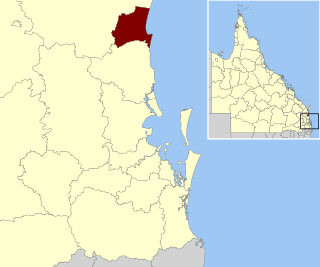
<span class="mw-page-title-main">Shire of Noosa</span> Local government area in Queensland, Australia

The Shire of Noosa is a local government area about 130 kilometres (81 mi) north of Brisbane in the Sunshine Coast district of South East Queensland, Australia. The shire covers an area of 870 square kilometres (335.9 sq mi). It existed as a local government entity from 1910 until 2008, when it was amalgamated with the Shire of Maroochy and City of Caloundra to form the Sunshine Coast Region. The shire was re-established on 1 January 2014. In the 2021 census, the shire had a population of 56,298 people.

<span class="mw-page-title-main">Catch points</span> Railway points used as safety devices

Catch points and trap points are types of points which act as railway safety devices. Both work by guiding railway carriages and trucks from a dangerous route onto a separate, safer track. Catch points are used to derail vehicles which are out of control on steep slopes. Trap points are used to protect main railway lines from unauthorised vehicles moving onto them from sidings or branch lines. Either of these track arrangements may lead the vehicles into a sand drag or safety siding, track arrangements which are used to safely stop them after they have left the main tracks.
<span class="mw-page-title-main">Noosa District State High School</span> State high school

Noosa District State High School is a twin campus high school based in Cooroy and Pomona in the Shire of Noosa, Queensland, Australia.

<span class="mw-page-title-main">Pomona, Queensland</span> Town in Queensland, Australia

Pomona is a rural town and locality in the Shire of Noosa, Queensland, Australia. It is about 135 kilometres north of Brisbane. The town was originally called Pinbarren Siding from 1890-1900 as a subsidiary to Pinbarren. In the 2021 census, the locality of Pomona had a population of 2,931 people.

<span class="mw-page-title-main">Cooran railway station</span> Railway station in Queensland, Australia

Cooran railway station is located on the North Coast line in Queensland, Australia. It serves the town of Cooran in the Shire of Noosa.

<span class="mw-page-title-main">Nambour railway station</span> Railway station in Queensland, Australia

Nambour railway station is located on the North Coast line in Queensland, Australia. It serves the town of Nambour in the Sunshine Coast Region.

<span class="mw-page-title-main">Cooroy railway station</span> Historic railway station in Queensland, Australia

Cooroy railway station is a heritage-listed railway station at 14 Myall Street, Cooroy, Shire of Noosa, Queensland, Australia. It is on the North Coast railway line serving the town of Cooroy. It was designed by the Office of the Chief Engineer of Queensland Rail and built in 1890 by Fitzwilliam Williams. It opened on 17 July 1891 with the opening of the line from Cooran. It was added to the Queensland Heritage Register on 14 August 2008.
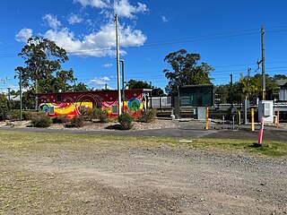
<span class="mw-page-title-main">Pomona railway station</span> Railway station in Queensland, Australia

Pomona railway station is a railway station on Factory Street, Pomona, Shire of Noosa, Queensland, Australia. It is on the North Coast railway line serving the town of Pomona. It was designed by the Office of the Chief Engineer of Queensland Rail and built and opened in 1891 by Fitzwilliam Williams. Originally called Pinbarren Siding from 1891, the location was renamed to Pinbarren railway station in 1897 and then to its current name Pomona railway station in 1900.

<span class="mw-page-title-main">South Coast railway line, Queensland</span> Former railway line in Queensland, Australia

The South Coast railway line was a railway from Brisbane, the capital city of Queensland, Australia. The route via the South Coast to Tweed Heads on the border of Queensland and New South Wales. The line operated from 1889 to 1964. Between 1903 and 1961 steam trains ran from Beenleigh to the NSW border. The Gold Coast railway line re-opened in 1996 along a modified alignment in the north and a new route south but does not extend as far south yet as the South Coast line.
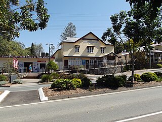
<span class="mw-page-title-main">Cooran, Queensland</span> Town in Queensland, Australia

Cooran is a rural hinterland town and locality in the Shire of Noosa, Queensland, Australia. In the 2021 census, the locality of Cooran had a population of 1,756 people.

Black Mountain is a rural locality in the Shire of Noosa, Queensland, Australia. In the 2021 census, Black Mountain had a population of 1,560 people.

Ringtail Creek is a rural locality in the Shire of Noosa, Queensland, Australia. In the 2021 census, Ringtail Creek had a population of 203 people.

Cootharaba is a rural locality in the Shire of Noosa, Queensland, Australia. In the 2021 census, Cootharaba had a population of 866 people.

<span class="mw-page-title-main">Eerwah Vale, Queensland</span> Suburb of Sunshine Coast, Queensland, Australia

Eerwah Vale is a locality split between the Sunshine Coast Region and Shire of Noosa, both in Queensland, Australia. In the 2021 census, Eerwah Vale had a population of 671 people.

<span class="mw-page-title-main">Traveston</span> Town in Queensland, Australia

Traveston is a rural town and locality in the Gympie Region, Queensland, Australia. In the 2021 census, the locality of Traveston had a population of 509 people.

<span class="mw-page-title-main">Pomona Police Station and Court House</span> Historic site in Queensland, Australia

The Pomona Police Station and Court House is a heritage-listed former police station at Red Street, Pomona, Shire of Noosa, Queensland, Australia. It was built in 1934. It was added to the Queensland Heritage Register on 27 May 2005.

Tandur is a rural locality in the Gympie Region, Queensland, Australia. In the 2021 census, Tandur had a population of 188 people.

The King of the Mountain is an annual mountain climb race held in Pomona, in the Australian state of Queensland and organised by the Cooroy-Pomona Lions Club. Since its first formal race in 1959 following a bet in the Railway Hotel in 1958, the race has become a local holiday involving the district schools and a carnival like atmosphere.

Noosa District State High School – Pomona Campus is a high school based in Pomona in the Shire of Noosa, Queensland, Australia. It is the junior campus of Noosa District State High School.

References

  1. "Cooroy Notes - Electric Staff System Fails". Trove.nla.gov.au.
  2. 1 2 "Removing building". Nambour Chronicle and North Coast Advertiser. 14 August 1925.
  3. "Siding for Yurol". Noosa Advocate and Cooroora Advertiser. 2 January 1931.
  4. 1 2 3 4 "Deviation Yurol". Noosa Advocate and Cooroora Advertiser. 11 October 1929.
  5. 1 2 3 "District News - Cooroy". Gympie Times and Mary River Mining Gazette. 22 May 1915.
  6. "Names for Railway stations". Brisbane Courier. 23 May 1913.
  7. "A carriage derailed".
  8. "Siding for Yurol". Noosa Advocate and Cooroora Advertiser. 2 January 1931.
  9. "Train jumpers increase".
  10. "Line Subsides on North Coast". Courier-Mail. 30 December 1933.
  11. "Country News - Cooroy". Courier-Mail. 2 February 1935.
  12. "Country Centres - Cooroy".
  13. "North Coast Trains on move again". Brisbane Telegraph. 28 February 1950.