Tarnów Voivodeship was a unit of administrative division and local government in Poland in years 1975–1998, superseded by a much larger Lesser Poland Voivodeship. Its capital city was Tarnów. Located in southeastern part of the country, its area was 4,151 km2.. In 1975 the population was 577,900, in 1998 it grew to 700,800.

Nowy Sacz Voivodeship was a unit of administrative division and local government, located in southern Poland in the years 1975–1998, superseded by Lesser Poland Voivodeship. Its capital city was Nowy Sącz.

Podhale is Poland's southernmost region, sometimes referred to as the "Polish highlands". The Podhale is located in the foothills of the Tatra range of the Carpathian mountains.

Krynica-Zdrój is a town in Nowy Sącz County, Lesser Poland Voivodeship, Poland. It is inhabited by over eleven thousand people. It is the biggest spa town in Poland often called the Pearl of Polish Spas; and a popular tourist and winter sports destination situated in the heart of the Beskids mountain range.
The 2001 Winter Universiade, the XX Winter Universiade, took place in Zakopane, Poland.

Bíbrka is a town in western Ukraine, located in Peremyshliany Raion of Lviv Oblast (region) about 29 km southeast of Lviv on H09. Its population is approximately 3,817 (2017 est.).
Wieniec is a village located in Lesser Poland, Poland.
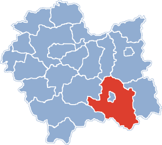
Gmina Dębno is a rural gmina in Brzesko County, Lesser Poland Voivodeship, in southern Poland. Its seat is the village of Dębno, which lies approximately 8 kilometres (5 mi) east of Brzesko and 57 km (35 mi) east of the regional capital Kraków.

Cikowice is a village in the administrative district of Gmina Bochnia, within Bochnia County, Lesser Poland Voivodeship, in southern Poland. It lies approximately 5 kilometres (3 mi) west of Bochnia and 32 km (20 mi) east of the regional capital Kraków.

Dąbrowica is a village in the administrative district of Gmina Bochnia, within Bochnia County, Lesser Poland Voivodeship, in southern Poland.

Damienice is a village in the administrative district of Gmina Bochnia, within Bochnia County, Lesser Poland Voivodeship, in southern Poland. It lies approximately 3 kilometres (2 mi) west of Bochnia and 35 km (22 mi) east of the regional capital Kraków.
Grabina is a village in the administrative district of Gmina Bochnia, within Bochnia County, Lesser Poland Voivodeship, in southern Poland.
Gwoździec is a village in the administrative district of Gmina Zakliczyn, within Tarnów County, Lesser Poland Voivodeship, in southern Poland. It lies approximately 7 kilometres (4 mi) north-west of Zakliczyn, 25 km (16 mi) south-west of Tarnów, and 62 km (39 mi) east of the regional capital Kraków.
Witanowice is a village in the administrative district of Gmina Tomice, within Wadowice County, Lesser Poland Voivodeship, in southern Poland. It lies approximately 6 kilometres (4 mi) north-east of Tomice, 7 km (4 mi) north-east of Wadowice, and 32 km (20 mi) south-west of the regional capital Kraków.
Byszyce is a village in the administrative district of Gmina Wieliczka, within Wieliczka County, Lesser Poland Voivodeship, in southern Poland. It lies approximately 8 kilometres (5 mi) south-west of Wieliczka and 16 km (10 mi) south of the regional capital Kraków.
Chorągwica is a village in the administrative district of Gmina Wieliczka, within Wieliczka County, Lesser Poland Voivodeship, in southern Poland. It lies approximately 5 kilometres (3 mi) south of Wieliczka and 17 km (11 mi) south-east of the regional capital Kraków.
Mietniów is a village in the administrative district of Gmina Wieliczka, within Wieliczka County, Lesser Poland Voivodeship, in southern Poland. It is approximately 4 kilometres (2 mi) south of Wieliczka and 16 km (10 mi) southeast of the regional capital Kraków.
Fałkowice is a village in the administrative district of Gmina Gdów, within Wieliczka County, Lesser Poland Voivodeship, in southern Poland.
Jaroszówka is a village in the administrative district of Gmina Gdów, within Wieliczka County, Lesser Poland Voivodeship, in southern Poland.

Qubbat al-Khazna, meaning the "Dome of the Treasury", is an old structure, located inside the courtyard of the Umayyad Mosque in Damascus, Syria. It is an octagonal structure decorated with mosaics, standing on eight Roman columns. The Dome of the Treasury, like the mosque's prayer hall facade, was once completely covered in the colorful mosaic decoration for which the mosque was famous. The dome was built under orders from the governor of Damascus, Fadl ibn Salih, in 789.