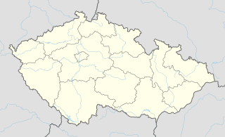
Kněžice is very small village in the Pardubice Region of the Czech Republic. It has around 150 inhabitants.

Hammam Sousse is a coastal town in north-eastern Tunisia. It is located north of Sousse, at around 35°51′32″N10°35′38″E. It has about 42,691 inhabitants. Former President Zine el Abidine Ben Ali and the minister of defense, Kamel Morjane, were born in this town.

This is a list of the extreme points of the Czech Republic: the points that are farther north, south, east or west than any other location.

Nārag Syedan is a town of Chakwal District, in the Punjab province of Pakistan.
Kurów is a village in the administrative district of Gmina Wiązów, within Strzelin County, Lower Silesian Voivodeship, in south-western Poland. Prior to 1945 it was in Germany.
Hải An is an urban district (quận) of Hai Phong, the third largest city of Vietnam.
Van Hauen Pass is a mountain pass on northwestern Ellesmere Island, Nunavut, Canada.

Jadowniki Bielskie is a village in the administrative district of Gmina Żnin, within Żnin County, Kuyavian-Pomeranian Voivodeship, in north-central Poland. It lies approximately 10 kilometres (6 mi) east of Żnin and 31 km (19 mi) south of Bydgoszcz.

Huta Padniewska is a village in the administrative district of Gmina Mogilno, within Mogilno County, Kuyavian-Pomeranian Voivodeship, in north-central Poland. It lies approximately 7 kilometres (4 mi) west of Mogilno and 54 km (34 mi) south of Bydgoszcz.

Orta Ceyrançöl is a village in the Tovuz Rayon of Azerbaijan.

Adamka is a village in the administrative district of Gmina Zadzim, within Poddębice County, Łódź Voivodeship, in central Poland. It lies approximately 3 kilometres (2 mi) southwest of Zadzim, 18 km (11 mi) southwest of Poddębice, and 44 km (27 mi) west of the regional capital Łódź.

Obiechów is a village in the administrative district of Gmina Słupia, within Jędrzejów County, Świętokrzyskie Voivodeship, in south-central Poland. It lies approximately 9 kilometres (6 mi) west of Słupia, 32 km (20 mi) west of Jędrzejów, and 64 km (40 mi) south-west of the regional capital Kielce.

Huta Podłysica is a village in the administrative district of Gmina Bieliny, within Kielce County, Świętokrzyskie Voivodeship, in south-central Poland. It lies approximately 6 kilometres (4 mi) east of Bieliny and 27 km (17 mi) east of the regional capital Kielce.

Marzysz is a village in the administrative district of Gmina Daleszyce, within Kielce County, Świętokrzyskie Voivodeship, in south-central Poland. It lies approximately 10 kilometres (6 mi) south-west of Daleszyce and 15 km (9 mi) south of the regional capital Kielce.

Bebelno-Kolonia is a village in the administrative district of Gmina Włoszczowa, within Włoszczowa County, Świętokrzyskie Voivodeship, in south-central Poland. It lies approximately 11 kilometres (7 mi) south of Włoszczowa and 46 km (29 mi) west of the regional capital Kielce.
Bagienice is a village in the administrative district of Gmina Chorzele, within Przasnysz County, Masovian Voivodeship, in east-central Poland.

Dranouter is a village and a deelgemeente in the municipality of Heuvelland in West Flanders, Belgium. Dranouter was an independent municipality before the 1977 local government reforms. Since then, it has been part of the municipality of Heuvelland. The area of the deelgemeente Dranouter is 10.73 km². The Dranouter Folk Festival is organised in the village every year. The postal code is 8951.
Gomo Station is a railway station on the Gyeongbu Line in South Korea.
Stein Mountain, elev. 2761 m, is a mountain in the Lillooet Ranges of southwestern British Columbia, Canada, located northwest of the confluence of the Stein and Fraser Rivers, which is just upstream from the town of Lytton. Its name derives from that of the Stein River.
Eskişehir Caricature Museum is a museum in Eskişehir, Turkey The museum is in Odunpazarı ilçe of Eskişehir at 39°45′57″N30°31′32″E. It is in a neighborhood of museums.


