
Bihale is a village in the administrative district of Gmina Wielkie Oczy, within Lubaczów County, Subcarpathian Voivodeship, in south-eastern Poland, close to the border with Ukraine. It lies approximately 12 kilometres (7 mi) north-west of Wielkie Oczy, 11 km (7 mi) south-west of Lubaczów, and 74 km (46 mi) east of the regional capital Rzeszów.

Czopy is a village in the administrative district of Gmina Wielkie Oczy, within Lubaczów County, Subcarpathian Voivodeship, in south-eastern Poland, close to the border with Ukraine. It lies approximately 7 kilometres (4 mi) north-west of Wielkie Oczy, 10 km (6 mi) south of Lubaczów, and 80 km (50 mi) east of the regional capital Rzeszów.
Gieregi is a settlement in the administrative district of Gmina Wielkie Oczy, within Lubaczów County, Subcarpathian Voivodeship, in south-eastern Poland, close to the border with Ukraine. It lies approximately 2 kilometres (1 mi) south-west of Wielkie Oczy, 17 km (11 mi) south of Lubaczów, and 82 km (51 mi) east of the regional capital Rzeszów.
Kobylnica Ruska is a village in the administrative district of Gmina Wielkie Oczy, within Lubaczów County, Subcarpathian Voivodeship, in south-eastern Poland, close to the border with Ukraine. It lies approximately 7 kilometres (4 mi) west of Wielkie Oczy, 18 km (11 mi) south of Lubaczów, and 76 km (47 mi) east of the regional capital Rzeszów.

Kobylnica Wołoska is a village in the administrative district of Gmina Wielkie Oczy, within Lubaczów County, Subcarpathian Voivodeship, in south-eastern Poland, close to the border with Ukraine. It lies approximately 5 kilometres (3 mi) south-west of Wielkie Oczy, 19 km (12 mi) south of Lubaczów, and 79 km (49 mi) east of the regional capital Rzeszów.

Łukawiec is a village in the administrative district of Gmina Wielkie Oczy, within Lubaczów County, Subcarpathian Voivodeship, in south-eastern Poland, close to the border with Ukraine. It lies approximately 6 kilometres (4 mi) north-west of Wielkie Oczy, 12 km (7 mi) south of Lubaczów, and 80 km (50 mi) east of the regional capital Rzeszów. Łukawiec has existed since the XVIth Century.
Majdan Lipowiecki is a village in the administrative district of Gmina Wielkie Oczy, within Lubaczów County, Subcarpathian Voivodeship, in south-eastern Poland, close to the border with Ukraine. It lies approximately 5 kilometres (3 mi) north of Wielkie Oczy, 12 km (7 mi) south of Lubaczów, and 84 km (52 mi) east of the regional capital Rzeszów.
Mielnik is a village in the administrative district of Gmina Wielkie Oczy, within Lubaczów County, Subcarpathian Voivodeship, in south-eastern Poland, close to the border with Ukraine. It lies approximately 2 kilometres (1 mi) north-west of Wielkie Oczy, 16 km (10 mi) south of Lubaczów, and 83 km (52 mi) east of the regional capital Rzeszów.
Niwa is a village in the administrative district of Gmina Wielkie Oczy, within Lubaczów County, Subcarpathian Voivodeship, in south-eastern Poland, close to the border with Ukraine. It lies approximately 12 kilometres (7 mi) north-west of Wielkie Oczy, 12 km (7 mi) south-west of Lubaczów, and 74 km (46 mi) east of the regional capital Rzeszów.
Podłozy is a settlement in the administrative district of Gmina Wielkie Oczy, within Lubaczów County, Subcarpathian Voivodeship, in south-eastern Poland, close to the border with Ukraine. It lies approximately 5 kilometres (3 mi) west of Wielkie Oczy, 18 km (11 mi) south of Lubaczów, and 79 km (49 mi) east of the regional capital Rzeszów.
Potok Jaworowski is a village in the administrative district of Gmina Wielkie Oczy, within Lubaczów County, Subcarpathian Voivodeship, in south-eastern Poland, close to the border with Ukraine. It lies approximately 9 kilometres (6 mi) west of Wielkie Oczy, 18 km (11 mi) south of Lubaczów, and 75 km (47 mi) east of the regional capital Rzeszów.
Skolin is a village in the administrative district of Gmina Wielkie Oczy, within Lubaczów County, Subcarpathian Voivodeship, in south-eastern Poland, close to the border with Ukraine. It lies approximately 3 kilometres (2 mi) south of Wielkie Oczy, 19 km (12 mi) south of Lubaczów, and 84 km (52 mi) east of the regional capital Rzeszów.
Sople is a village in the administrative district of Gmina Wielkie Oczy, within Lubaczów County, Subcarpathian Voivodeship, in south-eastern Poland, close to the border with Ukraine. It lies approximately 11 kilometres (7 mi) north-west of Wielkie Oczy, 11 km (7 mi) south-west of Lubaczów, and 75 km (47 mi) east of the regional capital Rzeszów.
Szczeble is a settlement in the administrative district of Gmina Wielkie Oczy, within Lubaczów County, Subcarpathian Voivodeship, in south-eastern Poland, close to the border with Ukraine. It lies approximately 3 kilometres (2 mi) west of Wielkie Oczy, 16 km (10 mi) south of Lubaczów, and 80 km (50 mi) east of the regional capital Rzeszów.
Tarnawskie is a settlement in the administrative district of Gmina Wielkie Oczy, within Lubaczów County, Subcarpathian Voivodeship, in south-eastern Poland, close to the border with Ukraine. It lies approximately 5 kilometres (3 mi) north of Wielkie Oczy, 12 km (7 mi) south of Lubaczów, and 82 km (51 mi) east of the regional capital Rzeszów.
Wielkie Oczy is a village in Lubaczów County, Subcarpathian Voivodeship, in south-eastern Poland, close to the border with Ukraine. It is the seat of the gmina called Gmina Wielkie Oczy. It lies approximately 17 kilometres (11 mi) south of Lubaczów and 83 km (52 mi) east of the regional capital Rzeszów.
Wola is a settlement in the administrative district of Gmina Wielkie Oczy, within Lubaczów County, Subcarpathian Voivodeship, in south-eastern Poland, close to the border with Ukraine. It lies approximately 7 kilometres (4 mi) north-west of Wielkie Oczy, 11 km (7 mi) south of Lubaczów, and 81 km (50 mi) east of the regional capital Rzeszów.
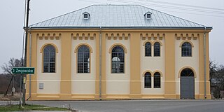
Wólka Żmijowska is a village in the administrative district of Gmina Wielkie Oczy, within Lubaczów County, Subcarpathian Voivodeship, in south-eastern Poland, close to the border with Ukraine. It lies approximately 5 kilometres (3 mi) north-east of Wielkie Oczy, 15 km (9 mi) south-east of Lubaczów, and 86 km (53 mi) east of the regional capital Rzeszów.
Żmijowiska is a village in the administrative district of Gmina Wielkie Oczy, within Lubaczów County, Subcarpathian Voivodeship, in south-eastern Poland, close to the border with Ukraine. It lies approximately 2 kilometres (1 mi) south-east of Wielkie Oczy, 18 km (11 mi) south of Lubaczów, and 85 km (53 mi) east of the regional capital Rzeszów.


