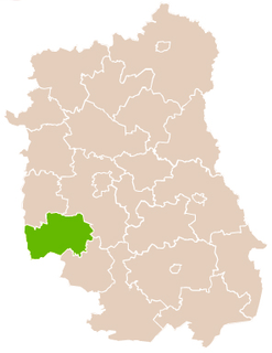
The Canton of Saint-Pol-sur-Ternoise is a canton situated in the Pas-de-Calais département and in the Hauts-de-France region of France.

Jaszowice is a village in the administrative district of Gmina Kobierzyce, within Wrocław County, Lower Silesian Voivodeship, in south-western Poland. Prior to 1945 it was in Germany.
Wysokie is a village in the administrative district of Gmina Uchanie, within Hrubieszów County, Lublin Voivodeship, in eastern Poland. It lies approximately 5 kilometres (3 mi) north-east of Uchanie, 18 km (11 mi) north-west of Hrubieszów, and 87 km (54 mi) south-east of the regional capital Lublin.
Bystrzyca is a village in the administrative district of Gmina Zakrzówek, within Kraśnik County, Lublin Voivodeship, in eastern Poland.
Góry is a village in the administrative district of Gmina Zakrzówek, within Kraśnik County, Lublin Voivodeship, in eastern Poland.
Józefin is a village in the administrative district of Gmina Zakrzówek, within Kraśnik County, Lublin Voivodeship, in eastern Poland.
Kopaniny is a village in the administrative district of Gmina Zakrzówek, within Kraśnik County, Lublin Voivodeship, in eastern Poland.
Lipno is a village in the administrative district of Gmina Zakrzówek, within Kraśnik County, Lublin Voivodeship, in eastern Poland.
Majorat is a village in the administrative district of Gmina Zakrzówek, within Kraśnik County, Lublin Voivodeship, in eastern Poland.
Rudnik Drugi is a village in the administrative district of Gmina Zakrzówek, within Kraśnik County, Lublin Voivodeship, in eastern Poland. It lies approximately 18 kilometres (11 mi) east of Kraśnik and 35 km (22 mi) south of the regional capital Lublin.
Rudnik Pierwszy is a village in the administrative district of Gmina Zakrzówek, within Kraśnik County, Lublin Voivodeship, in eastern Poland.
Studzianki is a village in the administrative district of Gmina Zakrzówek, within Kraśnik County, Lublin Voivodeship, in eastern Poland. It lies approximately 15 kilometres (9 mi) east of Kraśnik and 42 km (26 mi) south of the regional capital Lublin.
Studzianki-Kolonia is a village in the administrative district of Gmina Zakrzówek, within Kraśnik County, Lublin Voivodeship, in eastern Poland. It lies approximately 17 kilometres (11 mi) east of Kraśnik and 42 km (26 mi) south of the regional capital Lublin.
Świerczyna is a village in the administrative district of Gmina Zakrzówek, within Kraśnik County, Lublin Voivodeship, in eastern Poland. It lies approximately 5 kilometres (3 mi) east of Zakrzówek, 16 km (10 mi) east of Kraśnik, and 37 km (23 mi) south of the regional capital Lublin.
Tartak is a village in the administrative district of Gmina Zakrzówek, within Kraśnik County, Lublin Voivodeship, in eastern Poland.
Zakrzówek is a village in Kraśnik County, Lublin Voivodeship, in eastern Poland. It is the seat of the gmina called Gmina Zakrzówek. It lies approximately 11 kilometres (7 mi) east of Kraśnik and 38 km (24 mi) south of the regional capital Lublin.
Zakrzówek Nowy is a village in the administrative district of Gmina Zakrzówek, within Kraśnik County, Lublin Voivodeship, in eastern Poland. It lies approximately 15 kilometres (9 mi) east of Kraśnik and 35 km (22 mi) south of the regional capital Lublin.
Zakrzówek-Wieś is a village in the administrative district of Gmina Zakrzówek, within Kraśnik County, Lublin Voivodeship, in eastern Poland.
Krajków is a village in the administrative district of Gmina Pawłów, within Starachowice County, Świętokrzyskie Voivodeship, in south-central Poland. It lies approximately 8 kilometres (5 mi) south-west of Pawłów, 15 km (9 mi) south of Starachowice, and 30 km (19 mi) east of the regional capital Kielce.
Psary is a village in Będzin County, Silesian Voivodeship, in southern Poland. It is the seat of the gmina called Gmina Psary. It lies approximately 6 kilometres (4 mi) north of Będzin and 17 km (11 mi) north-east of the regional capital Katowice.