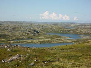
Salekhard is a town and the administrative center of Yamalo-Nenets Autonomous Okrug, Russia. It crosses the Polar circle, the main parts being about 1 kilometer (0.62 mi) south and suburbs stretching to the north of the circle. Population: 42,544 (2010 Census); 36,827 (2002 Census); 32,334 (1989 Census).

Nadym is a town in Yamalo-Nenets Autonomous Okrug, Russia, located on the Nadym River. Population: 46,611 (2010 Census); 45,943 (2002 Census); 52,586 (1989 Census).
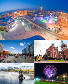
Novy Urengoy is a city in Yamalo-Nenets Autonomous Okrug, Russia. Population: 104,107 (2010 Census); 94,456 (2002 Census); 93,235 (1989 Census). It is the second largest city in the autonomous okrug after Noyabrsk.

Tarko-Sale is a town and the administrative center of Purovsky District in Yamalo-Nenets Autonomous Okrug, Russia, located on the Pyakupur River near its confluence with the Ayvasedapur, 560 kilometers (350 mi) southeast of Salekhard, the administrative center of the autonomous okrug. Population: 20,398 (2010 Census); 18,517 (2002 Census); 17,400 (1989 Census).

Muravlenko is a town in Yamalo-Nenets Autonomous Okrug, Russia, located 480 kilometers (300 mi) southeast of Salekhard. Population: 33,391 (2010 Census); 35,926 (2002 Census).

Labytnangi is a town in Yamalo-Nenets Autonomous Okrug, Russia, located on the left bank of the Ob River, 20 kilometers (12 mi) northwest of Salekhard. Population: 26,936 (2010 Census); 27,304 (2002 Census); 31,501 (1989 Census).

Gubkinsky is a town in Yamalo-Nenets Autonomous Okrug, Russia, located on the left bank of the Pyakupur River, south of Salekhard. Population: 23,335 (2010 Census); 20,407 ; 9,676.
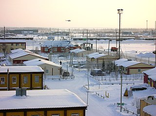
Nadymsky District is an administrative and municipal district (raion), one of the seven in Yamalo-Nenets Autonomous Okrug of Tyumen Oblast, Russia. It is located in the central and southern parts of the autonomous okrug. The area of the district is 103,960 square kilometers (40,140 sq mi). Its administrative center is the town of Nadym. Population: 19,919 ; 23,470 (2002 Census); 29,772 (1989 Census).
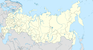
Prirechny is a rural locality in Pechengsky District of Murmansk Oblast, Russia, located beyond the Arctic Circle at a height of 163 meters (535 ft) above sea level. Population: 45.
Korzunovo is a rural locality in Pechengsky District of Murmansk Oblast, Russia, located beyond the Arctic Circle at a height of 63 meters (207 ft) above sea level. Population: 275.
Putevaya Usadba 9 km zheleznoy dorogi Luostari–Nikel is a rural locality in Pechengsky District of Murmansk Oblast, Russia, located beyond the Arctic Circle. Population: 0.

Gubkinsky Urban Okrug is the name of several municipal formations in Russia:

Krasnoselkupsky District is an administrative and municipal district (raion), one of the seven in Yamalo-Nenets Autonomous Okrug of Tyumen Oblast, Russia. It is located in the southeast of the autonomous okrug. The area of the district is 106,270 square kilometers (41,030 sq mi). Its administrative center is the rural locality of Krasnoselkup. Population: 6,204 ; 6,384 (2002 Census); 7,940 (1989 Census). The population of Krasnoselkup accounts for 64.1% of the district's total population.

Priuralsky District is an administrative and municipal district (raion), one of the seven in Yamalo-Nenets Autonomous Okrug of Tyumen Oblast, Russia. It is located in the west of the autonomous okrug. The area of the district is 64,150 square kilometers (24,770 sq mi). Its administrative center is the rural locality of Aksarka. Population: 14,995 ; 7,680 (2002 Census); 6,616 (1989 Census). The population of Aksarka accounts for 20.9% of the district's total population.

Purovsky District is an administrative and municipal district (raion), one of the seven in Yamalo-Nenets Autonomous Okrug of Tyumen Oblast, Russia. It is located in the center and south of the autonomous okrug. The area of the district is 108,400 square kilometers (41,900 sq mi). Its administrative center is the town of Tarko-Sale. Population: 51,280 ; 47,667 (2002 Census); 56,049 (1989 Census). The population of Tarko-Sale accounts for 39.8% of the district's total population.

Shuryshkarsky District is an administrative and municipal district (raion), one of the seven in Yamalo-Nenets Autonomous Okrug of Tyumen Oblast, Russia. It is located in the southwest of the autonomous okrug. The area of the district is 54,016 square kilometers (20,856 sq mi). Its administrative center is the rural locality of Muzhi. Population: 9,814 ; 9,559 (2002 Census); 9,001 (1989 Census). The population of Muzhi accounts for 36.8% of the district's total population.
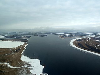
Tazovsky District is an administrative and municipal district (raion), one of the seven in Yamalo-Nenets Autonomous Okrug of Tyumen Oblast, Russia. It is located in the north, northeast, and east of the autonomous okrug. The area of the district is 174,343.92 square kilometers (67,314.56 sq mi). Its administrative center is the rural locality of Tazovsky. Population: 16,537 ; 15,600 (2002 Census); 18,515 (1989 Census). The population of the administrative center accounts for 41.1% of the district's total population.

Yamalsky District is an administrative and municipal district (raion), one of the seven in Yamalo-Nenets Autonomous Okrug of Tyumen Oblast, Russia. It is located in the north and northwest of the autonomous okrug. The area of the district is 117,410 square kilometers (45,330 sq mi). Its administrative center is the rural locality of Yar-Sale. Population: 16,310 ; 14,918 (2002 Census); 15,029 (1989 Census). The population of Yar-Sale accounts for 39.8% of the district's total population.
Aksarka is a rural locality and the administrative center of Priuralsky District of Yamalo-Nenets Autonomous Okrug, Russia. Population: 3,133 (2010 Census); 2,569 (2002 Census); 2,365 (1989 Census).