Chelyabinsk is the administrative center and largest city of Chelyabinsk Oblast, Russia. It is the seventh-largest city in Russia, with a population of over 1.1 million people, and the second-largest city in the Ural Federal District, after Yekaterinburg. Chelyabinsk is located to the East behind the South part of the Ural Mountains and runs along the Miass River.

Ufa is the largest city in and the capital of Bashkortostan, Russia. The city lies at the confluence of the Belaya and Ufa rivers, in the centre-north of Bashkortostan, on hills forming the Ufa Plateau to the west of the southern Ural Mountains, with a population of over 1.1 million residents, up to 1.4 million residents in the urban agglomeration. Ufa is the tenth-most populous city in Russia, and the fourth-most populous city in the Volga Federal District.

The Herzegovina-Neretva Canton is one of 10 cantons of the Federation of Bosnia and Herzegovina in Bosnia and Herzegovina.

Chelyabinsk Oblast is a federal subject of Russia in the Ural Mountains region, on the border of Europe and Asia. Its administrative center is the city of Chelyabinsk.

Ural Economic Region is one of twelve economic regions of Russia. This prominent industrial region consists of the following subdivisions : Bashkortostan (Ufa), Chelyabinsk Oblast (Chelyabinsk), Kurgan Oblast (Kurgan), Orenburg Oblast (Orenburg), Perm Krai (Perm), Sverdlovsk Oblast (Yekaterinburg) and Udmurt Republic (Izhevsk). It is mostly located in the Central, and partly in the Southern and Northern parts of the Urals, but also includes parts of the East European and West Siberian Plains. Its extent is different from that of the Ural Federal District; Bashkortostan, Orenburg Oblast, Perm Krai and Udmurtia are in the Volga Federal District while the other three are in the Ural Federal District.

Sterlitamak is the second largest city in the Republic of Bashkortostan, Russia, located on the left bank of the Belaya River, 121 kilometers (75 mi) from Ufa. The city's name comes from the Bashkir language and literally means "mouth of the Sterlya river". According to data released by Bashstat, Sterlitamak had a population of 277,410 at the time of the census. Permanent population of Sterlitamak as of January 1, 2023 amounted to 279,174 people.
Vinegar Hill is an unincorporated community in Markham, Ontario, Canada bounded by Highway 7 to the north, Highway 407 to the south, and streets just west and east of Main Street South, bordered by the Rouge River. The name of the community is believed to be linked to a cider mill on the east side of the river valley or barrel makers that filled them with vinegar to test their straightness when rolling down Markham Road.

The Russian route M5 is a major trunk road running across a distance of 1879 km from Moscow to the Ural Mountains. It is part of the European route E30 and the Trans-Siberian Highway. The section from Yekaterinburg to Chelyabinsk is also part of AH7, and the section from Chelyabinsk to Moscow is also part of AH6.

Ponoarele is a commune located in Mehedinți County, Oltenia, Romania. It is composed of fifteen villages: Băluța, Bârâiacu, Brânzeni, Buicani, Ceptureni, Cracu Muntelui, Delureni, Gărdăneasa, Gheorghești, Ludu, Ponoarele, Proitești, Răiculești, Șipotu, and Valea Ursului.

Zaton Doli is a village in Croatia, on the border with Neum, Bosnia and Herzegovina. It is connected by the D8 highway.

Perm Governorate, also known as the Governorate of Perm, was an administrative-territorial unit (guberniya) of the Russian Empire and the Russian SFSR from 1781 to 1923. It was located on both slopes of the Ural Mountains, and its administrative center was the city of Perm. The region gave its name to the Permian period.

Nizhneserginsky District is an administrative district (raion), one of the thirty in Sverdlovsk Oblast, Russia. As a municipal division, it is incorporated as Nizhneserginsky Municipal District. The area of the district is 3,689.8 square kilometers (1,424.6 sq mi). Its administrative center is the town of Nizhniye Sergi. Population: 55,135 ; 60,512 (2002 Census); 72,257 (1989 Soviet census). The population of Nizhniye Sergi accounts for 18.8% of the district's total population.
Zaton is a village in the municipality of Bijelo Polje, Montenegro.
Southern Ural - the south, the widest part of the Ural Mountains, stretches from the river Ufa to the Ural River. From the west and east the Southern Ural is limited to the East European Plain, West Siberian Plain and the steppes near Aral Sea and Caspian Sea.
Kuybyshevsky Zaton is an urban locality in Kamsko-Ustyinsky District of the Republic of Tatarstan, Russia, located on the shores of Kuybyshev Reservoir, 9 kilometers (5.6 mi) from Kamskoye Ustye, the administrative center of the district. As of the 2010 Census, its population was 2,677.

Ufa is a Central Ufa railway terminus, located in the Sovetsky District of Ufa on the historical direction of the Trans-Siberian Railway.

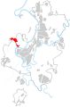
The Zaton bridge is a bridge, that carries four lanes of traffic over the Belaya River, between Ufa center and Zaton neighbourhood of Ufa, in Bashkortostan.
Milovka is a rural locality and the administrative centre of Milovsky Selsoviet, Ufimsky District, Bashkortostan, Russia. The population was 2,767 as of 2010. There are 68 streets.