Ogorzelewo is a village in the administrative district of Gmina Chodecz, within Włocławek County, Kuyavian-Pomeranian Voivodeship, in north-central Poland.

Kolonia Szczercowska is a village in the administrative district of Gmina Szczerców, within Bełchatów County, Łódź Voivodeship, in central Poland. It lies approximately 4 kilometres (2 mi) north-west of Szczerców, 20 km (12 mi) west of Bełchatów, and 55 km (34 mi) south-west of the regional capital Łódź.
Jedlno Pierwsze is a village in the administrative district of Gmina Ładzice, within Radomsko County, Łódź Voivodeship, in central Poland. It lies approximately 8 kilometres (5 mi) west of Ładzice, 15 km (9 mi) west of Radomsko, and 80 km (50 mi) south of the regional capital Łódź.
Borzęckie is a village in the administrative district of Gmina Złoczew, within Sieradz County, Łódź Voivodeship, in central Poland. It lies approximately 4 kilometres (2 mi) east of Złoczew, 23 km (14 mi) south of Sieradz, and 70 km (43 mi) south-west of the regional capital Łódź.
Regulice is a village in the administrative district of Gmina Alwernia, within Chrzanów County, Lesser Poland Voivodeship, in southern Poland. It lies approximately 3 kilometres (2 mi) north-east of Alwernia, 11 km (7 mi) south-east of Chrzanów, and 30 km (19 mi) west of the regional capital Kraków.
Glinianki is a village in the administrative district of Gmina Tomaszów Lubelski, within Tomaszów Lubelski County, Lublin Voivodeship, in eastern Poland.
Turyna is a village in the administrative district of Gmina Ulhówek, within Tomaszów Lubelski County, Lublin Voivodeship, in eastern Poland, close to the border with Ukraine. It lies approximately 5 kilometres (3 mi) south of Ulhówek, 26 km (16 mi) east of Tomaszów Lubelski, and 126 km (78 mi) south-east of the regional capital Lublin.
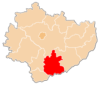
Lścin is a village in the administrative district of Gmina Jędrzejów, within Jędrzejów County, Świętokrzyskie Voivodeship, in south-central Poland. It lies approximately 8 kilometres (5 mi) east of Jędrzejów and 32 km (20 mi) south-west of the regional capital Kielce.
Zagajów is a village in the administrative district of Gmina Michałów, within Pińczów County, Świętokrzyskie Voivodeship, in south-central Poland. It lies approximately 4 kilometres (2 mi) west of Michałów, 11 km (7 mi) south-west of Pińczów, and 46 km (29 mi) south of the regional capital Kielce.
Szwagrów is a village in the administrative district of Gmina Osiek, within Staszów County, Świętokrzyskie Voivodeship, in south-central Poland. It lies approximately 8 kilometres (5 mi) south of Osiek, 21 km (13 mi) south-east of Staszów, and 73 km (45 mi) south-east of the regional capital Kielce.
Rudna Wielka is a village in the administrative district of Gmina Świlcza, within Rzeszów County, Subcarpathian Voivodeship, in south-eastern Poland. It lies approximately 4 kilometres (2 mi) north-east of Świlcza and 7 km (4 mi) north-west of the regional capital Rzeszów.
Żwirówka is a village in the administrative district of Gmina Halinów, within Mińsk County, Masovian Voivodeship, in east-central Poland.
Miedniewice is a village in the administrative district of Gmina Wiskitki, within Żyrardów County, Masovian Voivodeship, in east-central Poland. It lies approximately 7 kilometres (4 mi) west of Wiskitki, 10 km (6 mi) west of Żyrardów, and 50 km (31 mi) west of Warsaw.
Pogoń Gosławicka is a village in the administrative district of Gmina Ślesin, within Konin County, Greater Poland Voivodeship, in west-central Poland. It lies approximately 8 kilometres (5 mi) east of Ślesin, 18 km (11 mi) northeast of Konin, and 102 km (63 mi) east of the regional capital Poznań.
Huby-Oporowo is a village in the administrative district of Gmina Wronki, within Szamotuły County, Greater Poland Voivodeship, in west-central Poland. It lies approximately 4 kilometres (2 mi) south-east of Wronki, 15 km (9 mi) north-west of Szamotuły, and 47 km (29 mi) north-west of the regional capital Poznań.

Mucków, German Mutzkau, is a village in the administrative district of Gmina Głogówek, within Prudnik County, Opole Voivodeship, in south-western Poland, close to the Czech border. It lies approximately 9 kilometres (6 mi) north-west of Głogówek, 19 km (12 mi) north-east of Prudnik, and 31 km (19 mi) south of the regional capital Opole.

Sysłów, German Syßlau is a village in the administrative district of Gmina Głogówek, within Prudnik County, Opole Voivodeship, in south-western Poland, close to the Czech border. It lies approximately 9 kilometres (6 mi) north-west of Głogówek (Oberglogau), 19 km (12 mi) north-east of Prudnik, and 31 km (19 mi) south of the regional capital Opole.
Pawłowo is a village in the administrative district of Gmina Trąbki Wielkie, within Gdańsk County, Pomeranian Voivodeship, in northern Poland. It lies approximately 10 kilometres (6 mi) south-west of Trąbki Wielkie, 21 km (13 mi) south-west of Pruszcz Gdański, and 30 km (19 mi) south-west of the regional capital Gdańsk.
Żurawiec is a village in the administrative district of Gmina Markusy, within Elbląg County, Warmian-Masurian Voivodeship, in northern Poland. It lies approximately 5 kilometres (3 mi) north of Markusy, 1 km (1 mi) south of Elbląg, and 80 km (50 mi) north-west of the regional capital Olsztyn.

Gierłoż is a village in the administrative district of Gmina Kętrzyn, within Kętrzyn County, Warmian-Masurian Voivodeship, in north-east Poland. It lies approximately 8 kilometres (5 mi) east of Kętrzyn and 74 km (46 mi) north-east of the regional capital Olsztyn.