
Zoetermeer is a city in the Western Netherlands, in the province of South Holland. The municipality covers an area of 37.05 km2 (14.31 sq mi) of which 2.60 km2 (1.00 sq mi) is water. A small village until the late 1960s, it had 6,392 inhabitants in 1950. By 2013 this had grown to 123,328, making it the third largest population centre in the province of South Holland, after Rotterdam and The Hague. While now a city in its own right, Zoetermeer started out as a suburb of The Hague and is still a part of the Greater The Hague urban area.
Loosdrecht is a town in the municipality of Wijdemeren, North Holland, the Netherlands, with a population of about 8,600 inhabitants.
Pijnacker is a town in the Dutch province of South Holland. It is bordered Zoetermeer to the north, by Nootdorp to the northwest, by Delfgauw to the southwest, by Rotterdam to the south and by Berkel en Rodenrijs to the east.

Nootdorp is a small town in the Dutch province of South Holland. It is bordered by Zoetermeer to the north, by The Hague to the west, by Delfgauw to the south and by Pijnacker to the east. Nootdorp was a separate municipality until 2002, when it merged with Pijnacker to form Pijnacker-Nootdorp, which is a part of Greater The Hague.
Mariekerke is a former municipality in the Dutch province of Zeeland. The municipality was formed in a merger of Aagtekerke, Grijpskerke and Meliskerke in 1966, and existed until 1997 when it merged into the municipality of Veere.
Tolsteeg is a neighbourhood in the south of the Dutch city of Utrecht.
Oudenrijn is a hamlet in the Dutch province of Utrecht. It is located in the municipality of Utrecht, in the western part of the city, surrounded by the new neighbourhoods of Leidsche Rijn.
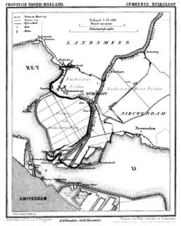
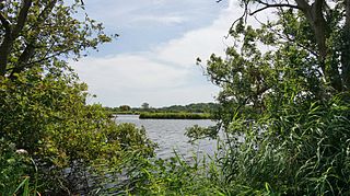
Buiksloot is a former village in the Dutch province of North Holland. It is now a neighbourhood of Amsterdam-Noord.

Schoten is a former village in the Dutch province of North Holland. It was located between Haarlem and Santpoort.
Ambt Ommen is a former municipality in the Dutch province of Overijssel. It consisted of the countryside surrounding the city of Ommen, which was a separate municipality.

Steenwijkerwold is a village in the Dutch province of Overijssel. It is located in the municipality of Steenwijkerland, about 5 km northwest of Steenwijk. Steenwijkerwold was a separate municipality until 1973, when it became a part of Steenwijk.

Groeneveld is a former municipality in the Dutch province of South Holland. It was located to the west of the city of Delft. The municipality covered the Groeneveldse Polder, northwest of De Lier, and contained no towns or villages; only the hamlet of Lierhand.
Moerkapelle is a small town in the Dutch province of South Holland. It is located about 6 km east of the city of Zoetermeer, in the municipality of Zuidplas.
Oudshoorn is a former village in the Dutch province of South Holland. It was located on the Oude Rijn, opposite the village of Alphen, with which it merged to form the city of Alphen aan den Rijn.

Stompwijk is a village in the Dutch province of South Holland. It is located between the cities Leiden and Zoetermeer and is part of the municipality of Leidschendam-Voorburg.
Tempel, also known as De Tempel, is a former municipality and former manorial estate in the Dutch province of South Holland. It was located about 3 km southwest of the center of the current village of Berkel en Rodenrijs.
De Vennip is a former municipality in the Netherlands, which at the time belonged to the province of South Holland. It consisted of a small area of land east of Hillegom, and a large part of the Haarlemmermeer lake, including the island of Beinsdorp. The area of the municipality was 38.61 km², of which only 1.18 km² was land.

Zevenhuizen is a village in the Dutch province of South Holland. It is located about 12 km northeast of the city of Rotterdam.
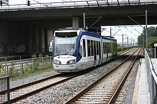
Zoetermeer Stadslijn is a light-rail line converted from a former commuter rail line in the Netherlands, between The Hague and Zoetermeer.

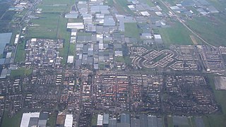
Seghwaert is a district in Zoetermeer that was formed around the old village of Zegwaart, which fused with the municipality of Zoetermeer in 1935, using the archaic spelling of the locale's name. The old Zegwaart was a ribbon development along what remains until today as Zegwaartseweg, which is perpendicular to Dorpstraat. The district is divided into Seghwaert-Oost (2723), -Midden (2724) and -Noord (2727).
