Zelenik

Last updated
Zelenik
Village
Serbia adm location map.svg
Red pog.svg
Zelenik
Coordinates: 44°34′30″N21°33′50″E / 44.57500°N 21.56389°E / 44.57500; 21.56389
CountryFlag of Serbia.svg  Serbia
District Braničevo District
Municipality Kučevo
Population (2002)
  Total 251
Time zone CET (UTC+1)
  Summer (DST) CEST (UTC+2)

Zelenik is a village in the municipality of Kučevo, Serbia. According to the 2002 census, the village has a population of 251 people. [1]

Village Small clustered human settlement smaller than a town

A village is a clustered human settlement or community, larger than a hamlet but smaller than a town, with a population ranging from a few hundred to a few thousand. Though villages are often located in rural areas, the term urban village is also applied to certain urban neighborhoods. Villages are normally permanent, with fixed dwellings; however, transient villages can occur. Further, the dwellings of a village are fairly close to one another, not scattered broadly over the landscape, as a dispersed settlement.

Kučevo Town and municipality in Southern and Eastern Serbia, Serbia

Kučevo is a town and municipality located in the Braničevo District of the eastern Serbia. In 2011, the population of the town was 3,950, while the population of the municipality was 15,490.

Serbia Republic in Southeastern Europe

Serbia, officially the Republic of Serbia, is a country situated at the crossroads of Central and Southeast Europe in the southern Pannonian Plain and the central Balkans. The sovereign state borders Hungary to the north, Romania to the northeast, Bulgaria to the southeast, North Macedonia to the south, Croatia and Bosnia and Herzegovina to the west, and Montenegro to the southwest. The country claims a border with Albania through the disputed territory of Kosovo. Serbia's population is about seven million. Its capital, Belgrade, ranks among the oldest and largest citiеs in Europe.

Related Research Articles

Söderfjärden

Söderfjärden is a polder in Ostrobothnia, western Finland, 10 kilometres south of the town of Vaasa. The plain is in an impact crater which was made at least some 640 million years old. The crater's diameter is 6.6 km and its maximum depth is 300 metres. It is filled with Cambrian sandstones leaving only the outer rim visible. There is also a central uplift, which is buried. After rising from the sea due to post-glacial rebound, Söderfjärden was a wetland but was later drained with help of a pump station. It is currently cultivated and is clearly visible from air as a large circular field. This makes Söderfjärden unique among the other impact structures in Finland which are at least partially below sea level.

Çumra District in Turkey

Çumra is a town and district of Konya Province in the Central Anatolia region of Turkey. According to 2000 census, population of the district is 104,576 of which 42,308 live in the town of Çumra.

Ladomerská Vieska municipality of Slovakia

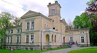
Ladomerská Vieska is a village and municipality in Žiar nad Hronom District in the Banská Bystrica Region of central Slovakia.

Mandavalli is a village in Krishna district of the Indian state of Andhra Pradesh.

Getazat Place in Ararat, Armenia

Getazat is a small town in the Ararat Province of Armenia.

Rzemieniewice Village in Kuyavian-Pomeranian, Poland

Rzemieniewice is a village in the administrative district of Gmina Szubin, within Nakło County, Kuyavian-Pomeranian Voivodeship, in north-central Poland. It lies approximately 13 kilometres (8 mi) west of Szubin, 16 km (10 mi) south of Nakło nad Notecią, and 33 km (21 mi) south-west of Bydgoszcz.

İşıqlı, Fizuli Place in Fizuli, Azerbaijan

İşıqlı is a village in the Fizuli Rayon of Azerbaijan.

Haran, Azerbaijan Place in Lerik, Azerbaijan

Haran is a village in the Lerik Rayon of Azerbaijan. The village forms part of the municipality of Hamarmeşə.

Września is a village in the administrative district of Gmina Wodzisław, within Jędrzejów County, Świętokrzyskie Voivodeship, in south-central Poland.

Łoniów Village in Świętokrzyskie, Poland

Łoniów is a village in Sandomierz County, Świętokrzyskie Voivodeship, in south-central Poland. It is the seat of the gmina called Gmina Łoniów. It lies approximately 21 kilometres (13 mi) south-west of Sandomierz and 74 km (46 mi) south-east of the regional capital Kielce.

Górka Powielińska is a village in the administrative district of Gmina Winnica, within Pułtusk County, Masovian Voivodeship, in east-central Poland.

Mogielnica, Siedlce County Village in Masovian, Poland

Mogielnica is a village in the administrative district of Gmina Korczew, within Siedlce County, Masovian Voivodeship, in east-central Poland. It lies approximately 5 kilometres (3 mi) north-west of Korczew, 33 km (21 mi) north-east of Siedlce, and 109 km (68 mi) east of Warsaw.

Bednarki is a village in the administrative district of Gmina Ostróda, within Ostróda County, Warmian-Masurian Voivodeship, in northern Poland.

Bartlewo is a village in the administrative district of Gmina Ruciane-Nida, within Pisz County, Warmian-Masurian Voivodeship, in northern Poland.

Yaouri is a village and rural commune in Niger.

Žitni Potok Village in Toplica District, Serbia

Žitni Potok is a village in the municipality of Prokuplje, Serbia. According to the 2002 census, the village has a population of 592 people.

Skrobnica Village in Zaječar District, Serbia

Skrobnica is a village in the municipality of Knjaževac, Serbia. According to the 2002 census, the village has a population of 178 people.

Žitkovica Village in Braničevo District, Serbia

Žitkovica is a village in the municipality of Golubac, Serbia. According to the 2002 census, the village has a population of 142 people.

Dujakovci Village in Republika Srpska, Bosnia and Herzegovina

Dujakovci is a village in the municipality of Banja Luka, Republika Srpska, Bosnia and Herzegovina.

Prisjeka Gornja Village in Ključ, Bosnia and Herzegovina

Prisjeka Gornja is a village in the municipality of Ključ, Bosnia and Herzegovina.

References

  1. Popis stanovništva, domaćinstava i Stanova 2002. Knjiga 1: Nacionalna ili etnička pripadnost po naseljima. Republika Srbija, Republički zavod za statistiku Beograd 2003. ISBN   86-84433-00-9

Coordinates: 44°34′30″N21°33′50″E / 44.57500°N 21.56389°E / 44.57500; 21.56389

Geographic coordinate system Coordinate system

A geographic coordinate system is a coordinate system that enables every location on Earth to be specified by a set of numbers, letters or symbols. The coordinates are often chosen such that one of the numbers represents a vertical position and two or three of the numbers represent a horizontal position; alternatively, a geographic position may be expressed in a combined three-dimensional Cartesian vector. A common choice of coordinates is latitude, longitude and elevation. To specify a location on a plane requires a map projection.