Tekirdağ Province is a province of Turkey. It is located in the East Thrace region of the country, also known as European Turkey, one of only three provinces entirely within continental Europe. Tekirdağ Province is bordered by Istanbul Province to the east, Kırklareli Province to the north, Edirne Province to the west, and the Gallipoli peninsula of Çanakkale Province to the south.
Gornaya Shoria, Mountainous Shoria, or Mountain Shoria is a territory in southern Siberia, Russia, east of the Altay Mountains. It is the southern part of Kemerovo Oblast. The indigenous population are the Shors people.

Kagalaska Island is an island in the Andreanof Islands of the Aleutian Islands of Alaska.
Podole is a village in the administrative district of Gmina Raciążek, within Aleksandrów County, Kuyavian-Pomeranian Voivodeship, in north-central Poland.

Zariver ; formerly known as Aghyokhush, is an abandoned village in the Gegharkunik Province of Armenia. Zariver belonged to the community of Kutakan village.

Ishii Station is a railway station in Sayō, Sayō District, Hyōgo Prefecture, Japan, operated by the third-sector semi-public railway operator Chizu Express.

Lələbağırlı is a village in the Lachin Rayon of Azerbaijan.
Dąbrowa is a village in the administrative district of Gmina Łęki Szlacheckie, within Piotrków County, Łódź Voivodeship, in central Poland.

Bukowska Wola is a village in the administrative district of Gmina Miechów, within Miechów County, Lesser Poland Voivodeship, in southern Poland. It lies approximately 3 kilometres (2 mi) east of Miechów and 35 km (22 mi) north of the regional capital Kraków.
Kaplonosy-Kolonia is a village in the administrative district of Gmina Wyryki, within Włodawa County, Lublin Voivodeship, in eastern Poland.

Bażantarnia is a village in the administrative district of Gmina Żurawica, within Przemyśl County, Subcarpathian Voivodeship, in south-eastern Poland.

Xingshan District is a district of the city of Hegang, Heilongjiang province, China.

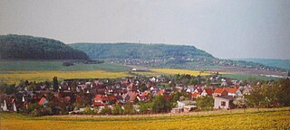
Bebra is a part of the town Sondershausen in Thuringia and it was first mentioned in a document in 1202. The village was incorporated in 1922.
Fu'an railway station is a railway station located in Fujian Province, People's Republic of China, on the Wenfu Railway which operated by Nanchang Railway Bureau, China Railway Corporation.

Atenica is a village in the municipality of Čačak, Serbia. According to the 2011 census, the village has a population of 558 people.
Valgu-Vanamõisa is a village in Märjamaa Parish, Rapla County in western Estonia.

Crnčići is a village in the municipality of Višegrad, Bosnia and Herzegovina.

Zanožje is a village in the municipality of Višegrad, Bosnia and Herzegovina.

Paspaul is a rural locality and the administrative center of Paspaulskoye Rural Settlement of Choysky District, the Altai Republic, Russia. The population is 1243 as of 2016.


