
Kłodzko County is a unit of territorial administration and local government (powiat) in Lower Silesian Voivodeship, south-western Poland. It came into being on January 1, 1999, as a result of the Polish local government reforms passed in 1998.

Dańczów is a village in the administrative district of Gmina Lewin Kłodzki, within Kłodzko County, Lower Silesian Voivodeship, in south-western Poland. It lies approximately 2 kilometres (1 mi) east of Lewin Kłodzki, 26 kilometres (16 mi) west of Kłodzko, and 95 kilometres (59 mi) south-west of the regional capital Wrocław.

Darnków is a village in the administrative district of Gmina Lewin Kłodzki, within Kłodzko County, Lower Silesian Voivodeship, in south-western Poland. It lies approximately 4 kilometres (2 mi) north-east of Lewin Kłodzki, 25 kilometres (16 mi) west of Kłodzko, and 92 kilometres (57 mi) south-west of the regional capital Wrocław.

Gołaczów ( is a village in the administrative district of Gmina Lewin Kłodzki, within Kłodzko County, Lower Silesian Voivodeship, in south-western Poland.

Jarków is a village in the administrative district of Gmina Lewin Kłodzki, within Kłodzko County, Lower Silesian Voivodeship, in south-western Poland. It lies approximately 3 kilometres (2 mi) south-west of Lewin Kłodzki, 28 kilometres (17 mi) west of Kłodzko, and 98 kilometres (61 mi) south-west of the regional capital Wrocław.
Jawornica is a village in the administrative district of Gmina Lewin Kłodzki, within Kłodzko County, Lower Silesian Voivodeship, in south-western Poland. It lies approximately 5 kilometres (3 mi) south-east of Lewin Kłodzki, 24 kilometres (15 mi) west of Kłodzko, and 96 kilometres (60 mi) south-west of the regional capital Wrocław.
Jeleniów is a village in the administrative district of Gmina Lewin Kłodzki, within Kłodzko County, Lower Silesian Voivodeship, in south-western Poland. It lies approximately 2 kilometres (1 mi) west of Lewin Kłodzki, 29 kilometres (18 mi) west of Kłodzko, and 96 kilometres (60 mi) south-west of the regional capital Wrocław. The village has a population of 620.

Jerzykowice Małe is a village in the administrative district of Gmina Lewin Kłodzki, within Kłodzko County, Lower Silesian Voivodeship, in south-western Poland. Prior to 1945 it was in Germany.

Jerzykowice Wielkie is a village in the administrative district of Gmina Lewin Kłodzki, within Kłodzko County, Lower Silesian Voivodeship, in south-western Poland. Prior to 1945 it was in Germany.

Kocioł is a village in the administrative district of Gmina Lewin Kłodzki, within Kłodzko County, Lower Silesian Voivodeship, in south-western Poland. Prior to 1945 it was in Germany.
Kulin Kłodzki is a village in the administrative district of Gmina Lewin Kłodzki, within Kłodzko County, Lower Silesian Voivodeship, in south-western Poland. Prior to 1945 it was in Germany. It lies approximately 4 kilometres (2 mi) east of Lewin Kłodzki, 24 km (15 mi) west of Kłodzko, and 93 km (58 mi) south-west of the regional capital Wrocław.
Leśna is a village in the administrative district of Gmina Lewin Kłodzki, within Kłodzko County, Lower Silesian Voivodeship, in south-western Poland. Prior to 1945 it was in Germany.

Lewin Kłodzki is a village in the Sudetes, in Kłodzko County, Lower Silesian Voivodeship, in south-western Poland, near the border with the Czech Republic. It is the seat of the administrative district (gmina) called Gmina Lewin Kłodzki.
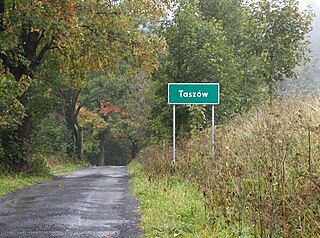
Taszów is a village in the administrative district of Gmina Lewin Kłodzki, within Kłodzko County, Lower Silesian Voivodeship, in south-western Poland. Prior to 1945 it was in Germany.
Witów is a village in the administrative district of Gmina Lewin Kłodzki, within Kłodzko County, Lower Silesian Voivodeship, in south-western Poland. Prior to 1945 it was in Germany. It lies approximately 4 kilometres (2 mi) south-east of Lewin Kłodzki, 24 km (15 mi) west of Kłodzko, and 95 km (59 mi) south-west of the regional capital Wrocław.
Zielone is a village in the administrative district of Gmina Lewin Kłodzki, within Kłodzko County, Lower Silesian Voivodeship, in south-western Poland. Prior to 1945 it was in Germany.
Ludowe is a village in the administrative district of Gmina Lewin Kłodzki, within Kłodzko County, Lower Silesian Voivodeship, in south-western Poland. Prior to 1945 it was in Germany.

Karłów is a village in the administrative district of Gmina Radków, within Kłodzko County, Lower Silesian Voivodeship, in south-western Poland.
Gmina Szczytna is an urban-rural gmina in Kłodzko County, Lower Silesian Voivodeship, in south-western Poland. Its seat is the town of Szczytna, which lies approximately 16 kilometres (10 mi) west of Kłodzko, and 90 kilometres (56 mi) south-west of the regional capital Wrocław.


