
Congo may refer to either of two countries that border the Congo River in central Africa:

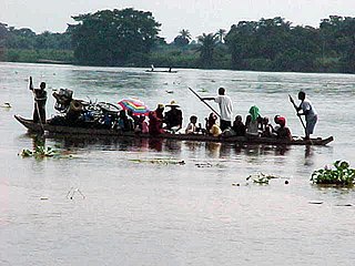
Ground transport in the Democratic Republic of the Congo (DRC) has always been difficult. The terrain and climate of the Congo Basin present serious barriers to road and rail construction, and the distances are enormous across this vast country. Furthermore, chronic economic mismanagement and internal conflict has led to serious under-investment over many years.
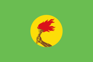
Zaire, officially the Republic of Zaire, was the name of a sovereign state between 1971 and 1997 in Central Africa that is now known as the Democratic Republic of the Congo. It was, by area, the largest country in sub-Saharan Africa, the third-largest in all of Africa, and the 11th-largest in the world. With a population of over 23 million inhabitants, Zaire was the most-populous officially Francophone country in Africa, as well as one of the most populous in Africa.

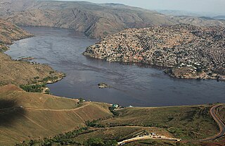
The Congo River, formerly also known as the Zaire River, is the second longest river in Africa, shorter only than the Nile, as well as the second largest river in the world by discharge volume, following only the Amazon. It is also the world's deepest recorded river, with measured depths in excess of 220 m (720 ft). The Congo-Lualaba-Chambeshi River system has an overall length of 4,700 km (2,920 mi), which makes it the world's ninth-longest river. The Chambeshi is a tributary of the Lualaba River, and Lualaba is the name of the Congo River upstream of Boyoma Falls, extending for 1,800 km (1,120 mi).

Kinshasa, formerly Léopoldville, is the capital and the largest city of the Democratic Republic of the Congo. With a total population of 15 million as of 2021, it is the most populous city in Africa.

Brazzaville is the capital and largest city of the Republic of the Congo. Constituting the financial and administrative centre of the country, it is located on the north side of the Congo River, opposite Kinshasa, the capital city of the Democratic Republic of the Congo.

The Ebola River, also commonly known by its indigenous name Legbala, is the headstream of the Mongala River, a tributary of the Congo River, in northern Democratic Republic of the Congo. It is roughly 250 kilometers (160 mi) in length.
Matadi is the chief sea port of the Democratic Republic of the Congo and the capital of the Kongo Central province, adjacent to the border with Angola. It had a population of 245,862 (2004). Matadi is situated on the left bank of the Congo River, 148 km (92 mi) from the mouth and 8 km (5.0 mi) below the last navigable point before the rapids that make the river impassable for a long stretch upriver. It was founded by Sir Henry Morton Stanley in 1879.
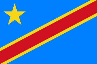
The Democratic Republic of the Congo (DRC), also known as Congo-Kinshasa, DR Congo, the DROC, the DRC, or simply either Congo or the Congo, and historically Zaire, is a country in Central Africa. It is, by area, the largest country in sub-Saharan Africa, the second-largest in all of Africa, and the 11th-largest in the world. With a population of around 105 million, the Democratic Republic of the Congo is the most populous officially Francophone country in the world, as well as the 4th-most populous country in Africa and the 15th-most populous country in the world. It is a member of the United Nations, Non-Aligned Movement, African Union, and COMESA. Since 2015, the Eastern DR Congo has been the site of an ongoing military conflict in Kivu. The capital and largest city is Kinshasa.

The Ubangi River, also spelled Oubangui, is the largest right-bank tributary of the Congo River in the region of Central Africa. It begins at the confluence of the Mbomou and Uele Rivers and flows west, forming the border between Central African Republic (CAR) and Democratic Republic of the Congo. Subsequently, the Ubangi bends to the southwest and passes through Bangui, the capital of the CAR, after which it flows south – forming the border between Democratic Republic of the Congo and Republic of Congo. The Ubangi finally joins the Congo River at Liranga.

Zaire is one of the 18 provinces of Angola. It occupies 40,130 square kilometres (15,490 sq mi) in the north west of the country and had a population of 594,428 inhabitants in 2014. It is bordered on the west by the Atlantic Ocean, on the north by the Democratic Republic of Congo, on the east by the Uíge Province, and on the south by the Bengo Province.

Bandundu is one of eleven former provinces of the Democratic Republic of the Congo. It bordered the provinces of Kinshasa and Bas-Congo to the west, Équateur to the north, and Kasai-Occidental to the east. The provincial capital is also called Bandundu.
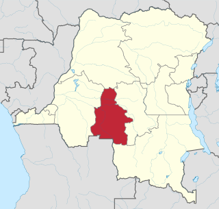
Kasaï-Occidental was one of the eleven provinces of the Democratic Republic of the Congo between 1966 and 2015, when it was split into the Kasaï-Central and the Kasaï provinces.

Benue–Congo is a major branch of the Volta-Congo languages which covers most of Sub-Saharan Africa.
The Kwilu River is a major river that originates in Angola and flows north through Bandundu Province in the Democratic Republic of the Congo (DRC) to the city of Bandundu, where it joins the Kwango River just before this stream enters the Kasai River. In the DRC the river flows past the towns of Gungu, Kikwit, Bulungu, Bagata, Rutherfordia and Bandundu. Lusanga, formerly Leverville, lies at the location where the Kwenge River joins the Kwilu, between Kikwit and Bulungu.

Southern Bantoid is a branch of the Bantoid language family. It consists of the Bantu languages along with several small branches and isolates of eastern Nigeria and west-central Cameroon. Since the Bantu languages are spoken across most of Sub-Saharan Africa, Southern Bantoid comprises 643 languages as counted by Ethnologue, though many of these are mutually intelligible.

The Congo Basin is the sedimentary basin of the Congo River. The Congo Basin is located in Central Africa, in a region known as west equatorial Africa. The Congo Basin region is sometimes known simply as the Congo. It contains some of the largest tropical rainforests in the world.

Bandundu, formerly known as Banningville or Banningstad, is the capital city of Kwilu Province of the Democratic Republic of the Congo.

The Republic of the Congo, also known as Congo-Brazzaville, the Congo Republic or simply either Congo or the Congo, is a country located in the western coast of Central Africa. The country is bordered to the west by Gabon, to its northwest by Cameroon and its northeast by the Central African Republic, to the southeast by the DR Congo, to its south by the Angolan exclave of Cabinda and to its southwest by the Atlantic Ocean. French is the official language of the Republic of the Congo.
