
Merseburg is a town in central Germany located in the southern part of Saxony-Anhalt on the river Saale, approx. 14 km south of Halle (Saale) and 30 km west of Leipzig. It is the capital of the Saalekreis district. It had a diocese founded by Archbishop Adalbert of Magdeburg. The University of Merseburg is located within the town. Merseburg has around 33,000 inhabitants. Merseburg is part of the Central German Metropolitan Region.

Saxony, officially the Free State of Saxony, is a landlocked state of Germany, bordering the states of Brandenburg, Saxony-Anhalt, Thuringia, Bavaria, as well as the countries of Poland and the Czech Republic. Its capital is Dresden, and its largest city is Leipzig. Saxony is the tenth largest of Germany's sixteen states, with an area of 18,413 square kilometres (7,109 sq mi), and the sixth most populous, with more than 4 million inhabitants.

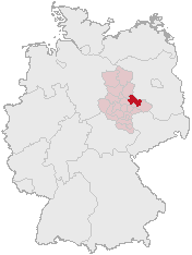
Saxony-Anhalt is a state of Germany, bordering the states of Brandenburg, Saxony, Thuringia and Lower Saxony. It covers an area of 20,447.7 square kilometres (7,894.9 sq mi) and has a population of 2.19 million inhabitants, making it the 8th-largest state in Germany by area and the 11th-largest by population. Its capital is Magdeburg and its largest city is Halle (Saale).

The Duchy of Anhalt was a historical German duchy. The duchy was located between the Harz Mountains in the west and the river Elbe and beyond to the Fläming Heath in the east. The territory was once ruled by the House of Ascania, and is now part of the federal state of Saxony-Anhalt.
A Verbandsgemeinde is a low-level administrative unit in the German federal states of Rhineland-Palatinate and Saxony-Anhalt. A Verbandsgemeinde is typically composed of a small group of villages or towns.
Anhalt-Zerbst was a district in Saxony-Anhalt, Germany. It is bounded by the districts Potsdam-Mittelmark (Brandenburg) and Wittenberg, the city of Dessau and the districts of Köthen, Schönebeck and Jerichower Land.

The Province of Saxony, also known as Prussian Saxony was a province of the Kingdom of Prussia and later the Free State of Prussia from 1816 until 1944. Its capital was Magdeburg.

Wettin is a small town belonging to the municipality of Wettin-Löbejün in the Saale District of Saxony-Anhalt (Saxony-Ascania), Germany. It is situated on the River Saale, just north of Halle. It is known for Wettin Castle, the ancestral seat of the House of Wettin, the former ruling dynasty of Saxony, Poland, the United Kingdom, Belgium, and Bulgaria. The town and its name are of Slavic origin.

Sangerhausen is a town in Saxony-Anhalt, central Germany, capital of the district of Mansfeld-Südharz. It is situated southeast of the Harz, approx. 35 kilometres east of Nordhausen, and 50 km (31 mi) west of Halle (Saale). About 26,000 people live in Sangerhausen (2020).
Central Germany is an economic and cultural region in Germany. Its exact borders depend on context, but it is often defined as being a region within the federal states of Saxony, Thuringia and Saxony-Anhalt, or a smaller part of this region, such as the metropolitan area of Leipzig and Halle plus the surrounding counties.
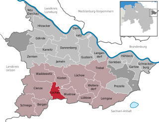
Luckau (Wendland) is a village or Gemeinde (municipality) in the south of the Kreis of Lüchow-Dannenberg in Lower Saxony, Germany, where it forms part of the Samtgemeinde of Lüchow (Wendland).

Freyburg is a town in the Burgenlandkreis district, in Saxony-Anhalt, Germany. It is situated on the river Unstrut, 9 km northwest of Hanseatic Naumburg, 63 km from Leipzig and 231 km from Berlin. It is part of the Verwaltungsgemeinschaft Unstruttal. On 1 July 2009 it absorbed the former municipalities Pödelist, Schleberoda, Weischütz and Zeuchfeld. Freyburg consists of the Ortsteile (divisions) Dobichau, Freyburg, Nißmitz, Pödelist, Schleberoda, Weischütz, Zeuchfeld and Zscheiplitz.

Jessen is a municipality on the Black Elster river and lies in the eastern part of Saxony-Anhalt in the district of Wittenberg.

Benneckenstein is a town in the district of Harz, in Saxony-Anhalt, Germany. Since 1 January 2010, it has been part of the town of Oberharz am Brocken. Benneckenstein is in the eastern Harz, 14 km southeast of Braunlage, and 24 km south of Wernigerode.

Gödnitz is a village and a former municipality in the district of Anhalt-Bitterfeld, in Saxony-Anhalt, Germany. Since 1 January 2010, it is part of the town Zerbst/Anhalt.

Balgstädt is a municipality in the Burgenlandkreis district, in Saxony-Anhalt, Germany. Since 2009 it has incorporated the former municipalities of Burkersroda, Größnitz and Hirschroda.
The Romanesque Road is a scenic route in the German state of Saxony-Anhalt in central-east Germany. It is part of the Transromanica network, a major European Cultural Route since 2006.

The Helme is river in central Germany that is about 65 kilometres (40 mi) long and which forms a left-hand, western tributary of the Unstrut in the states of Thuringia and Saxony-Anhalt.
The State of Saxony-Anhalt was a subdivision of the Soviet occupation zone and state of East Germany which corresponds widely to the present-day German state Saxony-Anhalt. After the retreat of the US troops from the Western parts - following the agreements of the Yalta Conference - it was formed as administrative division called Province of Saxony by the Soviet Military Administration in Germany (SMAD) in July 1945. The province was a re-establishment of the Province of Saxony which existed in Prussia from 1816 to 1944. On 1 July 1944, the Province of Saxony was divided along the lines of its three government districts of Halle-Merseburg, Magdeburg and Erfurt. The two provinces became part of the new state including small parts of Thuringia (Allstedt) and Soviet-occupied parts of Anhalt (Dessau) and Brunswick. Following the first election for the Landtag in October 1946, the state was renamed to Province of Saxony-Anhalt on the same day. With the abolition of Prussia in February 1947, it was named State of Saxony-Anhalt. Compared to the administrative divisions of Nazi Germany, it comprised the Gaue Magdeburg-Anhalt, Halle-Merseburg and small parts of Southern Hanover-Brunswick and Thuringia.


