The Alps are one of the highest and most extensive mountain ranges in Europe, stretching approximately 1,200 km (750 mi) across eight Alpine countries : Monaco, France, Switzerland, Italy, Liechtenstein, Germany, Austria and Slovenia.

The geography of Switzerland features a mountainous and landlocked country located in Western and Central Europe. Switzerland's natural landscape is marked by its numerous lakes and mountains. It is surrounded by five countries: Austria and Liechtenstein to the east, France to the west, Italy to the south and Germany to the north. Switzerland has a maximum north–south length of 220 kilometres (140 mi) and an east–west length of about 350 kilometres (220 mi).

The Grisons or Graubünden, more formally the Canton of the Grisons or the Canton of Graubünden, is one of the twenty-six cantons of Switzerland. It has eleven districts, and its capital is Chur. The German name of the canton, Graubünden, translates as the "Grey Leagues", referring to the canton's origin in three local alliances, the Three Leagues. The other native names also refer to the Grey League: Grischùn in Sutsilvan, Grischun in the other forms of Romansh, and Grigioni in Italian. Rhaetia is the Latin name for the area. The Alpine ibex is the canton's heraldic symbol.

The Engadin or Engadine is a long high Alpine valley region in the eastern Swiss Alps in the canton of Graubünden in southeasternmost Switzerland with about 25,000 inhabitants. It follows the route of the Inn from its headwaters at Maloja Pass in the southwest running roughly northeast until the Inn flows into Austria, little less than one hundred kilometers downstream. The En/Inn subsequently flows at Passau into the Danube, making it the only Swiss river to drain into the Black Sea. The Engadine is protected by high mountain ranges on all sides and is famous for its sunny climate, beautiful landscapes and outdoor activities.

Valais, more formally, the Canton of Valais, is one of the 26 cantons forming the Swiss Confederation. It is composed of thirteen districts and its capital and largest city is Sion.

Adelboden is a mountain village and a municipality in Switzerland, located in the Frutigen-Niedersimmental administrative district in the Bernese Highlands.

There are 122 municipalities in the canton of Valais, Switzerland.

The Bernese Oberland, sometimes also known as the Bernese Highlands, is the highest and southernmost part of the canton of Bern. It is one of the canton's five administrative regions. It constitutes the Alpine region of the canton and the northern side of the Bernese Alps, including many of its highest peaks, among which the Finsteraarhorn, the highest in both range and canton.

The Eastern Alps are usually defined as the area east of a line from Lake Constance and the Alpine Rhine valley, up to the Splügen Pass at the Alpine divide, and down the Liro River to Lake Como in the south. The peaks and mountain passes are lower than the Western Alps, while the range itself is broader and less arched.

The Weissmies 4,013 m (13,166 ft) is a mountain in the Pennine Alps in the canton of Valais in Switzerland near the village of Saas-Fee. It is the easternmost four-thousander of its range.

Lenzerheide is a mountain resort in the canton of Graubünden, Switzerland at the foot of the Parpaner Rothorn. The village lies in the municipality Vaz/Obervaz in the district of Albula, sub-district Alvaschein.
Antrona Schieranco is a comune (municipality) in the Province of Verbano-Cusio-Ossola in the Italian region Piedmont, located about 120 kilometres (75 mi) northeast of Turin and about 35 kilometres (22 mi) northwest of Verbania, in a branch of the Val d'Ossola, on the border with Switzerland.

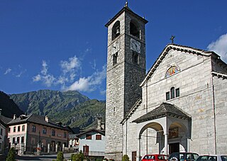
Bognanco, population about 250, is a commune in the Province of Verbano-Cusio-Ossola in the Italian region Piedmont, located in an Alpine valley about 120 kilometres (75 mi) northeast of Turin immediately to the west of Domodossola and on the border with Switzerland. Its municipal boundaries extend over an area of 58.1 square kilometres (22.4 sq mi) that ranges in elevation from 380 to 2,713 metres above sea-level and borders on the Italian communes of Antrona Schieranco, Crevoladossola, Domodossola, Montescheno and Trasquera, and Zwischbergen in the Swiss canton Valais.
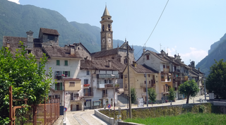
Varzo is a comune (municipality) in the Province of Verbano-Cusio-Ossola in the Italian region Piedmont, located about 130 kilometres (81 mi) northeast of Turin and about 35 kilometres (22 mi) northwest of Verbania, on the border with Switzerland. As of 31 December 2004, it had a population of 2,209 and an area of 94.4 square kilometres (36.4 sq mi).
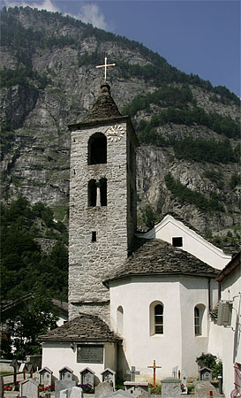
Zwischbergen is a municipality in the district of Brig in the canton of Valais in Switzerland.

PostAuto Switzerland, PostBus Ltd. (known as PostAuto Schweiz in Swiss Standard German, CarPostal Suisse in Swiss French, AutoPostale Svizzera in Swiss Italian, and AutoDaPosta Svizra in Romansh is a subsidiary company of the Swiss Post, which provides regional and rural bus services throughout Switzerland, and also in France, Germany, and Liechtenstein.

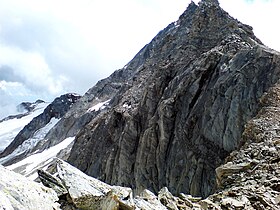
The Portjengrat is a mountain of the Pennine Alps, located on the border between Switzerland and Italy. It lies south of the Weissmies and the Zwischbergen Pass, where the international border diverges away from the main Alpine watershed. The summit of the Portjengrat has an elevation of 3,654 metres above sea level and is the tripoint between the valleys of Saas, Divedro and Antrona. It is the culminating point of the Antrona valley.

Tschawinersee is a lake in the canton of Valais, Switzerland. Located at an elevation of 2174 m, its surface area is 6.2 ha.

The High Alps are the parts of the Alps unsuitable for habitation or seasonal transhumance. This includes all regions higher than 3,000 m above sea level, as well as most regions between 2,500 m and 3,000 m. Alpine pastures are typically below 2,400 m but may exceptionally be located as high as 2,800 m.

The Diveria is an Alpine river which flows through Switzerland and Italy. It is a tributary of the Toce and therefore, via Lake Maggiore and the Ticino, of the Po. The valley crossed by the Diveria, the Val Divedro, is the only one in the Valais to form part of the Po basin rather than that of the Rhône.