
Fonserannes Locks are a flight of staircase locks on the Canal du Midi near Béziers.
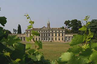
Pennautier is a commune in the Aude department in southern France.
The Épanchoir de Foucaud is a small botanical garden located in Pennautier just outside Carcassonne, Aude, Languedoc-Roussillon, France. It contains a collection of Mediterranean plants set about an épanchoir of the Canal du Midi, that is, a spillway for the canal's excess water. The garden is open daily without charge.

The La Nouvelle branch is a 37.3-kilometre (23.2 mi) branch of the Canal du Midi in Aude, southern France which runs from the Canal du Midi through Narbonne and on to the Mediterranean. It is made up of three waterways: the first 5.1 kilometres (3.2 mi) is the Canal de Jonction from the Canal du Midi to the Aude, the second section is 800 metres (2,625 ft) of the Aude itself and the third is the 31.6 kilometres (19.6 mi) Canal de la Robine which enters the Mediterranean at Port-la-Nouvelle. The La Nouvelle branch is designated a UNESCO World Heritage Site as part of the Canal du Midi and is managed by the French navigation authority, Voies navigables de France.

The Bassin de Naurouze is an octagonal holding tank, created during the building of the Canal du Midi as designed and built by Pierre-Paul Riquet. It was abandoned a few years after construction of the canal because of its recurrent silting problems. The flow of water from the Bassin de Saint-Ferréol joins the Canal du Midi at this point near the Seuil de Naurouze. Riquet hoped to build a city around the basin and also considered building a port. However, it easily filled with silt and its use discontinued. A lawn replaced the empty pool, and it is crossed by a straight path lined with plane trees.
The Bassin de Lampy was created during 1777 and 1781 when a dam was placed on the Lampy Valley in the Aude department in south-central France. The reservoir provides a source of water for the Canal du Midi. It was originally proposed in 1665 by the commission created by Louis XIV of France to evaluate Pierre-Paul Riquet's plan for the canal enterprise.
The Épanchoir du Vivier is a siphon for water release from the Canal du Midi immediately to the west of the triple lock of the Vivier lock.
The Épanchoir de Villepinte is a siphon for water release from the Canal du Midi immediately to the west of the single lock of the Villepinte lock and south of the village of Villepinte.
The Épanchoir de Villeséque is a siphon for water release from the Canal du Midi immediately to the west of the single lock of the Villeséquelande Lock and southeast of the village of Villesèquelande.
The Épanchoir de Charques is a siphon for water release from the Canal du Midi east of the Fresquel Single Lock and southeast of the village of Villemoustaussou in France.
The Épanchoir de Ste-Julia is a siphon for water release from the Canal du Midi east of the triple lock of the Trèbes Lock and southeast of the village of Trèbes.
The Épanchoir de d'Argentdouble is a siphon for water release from the Canal du Midi immediately to the west of the Argent-Double Aqueduct and southeast of the village of La Redorte.
The Épanchoir des Patiasses is a siphon for water release from the Canal du Midi immediately to the west of the Cesse Aqueduct and southeast of the village of Mirepeisset.
The Déversoir de Villepinte is a weir for water release from the Canal du Midi immediately to the west of the Mezuran Aqueduct and southwest of the village of Villepinte.
The Déversoir de St-Jean is a weir for water release from the Canal du Midi immediately to the east of the St-Nazaire Aqueduct and northeast of Carcassonne.
The Déversoir de la Raye is a weir for water release from the Canal du Midi west of the Orbiel Aqueduct and northwest of Trèbes.
The Déversoir de Marseillette is a weir for water release from the Canal du Midi east of the Mercier Aqueduct and west of Marseillette.


