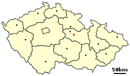
Leštinka is a small village in the Pardubice Region of the Czech Republic. It has around 140 inhabitants.

Stary Dwór is a village in the administrative district of Gmina Kąty Wrocławskie, within Wrocław County, Lower Silesian Voivodeship, in south-western Poland. Prior to 1945 it was in Germany.
Brzozówka-Kolonia is a village in the administrative district of Gmina Szastarka, within Kraśnik County, Lublin Voivodeship, in eastern Poland.
Pierekał is a village in the administrative district of Gmina Szudziałowo, within Sokółka County, Podlaskie Voivodeship, in north-eastern Poland, close to the border with Belarus.
Wola Krogulecka is a village in the administrative district of Gmina Stary Sącz, within Nowy Sącz County, Lesser Poland Voivodeship, in southern Poland. It lies approximately 6 kilometres (4 mi) south-east of Stary Sącz, 13 km (8 mi) south of Nowy Sącz, and 81 km (50 mi) south-east of the regional capital Kraków.
Klimontów is a village in the administrative district of Gmina Sędziszów, within Jędrzejów County, Świętokrzyskie Voivodeship, in south-central Poland. It lies approximately 8 kilometres (5 mi) south of Sędziszów, 23 km (14 mi) south-west of Jędrzejów, and 58 km (36 mi) south-west of the regional capital Kielce.
Wilków is a village in the administrative district of Gmina Bodzentyn, within Kielce County, Świętokrzyskie Voivodeship, in south-central Poland. It lies approximately 9 kilometres (6 mi) west of Bodzentyn and 17 km (11 mi) east of the regional capital Kielce.
Kozia Wola is a village in the administrative district of Gmina Stąporków, within Końskie County, Świętokrzyskie Voivodeship, in south-central Poland. It lies approximately 4 kilometres (2 mi) north-west of Stąporków, 8 km (5 mi) south-east of Końskie, and 33 km (21 mi) north of the regional capital Kielce.
Drochówka is a village in the administrative district of Gmina Naruszewo, within Płońsk County, Masovian Voivodeship, in east-central Poland.
Czaple-Kolonia is a village in the administrative district of Gmina Repki, within Sokołów County, Masovian Voivodeship, in east-central Poland.
Bodzewo is a village in the administrative district of Gmina Piaski, within Gostyń County, Greater Poland Voivodeship, in west-central Poland. It lies approximately 5 kilometres (3 mi) south of Piaski, 6 km (4 mi) south-east of Gostyń, and 63 km (39 mi) south of the regional capital Poznań.
Główczyce is a village in the administrative district of Gmina Dobrodzień, within Olesno County, Opole Voivodeship, in south-western Poland.
Żychckie Osady is a village in the administrative district of Gmina Konarzyny, within Chojnice County, Pomeranian Voivodeship, in northern Poland. It lies approximately 3 kilometres (2 mi) north of Konarzyny, 20 km (12 mi) north-west of Chojnice, and 101 km (63 mi) south-west of the regional capital Gdańsk.
Perklice is a village in the administrative district of Gmina Mikołajki Pomorskie, within Sztum County, Pomeranian Voivodeship, in northern Poland. It lies approximately 5 kilometres (3 mi) east of Mikołajki Pomorskie, 16 km (10 mi) south-east of Sztum, and 70 km (43 mi) south-east of the regional capital Gdańsk.
Witoszewo is a village in the administrative district of Gmina Zalewo, within Iława County, Warmian-Masurian Voivodeship, in northern Poland. It lies approximately 7 kilometres (4 mi) west of Zalewo, 27 km (17 mi) north of Iława, and 66 km (41 mi) west of the regional capital Olsztyn.
Joachimowo is a settlement in the administrative district of Gmina Mrągowo, within Mrągowo County, Warmian-Masurian Voivodeship, in northern Poland.
Zerbuń is a village in the administrative district of Gmina Jeziorany, within Olsztyn County, Warmian-Masurian Voivodeship, in northern Poland. It lies approximately 9 kilometres (6 mi) south-east of Jeziorany and 29 km (18 mi) north-east of the regional capital Olsztyn.
Gamerki Małe is a village in the administrative district of Gmina Jonkowo, within Olsztyn County, Warmian-Masurian Voivodeship, in northern Poland. It lies approximately 11 kilometres (7 mi) west of Jonkowo and 24 km (15 mi) west of the regional capital Olsztyn.
Bagniewko is a village in the administrative district of Gmina Biały Bór, within Szczecinek County, West Pomeranian Voivodeship, in north-western Poland.
Białka is a village in the administrative district of Gmina Biały Bór, within Szczecinek County, West Pomeranian Voivodeship, in north-western Poland. It lies approximately 5 kilometres (3 mi) south of Biały Bór, 19 km (12 mi) north-east of Szczecinek, and 158 km (98 mi) east of the regional capital Szczecin.


