Wodnica is a village in the administrative district of Gmina Wołów, within Wołów County, Lower Silesian Voivodeship, in south-western Poland. Prior to 1945 it was in Germany.
Piła-Młyn is a village in the administrative district of Gmina Cekcyn, within Tuchola County, Kuyavian-Pomeranian Voivodeship, in north-central Poland.
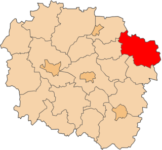
Wiktorowo is a village in the administrative district of Gmina Perlejewo, within Siemiatycze County, Podlaskie Voivodeship, in north-eastern Poland.
Konopki Leśne is a village in the administrative district of Gmina Rutki, within Zambrów County, Podlaskie Voivodeship, in north-eastern Poland. It lies approximately 24 kilometres (15 mi) north-east of Zambrów and 44 km (27 mi) west of the regional capital Białystok.
Rozpęd is a village in the administrative district of Gmina Kobiele Wielkie, within Radomsko County, Łódź Voivodeship, in central Poland. It lies approximately 8 kilometres (5 mi) west of Kobiele Wielkie, 8 km (5 mi) south-east of Radomsko, and 86 km (53 mi) south of the regional capital Łódź.
Świątniki is a village in the administrative district of Gmina Wodzisław, within Jędrzejów County, Świętokrzyskie Voivodeship, in south-central Poland.
Lelusin is a village in the administrative district of Gmina Chęciny, within Kielce County, Świętokrzyskie Voivodeship, in south-central Poland. It lies approximately 9 kilometres (6 mi) south of Chęciny and 19 km (12 mi) south-west of the regional capital Kielce.
Białe is a village in the administrative district of Gmina Gostynin, within Gostynin County, Masovian Voivodeship, in east-central Poland.
Krzymów is a village in the administrative district of Gmina Szczawin Kościelny, within Gostynin County, Masovian Voivodeship, in east-central Poland.
Nowe Mierzwice is a village in the administrative district of Gmina Sarnaki, within Łosice County, Masovian Voivodeship, in east-central Poland.
Barcikowo is a village in the administrative district of Gmina Słupno, within Płock County, Masovian Voivodeship, in east-central Poland. It lies approximately 14 kilometres (9 mi) east of Płock and 82 km (51 mi) north-west of Warsaw.
Gostolin is a village in the administrative district of Gmina Załuski, within Płońsk County, Masovian Voivodeship, in east-central Poland.
Ludwików is a village in the administrative district of Gmina Jedlińsk, within Radom County, Masovian Voivodeship, in east-central Poland.
Stare Trębice is a village in the administrative district of Gmina Paprotnia, within Siedlce County, Masovian Voivodeship, in east-central Poland.
Borki-Wyrki is a village in the administrative district of Gmina Zbuczyn, within Siedlce County, Masovian Voivodeship, in east-central Poland.
Czachurki is a village in the administrative district of Gmina Pobiedziska, within Poznań County, Greater Poland Voivodeship, in west-central Poland.
Jora Mała is a village in the administrative district of Gmina Mikołajki, within Mrągowo County, Warmian-Masurian Voivodeship, in northern Poland. It lies approximately 8 kilometres (5 mi) north-west of Mikołajki, 15 km (9 mi) east of Mrągowo, and 68 km (42 mi) east of the regional capital Olsztyn.
Gostomin is a village in the administrative district of Gmina Radowo Małe, within Łobez County, West Pomeranian Voivodeship, in north-western Poland. It lies approximately 8 kilometres (5 mi) north-west of Radowo Małe, 19 km (12 mi) west of Łobez, and 59 km (37 mi) north-east of the regional capital Szczecin.

Keephills is a hamlet in central Alberta, Canada within Parkland County. It is located approximately 19 kilometres (12 mi) south of Highway 16 and 64 kilometres (40 mi) southwest of Edmonton. A nearby employer is the Keephills Generating Station.
Hawandawaki is a village and rural commune in Niger.