Żary County is a unit of territorial administration and local government (powiat) in Lubusz Voivodeship, western Poland, on the German border. It came into being on January 1, 1999, as a result of the Polish local government reforms passed in 1998. Its administrative seat and largest town is Żary, which lies 43 km (27 mi) south-west of Zielona Góra and 123 km (76 mi) south of Gorzów Wielkopolski. The county contains three other towns: Lubsko, lying 21 km (13 mi) north-west of Żary, Jasień, lying 16 km (10 mi) north-west of Żary, and Łęknica, 30 km (19 mi) west of Żary.

Żagań County is a unit of territorial administration and local government (powiat) in Lubusz Voivodeship, western Poland. It came into being on January 1, 1999, as a result of the Polish local government reforms passed in 1998. Its administrative seat and largest town is Żagań, which lies 39 km (24 mi) south of Zielona Góra and 124 km (77 mi) south of Gorzów Wielkopolski. The county contains four other towns: Szprotawa, lying 14 km (9 mi) south-east of Żagań, Iłowa, lying 15 km (9 mi) south-west of Żagań, Małomice, lying 12 km (7 mi) south-east of Żagań, and Gozdnica, 25 km (16 mi) south-west of Żagań.

Tomaszów County is a unit of territorial administration and local government (powiat) in Lublin Voivodeship, eastern Poland, on the border with Ukraine. It was established on January 1, 1999, as a result of the Polish local government reforms passed in 1998. Its administrative seat and largest town is Tomaszów Lubelski, which lies 107 kilometres (66 mi) south-east of the regional capital Lublin. The only other towns in the county are Tyszowce, lying 28 km (17 mi) north-east of Tomaszów, and Łaszczów, lying 25 km (16 mi) east of Tomaszów.

Garwolin County is a unit of territorial administration and local government (powiat) in Masovian Voivodeship, east-central Poland. It came into being on 1 January 1999, as a result of the Polish local government reforms passed in 1998. Its administrative seat and largest town is Garwolin, which lies 56 kilometres (35 mi) south-east of Warsaw. The county contains three other towns: Łaskarzew, 13 km (8 mi) south of Garwolin, Pilawa, 10 km (6 mi) north-west of Garwolin, and Żelechów, 22 km (14 mi) south-east of Garwolin.

Otwock County is a unit of territorial administration and local government (powiat) in Masovian Voivodeship, east-central Poland. It came into being on January 1, 1999, as a result of the Polish local government reforms passed in 1998. Its administrative seat and largest town is Otwock, which lies 22 kilometres (14 mi) south-east of Warsaw. The county also contains the towns of Józefów, lying 3 km (2 mi) north-west of Otwock, and Karczew, 4 km (2 mi) south of Otwock.

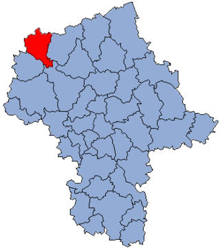
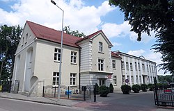
Żuromin County is a unit of territorial administration and local government (powiat) in Masovian Voivodeship, east-central Poland. It came into being on January 1, 1999, as a result of the Polish local government reforms passed in 1998. Its administrative seat and largest town is Żuromin, which lies 121 kilometres (75 mi) north-west of Warsaw. Other towns in the county are Bieżuń, lying 13 km (8 mi) south of Żuromin and Lubowidz, lying 9 km (6 mi) north-west of Żuromin.

Działdowo County is a unit of territorial administration and local government (powiat) in Warmian-Masurian Voivodeship, northern Poland. It came into being on January 1, 1999, as a result of the Polish local government reforms passed in 1998. Its administrative seat and largest town is Działdowo, which lies 65 kilometres (40 mi) south of the regional capital Olsztyn. The only other town in the county is Lidzbark, lying 25 km (16 mi) west of Działdowo.

Nowe Miasto County is a unit of territorial administration and local government (powiat) in Warmian-Masurian Voivodeship, northern Poland. It came into being on January 1, 1999, as a result of the Polish local government reforms passed in 1998. Its administrative seat and only town is Nowe Miasto Lubawskie, which lies 73 kilometres (45 mi) south-west of the regional capital Olsztyn.

Drawsko County is a unit of territorial administration and local government (powiat) in West Pomeranian Voivodeship, north-western Poland. It came into being on January 1, 1999, as a result of the Polish local government reforms passed in 1998. Its administrative seat is the town of Drawsko Pomorskie, which lies 82 kilometres (51 mi) east of the regional capital Szczecin. The county contains three other towns: Złocieniec, 15 km (9 mi) east of Drawsko Pomorskie, Czaplinek, 29 km (18 mi) east of Drawsko Pomorskie, and Kalisz Pomorski, 29 km (18 mi) south of Drawsko Pomorskie.

Rypin County is a unit of territorial administration and local government (powiat) in Kuyavian-Pomeranian Voivodeship, north-central Poland. It came into being on January 1, 1999, as a result of the Polish local government reforms passed in 1998. Its administrative seat and only town is Rypin, which lies 56 km (35 mi) east of Toruń and 98 km (61 mi) east of Bydgoszcz.

Lipno County is a unit of territorial administration and local government (powiat) in Kuyavian-Pomeranian Voivodeship, north-central Poland. It was formed on January 1, 1999, as a result of the Polish local government reforms passed in 1998. Its administrative seat and largest town is Lipno, which lies 43 km (27 mi) south-east of Toruń and 84 km (52 mi) east of Bydgoszcz. The county also contains the towns of Skępe, lying 13 km (8 mi) east of Lipno, and Dobrzyń nad Wisłą, 26 km (16 mi) south-east of Lipno.

Inowrocław County is a unit of territorial administration and local government (powiat) in Kuyavian-Pomeranian Voivodeship, north-central Poland. It came into being on January 1, 1999, as a result of the Polish local government reforms passed in 1998. Its administrative seat and largest town is Inowrocław, which lies 36 km (22 mi) south-west of Toruń and 40 km (25 mi) south-east of Bydgoszcz. The county contains four other towns: Kruszwica, lying 14 km (9 mi) south of Inowrocław, Janikowo, lying 12 km (7 mi) south-west of Inowrocław, Gniewkowo, 16 km (10 mi) north-east of Inowrocław, and Pakość, 13 km (8 mi) west of Inowrocław.

Wąbrzeźno County is a unit of territorial administration and local government (powiat) in Kuyavian-Pomeranian Voivodeship, north-central Poland. It came into being on January 1, 1999, as a result of the Polish local government reforms passed in 1998. Its administrative seat and only town is Wąbrzeźno, which lies 36 km (22 mi) north-east of Toruń and 66 km (41 mi) east of Bydgoszcz.

Radziejów County is a unit of territorial administration and local government (powiat) in Kuyavian-Pomeranian Voivodeship, north-central Poland. It came into being on January 1, 1999, as a result of the Polish local government reforms passed in 1998. Its administrative seat and largest town is Radziejów, which lies 45 km (28 mi) south of Toruń and 64 km (40 mi) south-east of Bydgoszcz. The only other town in the county is Piotrków Kujawski, lying 10 km (6 mi) south of Radziejów.

Grudziądz County is a unit of territorial administration and local government (powiat) in Kuyavian-Pomeranian Voivodeship, north-central Poland. It came into being on January 1, 1999, as a result of the Polish local government reforms passed in 1998. Its administrative seat is the city of Grudziądz, although the city is not part of the county. The only towns in Grudziądz County are Łasin, which lies 21 km (13 mi) east of Grudziądz, and Radzyń Chełmiński, 16 km (10 mi) south-east of Grudziądz.

Golub-Dobrzyń County is a unit of territorial administration and local government (powiat) in Kuyavian-Pomeranian Voivodeship, north-central Poland. It came into being on January 1, 1999, as a result of the Polish local government reforms passed in 1998. Its administrative seat and largest town is the town of Golub-Dobrzyń, which lies 30 km (19 mi) east of Toruń and 71 km (44 mi) east of Bydgoszcz. The only other town in the county is Kowalewo Pomorskie, lying 13 km (8 mi) north-west of Golub-Dobrzyń.
Gmina Górzno is an urban-rural gmina in Brodnica County, Kuyavian-Pomeranian Voivodeship, in north-central Poland. Its seat is the town of Górzno, which lies approximately 18 kilometres (11 mi) east of Brodnica and 72 km (45 mi) east of Toruń.
Gmina Bobrowo is a rural gmina in Brodnica County, Kuyavian-Pomeranian Voivodeship, in north-central Poland. Its seat is the village of Bobrowo, which lies approximately 9 kilometres (6 mi) north-west of Brodnica and 53 km (33 mi) north-east of Toruń.

Gmina Jabłonowo Pomorskie is an urban-rural gmina in Brodnica County, Kuyavian-Pomeranian Voivodeship, in north-central Poland. Its seat is the town of Jabłonowo Pomorskie, which lies approximately 23 kilometres (14 mi) north-west of Brodnica and 54 km (34 mi) north-east of Toruń.
Gmina Zbiczno is a rural gmina in Brodnica County, Kuyavian-Pomeranian Voivodeship, in north-central Poland. Its seat is the village of Zbiczno, which lies approximately 10 kilometres (6 mi) north of Brodnica and 61 km (38 mi) north-east of Toruń.


