Glinnik is a village in the administrative district of Gmina Lubochnia, within Tomaszów Mazowiecki County, Łódź Voivodeship, in central Poland. It lies approximately 7 kilometres (4 mi) south-east of Lubochnia, 9 km (6 mi) north-east of Tomaszów Mazowiecki, and 51 km (32 mi) south-east of the regional capital Łódź.

Spała is a village in the administrative district of Gmina Inowłódz, within Tomaszów Mazowiecki County, Łódź Voivodeship, in central Poland. It lies on the Pilica River, approximately 6 kilometres (4 mi) west of Inowłódz, 9 km (6 mi) east of Tomaszów Mazowiecki, and 54 km (34 mi) south-east of the regional capital Łódź. The village has a population of 400. It gives its name to the protected area called Spała Landscape Park.
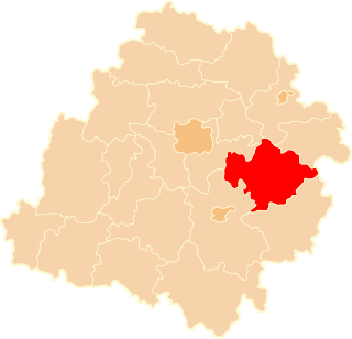
Gmina Lubochnia is a rural gmina in Tomaszów Mazowiecki County, Łódź Voivodeship, in central Poland. Its seat is the village of Lubochnia, which lies approximately 11 kilometres (7 mi) north of Tomaszów Mazowiecki and 45 km (28 mi) south-east of the regional capital Łódź.
Spała Landscape Park is a protected area in central Poland, established in 1995, covering an area of 128.75 square kilometres (49.71 sq mi). It takes its name from the village of Spała.
Drzazgowa Wola is a village in the administrative district of Gmina Będków, within Tomaszów Mazowiecki County, Łódź Voivodeship, in central Poland. It lies approximately 6 kilometres (4 mi) south-east of Będków, 16 km (10 mi) west of Tomaszów Mazowiecki, and 35 km (22 mi) south-east of the regional capital Łódź.
Rzeczków is a village in the administrative district of Gmina Będków, within Tomaszów Mazowiecki County, Łódź Voivodeship, in central Poland. It lies approximately 5 kilometres (3 mi) south of Będków, 20 km (12 mi) west of Tomaszów Mazowiecki, and 32 km (20 mi) south-east of the regional capital Łódź.
Wale is a village in the administrative district of Gmina Czerniewice, within Tomaszów Mazowiecki County, Łódź Voivodeship, in central Poland. It lies approximately 9 kilometres (6 mi) north-east of Czerniewice, 27 km (17 mi) north-east of Tomaszów Mazowiecki, and 56 km (35 mi) east of the regional capital Łódź.
Brzustów is a village in the administrative district of Gmina Inowłódz, within Tomaszów Mazowiecki County, Łódź Voivodeship, in central Poland. It lies approximately 6 kilometres (4 mi) south-west of Inowłódz, 11 km (7 mi) east of Tomaszów Mazowiecki, and 58 km (36 mi) south-east of the regional capital Łódź.
Dąbrowa is a village in the administrative district of Gmina Inowłódz, within Tomaszów Mazowiecki County, Łódź Voivodeship, in central Poland. It lies approximately 7 kilometres (4 mi) south-west of Inowłódz, 10 km (6 mi) east of Tomaszów Mazowiecki, and 58 km (36 mi) south-east of the regional capital Łódź.
Konewka is a village in the administrative district of Gmina Inowłódz, within Tomaszów Mazowiecki County, Łódź Voivodeship, in central Poland. It lies approximately 7 kilometres (4 mi) north-west of Inowłódz, 9 km (6 mi) north-east of Tomaszów Mazowiecki, and 53 km (33 mi) south-east of the regional capital Łódź.
Królowa Wola is a village in the administrative district of Gmina Inowłódz, within Tomaszów Mazowiecki County, Łódź Voivodeship, in central Poland. It lies approximately 5 kilometres (3 mi) north-west of Inowłódz, 12 km (7 mi) east of Tomaszów Mazowiecki, and 56 km (35 mi) south-east of the regional capital Łódź.
Liciążna is a village in the administrative district of Gmina Inowłódz, within Tomaszów Mazowiecki County, Łódź Voivodeship, in central Poland. It lies approximately 5 kilometres (3 mi) north-east of Inowłódz, 18 km (11 mi) east of Tomaszów Mazowiecki, and 61 km (38 mi) south-east of the regional capital Łódź.
Poświętne is a village in the administrative district of Gmina Inowłódz, within Tomaszów Mazowiecki County, Łódź Voivodeship, in central Poland. It lies approximately 3 kilometres (2 mi) north of Inowłódz, 15 km (9 mi) east of Tomaszów Mazowiecki, and 58 km (36 mi) south-east of the regional capital Łódź.
Teofilów is a village in the administrative district of Gmina Inowłódz, within Tomaszów Mazowiecki County, Łódź Voivodeship, in central Poland. It lies approximately 3 kilometres (2 mi) north-west of Inowłódz, 13 km (8 mi) east of Tomaszów Mazowiecki, and 57 km (35 mi) south-east of the regional capital Łódź.
Zakościele is a village in the administrative district of Gmina Inowłódz, within Tomaszów Mazowiecki County, Łódź Voivodeship, in central Poland. It lies approximately 2 kilometres (1 mi) east of Inowłódz, 16 km (10 mi) east of Tomaszów Mazowiecki, and 61 km (38 mi) south-east of the regional capital Łódź.
Świńsko is a village in the administrative district of Gmina Tomaszów Mazowiecki, within Tomaszów Mazowiecki County, Łódź Voivodeship, in central Poland. It lies approximately 9 kilometres (6 mi) north-west of Tomaszów Mazowiecki and 40 km (25 mi) south-east of the regional capital Łódź.
Wąwał is a village in the administrative district of Gmina Tomaszów Mazowiecki, within Tomaszów Mazowiecki County, Łódź Voivodeship, in central Poland. It lies approximately 4 kilometres (2 mi) south-east of Tomaszów Mazowiecki and 53 km (33 mi) south-east of the regional capital Łódź.
Zaborów Drugi is a village in the administrative district of Gmina Tomaszów Mazowiecki, within Tomaszów Mazowiecki County, Łódź Voivodeship, in central Poland. It lies approximately 6 kilometres (4 mi) north-west of Tomaszów Mazowiecki and 43 km (27 mi) south-east of the regional capital Łódź.
Zaborów Pierwszy is a village in the administrative district of Gmina Tomaszów Mazowiecki, within Tomaszów Mazowiecki County, Łódź Voivodeship, in central Poland. It lies approximately 6 kilometres (4 mi) north-west of Tomaszów Mazowiecki and 44 km (27 mi) south-east of the regional capital Łódź.