
Burkina Faso is a landlocked country in West Africa with an area of 274,200 km2 (105,900 sq mi), bordered by Mali to the northwest, Niger to the northeast, Benin to the southeast, Togo and Ghana to the south, and the Ivory Coast to the southwest. As of 2021, the country had an estimated population of 20,321,378. Previously called Republic of Upper Volta (1958–1984), it was renamed Burkina Faso by President Thomas Sankara. Its citizens are known as Burkinabè, and its capital and largest city is Ouagadougou. Its name is often translated into English as the "Land of Honest Men".

Burkina Faso is a landlocked Sahel country that shares borders with six nations. It lies between the Sahara desert and the Gulf of Guinea, south of the loop of the Niger River, mostly between latitudes 9° and 15°N, and longitudes 6°W and 3°E. The land is green in the south, with forests and fruit trees, and semi-arid in the north. Most of central Burkina Faso lies on a savanna plateau, 198–305 metres (650–1,001 ft) above sea level, with fields, brush, and scattered trees. Burkina Faso's game preserves – the most important of which are Arly, Nazinga, and W National Park—contain lions, elephants, hippopotamus, monkeys, common warthogs, and antelopes. Previously the endangered painted hunting dog, Lycaon pictus occurred in Burkina Faso, but, although the last sightings were made in Arli National Park, the species is considered extirpated from Burkina Faso.

Transport in Burkina Faso consists primarily of road, air and rail transportation. The World Bank classified country's transportation as underdeveloped but noted that Burkina Faso is a natural geographic transportation hub for West Africa.

Ouagadougou is the capital of Burkina Faso and the administrative, communications, cultural, and economic centre of the nation. It is also the country's largest city, with a population of 2,415,266 in 2019. The city's name is often shortened to Ouaga. The inhabitants are called ouagalais. The spelling of the name Ouagadougou is derived from the French orthography common in former French African colonies.

West Africa or Western Africa is the westernmost region of Africa. The United Nations defines Western Africa as the 16 countries of Benin, Burkina Faso, Cape Verde, The Gambia, Ghana, Guinea, Guinea-Bissau, Ivory Coast, Liberia, Mali, Mauritania, Niger, Nigeria, Senegal, Sierra Leone, and Togo, as well as Saint Helena, Ascension and Tristan da Cunha. The population of West Africa is estimated at 419 million people as of 2021, and at 381,981,000 as of 2017, of which 189,672,000 were female and 192,309,000 male. The region is demographically and economically one of the fastest growing on the African continent.

The Sahel region of Africa has long experienced a series of historic droughts, dating back to at least the 17th century. The Sahel region is a climate zone sandwiched between the Sudanian Savanna to the south and the Sahara desert to the north, across West and Central Africa. While the frequency of drought in the region is thought to have increased from the end of the 19th century, three long droughts have had dramatic environmental and societal effects upon the Sahel nations. Famine followed severe droughts in the 1910s, the 1940s, and the 1960s, 1970s and 1980s, although a partial recovery occurred from 1975-80. The most recent drought occurred in 2012.

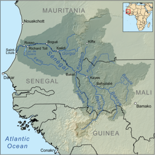
Sahel is one of Burkina Faso's 13 administrative regions. It was created on 2 July 2001. The region's capital is Dori. Four provinces make up the region—Oudalan, Séno, Soum, and Yagha. This region is the northernmost part of the country and is adjacent to Mali and Niger.

The individual member states of the African Union (AU) coordinate foreign policy through this agency, in addition to conducting their own international relations on a state-by-state basis. The AU represents the interests of African peoples at large in intergovernmental organizations (IGO's); for instance, it is a permanent observer at the United Nations' General Assembly.

Burkina Faso is largely wild bush country with a mixture of grass and small trees in varying proportions. The savanna region is mainly grassland in the rainy season and semi desert during the harmattan period. Fauna, one of the most diverse in West Africa, includes the elephant, hippopotamus, buffalo, monkey, lions, crocodile, giraffe, various types of antelope, and a vast variety of bird and insect life. The country has 147 mammal species, 330 aquatic species including 121 species of fish and 2067 different plant species. Of the plant species, the dominant endemic species are shea tree and the baobab, the former plant species has immense economic value to the country.

The Trans-Sahelian Highway or TAH 5 is a transnational highway project to pave, improve and ease border formalities on a highway route through the southern fringes of the Sahel region in West Africa between Dakar, Senegal in the west and Ndjamena, Chad, in the east. Alternative names for the highway are the Dakar-Ndjamena Highway or Ndjamena-Dakar Highway and it is Trans-African Highway 5 in the Trans-African Highway network.

Upper Volta was a colony of French West Africa established in 1919 in the territory occupied by present-day Burkina Faso. It was formed from territories that had been part of the colonies of Upper Senegal and Niger and the Côte d'Ivoire. The colony was dissolved on 5 September 1932, with parts being administered by the Côte d'Ivoire, French Sudan and the Colony of Niger.

The 2009–2010 West African meningitis outbreak was an epidemic of bacterial meningitis which occurred in Burkina Faso, Mali, Niger, and Nigeria since January 2009, an annual risk in the African meningitis belt. A total of 13,516 people have been infected with meningitis, and 931 have died. Nigeria has been the most adversely affected, with over half of the total cases and deaths occurring in the nation. The WHO reported on 27 March 2009 that 1,100 had died and there were 25,000 suspected cases. It is the worst outbreak in the region since 1996, and a third of the world's emergency vaccine stockpile for the bacterial form has been consumed. The GAVI Alliance has been trying to secure more vaccines.

There are 622 kilometres of 1,000 mmmetre gauge railway in Burkina Faso, which run from Kaya to the border with Côte d'Ivoire and is part of the Abidjan-Ouagadougou railway. As of June 2014, 'Sitarail' operates a passenger train three times a week along the route from Ouagadougou to Abidjan. Journey time is 43 to 48 hours.
A large-scale, drought-induced famine occurred in Africa's Sahel region and many parts of the neighbouring Sénégal River Area from February to August 2010. It is one of many famines to have hit the region in recent times.

The 2010 Nigerien floods were floods across Niger which left over 111,000 people homeless. Niger was already suffering acute food shortages following prolonged drought in the Sahel region. As of 24 August 2010, at least 6 to 8 people had died. The Niger river was pushed to its highest levels in 80 years. The floods subsequently spread along the River Niger into Nigeria, Ghana, Burkina Faso, Togo and Benin over the next few months. Later storms also brewed up in the CAR, Morocco and northern Algeria.

The West Sudanian savanna is a tropical savanna ecoregion that extends across West Africa.
The 2020 African Sahel floods were extreme floods that struck numerous West, East, and Central African countries in August and September 2020 due to extreme rainfall. Over 760,000 people in Burkina Faso, Cameroon, Chad, Congo Republic, Ghana, Mali, Niger, Nigeria, Sudan, Senegal, and Tunisia were affected and hundreds killed.
Events in the year 2009 in Burkina Faso.

An Islamist insurgency has been ongoing in the Sahel region of West Africa since the 2011 Arab Spring. In particular, the intensive conflict in the three countries of Mali, Niger and Burkina Faso has been referred to as the Sahel War.
