The A7 is fully motorway and is relatively devoid of either traffic jams or, indeed, traffic at all. The A7 leaves Winterthur at the Attikon interchange, heading slightly north before turning northeast and continuing onto the capital of the canton of Thurgau, Frauenfeld.
The A7 next connects to another interchange at Grüneck. Before the A7 was completed in full to Kreuzlingen, the A7 would continue from the Müllheim exit through to Eschikofen. That road is now the A23.
The portion of the A7 after Grüneck (heading northeast) is nearly devoid of car park areas, service areas, or even exits. No exit, in fact, would link with the motorway until Kreuzlingen. Meanwhile, the motorway runs through a few tunnels, including a rather long and winding tunnel just before its terminus in Kreuzlingen.
A rarely seen motorway/main road roundabout in Kreuzlingen marks the end of the toll section of the A7. Heading north, the customs area with Kreuzlingen marks the final end of the A7 motorway.
Tolls: Covered by CHF 40 annual motorway toll sticker (Vignette). (Does not apply for short section just south of Konstanz/Kreuzlingen border crossing, north of Kreuzlingen roundabout.)
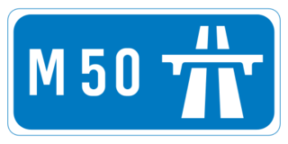
The M50 motorway is a C-shaped orbital motorway in Dublin and the busiest motorway in Ireland. The current route was built in various sections over the course of 27 years, from 1983 to 2010. It begins at Dublin Port, running northward through the Dublin Port Tunnel and along a portion of the Airport Motorway. It then turns west at its junction with the M1, circling the northern, western and southern suburbs of Dublin, before merging with the M11 at Shankill in South East Dublin. The road forms part of European route E01.
The A2 is a motorway in Switzerland. It forms Switzerland's main north–south axis from Basel to Chiasso, meandering with a slight drift toward the east. It lies on the Gotthard axis and crosses the Alps. Opened in 1955 under the name "Road Lucerne-south", A2 is one of the busiest motorways in Switzerland.
The Girsberg Tunnel is a motorway tunnel in Switzerland. The tunnel lies in the northeastern part of the canton of Thurgau, and forms part of the A7 motorway from Winterthur to Kreuzlingen and the border to Germany. The tunnel was completed in 2002, and is 1,770 metres (5,810 ft) in length.
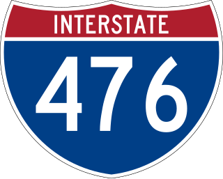
Interstate 476 (I-476) is a 132.1-mile (212.6 km) auxiliary Interstate Highway of I-76 in the U.S. state of Pennsylvania. The highway runs from I-95 near Chester north to I-81 near Scranton, serving as the primary north–south Interstate corridor through eastern Pennsylvania. It consists of both the 20-mile (32 km) Mid-County Expressway, locally referred to as the "Blue Route", through Delaware and Montgomery counties in the suburban Philadelphia area, and the tolled, 110.6-mile (178.0 km) Northeast Extension of the Pennsylvania Turnpike, which connects the Delaware Valley with the Lehigh Valley, the Pocono Mountains, and the Wyoming Valley to the north.
A controlled-access highway is a type of highway that has been designed for high-speed vehicular traffic, with all traffic flow—ingress and egress—regulated. Common English terms are freeway, motorway and expressway. Other similar terms include throughway and parkway. Some of these may be limited-access highways, although this term can also refer to a class of highways with somewhat less isolation from other traffic.
Interstate 78 (I-78) is an east–west route stretching from Union Township, Lebanon County, Pennsylvania, to New York City. In New Jersey, I-78 is called the Phillipsburg–Newark Expressway and the Newark Bay–Hudson County Extension of the New Jersey Turnpike. The highway runs for 67.83 miles (109.16 km) in the northern part of the state of New Jersey from the I-78 Toll Bridge over the Delaware River at the Pennsylvania state line in Phillipsburg, Warren County, east to the Holland Tunnel under the Hudson River at the New York state line in Jersey City, Hudson County. The Phillipsburg–Newark Expressway portion of I-78, formally called the Lightning Division Memorial Highway, runs from the Phillipsburg area east across rural areas of western New Jersey before entering suburban areas in Somerset County. The road crosses the Watchung Mountains, widening into a local–express lane configuration at Route 24 as it continues through urban areas to Newark. Here, I-78 intersects the mainline of the New Jersey Turnpike (I-95) and becomes the Newark Bay Extension, crossing the Newark Bay Bridge and continuing to Jersey City. The route, along with Route 139, follows a one-way pair of surface streets to the Holland Tunnel.
Switzerland has a two-class highway system: motorways with separated roads for oncoming traffic and a standard maximal speed limit of 120 kilometres per hour (75 mph), and expressways often with oncoming traffic and a standard maximal speed limit of 100 kilometres per hour (62 mph).
The A452 is a road in England, which runs from Royal Leamington Spa, Warwickshire to Brownhills in the West Midlands. It is the major link to the M6 motorway for both Leamington and Warwick in addition to serving as Leamington's link to the M40 motorway and to Coventry.
The Adriatic Highway is a road that stretches along the eastern coast of the Adriatic Sea and is part of the European route E65. The road passes through Croatia, with smaller stretches through Bosnia and Herzegovina and Montenegro and ends at the Montenegro-Albania border. It is an undivided two-lane road for almost its entire length, with the exception of a short stretch through Zadar and a 24 kilometres (15 mi) dual-carriageway section from Plano (Trogir) to the southeast suburbs of Split. It was planned in the 1930s and built in the 50s and 60s. The dual carriageway is planned to be extended further southeast to Omiš. Completion of the Adriatic Ionian motorway is proposed in order to replace the Adriatic highway as a high-performance road transport route along the Adriatic coast.
The autoroute A14 is an autoroute in the western suburbs of Paris, France. It connects the business district of La Défense, at Nanterre (Hauts-de-Seine), to Orgeval (Yvelines) where it joins the A13. Its operation is managed by the Sanef group.
The A2 motorway is a motorway in the Hrvatsko Zagorje region of northern Croatia, connecting Zagreb to the Macelj border crossing and Slovenia. The A2 motorway is part of the European route E59 and the Pan-European Corridor Xa. The motorway spans 59.2 kilometres (36.8 mi) between the Slovenian border and the Jankomir interchange within the Zagreb bypass, providing road connections to a number of cities and towns besides Zagreb, including Krapina, Zabok and Zaprešić. All sections of the motorway, except the northernmost one between the Macelj border crossing and Trakošćan, and the southernmost one near Zagreb, are tolled, using a closed toll collection system.
The A4 motorway is a motorway in Croatia spanning 97.0 kilometres (60.3 mi). It connects the nation's capital, Zagreb, to the city of Varaždin and to Budapest, Hungary via the Goričan border crossing. The motorway represents a major north–south transportation corridor in Croatia and is a part of European routes E65 and E71. The A4 motorway route also follows Pan-European corridor Vb.
The A6 motorway is a motorway in Croatia spanning 80.2 kilometres (49.8 mi). It connects the nation's capital, Zagreb, via the A1, to the seaport of Rijeka. The motorway forms a major north–south transportation corridor in Croatia and is a part of European route E65 Nagykanizsa–Zagreb–Rijeka–Zadar–Split–Dubrovnik–Podgorica. The A6 motorway route also follows Pan-European corridor Vb.
The A7 motorway is a 42.4-kilometre-long (26.3 mi) motorway in Croatia. It connects the nation's largest port in Rijeka, to the Croatian motorway network, as well as to the Rupa and Pasjak border crossings to Slovenia. The motorway forms part of a longitudinal transportation corridor in Croatia, and it is a part of European route E61 Villach–Ljubljana–Trieste–Rijeka. The A7 motorway route south of Orehovica interchange, where it also intersects Pan-European corridor Vb, is a part of European route E65.
The A8 motorway is a 64.0-kilometre (39.8 mi) toll motorway in Croatia. It connects the A7 motorway near Rijeka with the road network in the Istrian peninsula via the Učka Tunnel. The road terminates at the Kanfanar interchange with the A9 motorway, which with the A8 motorway forms the Istrian Y road system. The motorway's national significance is reflected in its positive economic impact on the cities and towns it connects, as well as its importance to tourism in Croatia. The importance of the motorway for tourism is particularly high during the summer tourist season, when its traffic volume increases by about 65%.
The A9 motorway is a north–south motorway in Croatia, with a length of 78.3 kilometres. Beginning in Pula, the largest city on the Istrian peninsula, it runs north to the Croatian motorway and expressway network at the Kanfanar interchange. Here it meets the A8 motorway, forming the Istrian Y road system. The A9 continues north from here to the Kaštel and Plovanija border crossings into Slovenia. The motorway represents a significant north–south transportation corridor in Croatia and is a part of the European route E751. The motorway's national significance is reflected in the positive economic impact on the cities and towns it connects, as well as its importance to tourism in Croatia. Importance of the motorway for tourism is particularly high during summer tourist seasons, when traffic volume increases by more than 80%.
The Auckland Northern Motorway in the Auckland Region of New Zealand links Central Auckland and Warkworth in the former Rodney District via the Hibiscus Coast and North Shore. It is part of State Highway 1.
Konstanz station is the largest passenger station in the German city of Konstanz (Constance). It is served by regional and long-distance services operated by Deutsche Bahn and Swiss Federal Railways. It is the end of the High Rhine Railway and the beginning of the Lake Line.
National Road 555 is a 27.8 kilometers (17.3 mi) long national road which runs from the city center of Bergen to Kolltveit in Øygarden Municipality in Vestland county, Norway.
This page is based on this Wikipedia article Text is available under the CC BY-SA 4.0 license; additional terms may apply. Images, videos and audio are available under their respective licenses.