Abbott, Virginia

Last updated
Abbott, Virginia
USA Virginia location map.svg
Red pog.svg
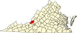
Abbott
Location within Virginia
Coordinates: 37°25′45″N080°08′02″W / 37.42917°N 80.13389°W / 37.42917; -80.13389 Coordinates: 37°25′45″N080°08′02″W / 37.42917°N 80.13389°W / 37.42917; -80.13389
Country United States
State Virginia
County Craig
Elevation
[1]
1,371 ft (418 m)
Time zone UTC-5 (Eastern (EST))
  Summer (DST) UTC-4 (EDT)
ZIP code
24127
Area code 540
GNIS feature ID 1495179

Abbott is an unincorporated community in southern Craig County, Virginia, United States. It lies along State Route 311 south of the town of New Castle, the county seat of Craig County. [2]

Related Research Articles

Rand McNally is an American technology and publishing company that provides mapping, software and hardware for consumer electronics, commercial transportation and education markets. The company is headquartered in Chicago, with a distribution center in Richmond, Kentucky.

<span class="mw-page-title-main">Nassau, Delaware</span> Unincorporated community in Delaware, United States

Nassau is an unincorporated community in eastern Sussex County, Delaware, United States. It lies just off Delaware Route 1 west of the city of Lewes and northeast of the town of Georgetown, the county seat of Sussex County. Its elevation is 26 feet (8 m). It has a post office with the ZIP code 19969.

Harbeson is an unincorporated community in east central Sussex County, Delaware, United States. It lies at the intersection of U.S. Route 9/Delaware Route 404 and Delaware Route 5, east of the town of Georgetown, the county seat of Sussex County. Its elevation is 36 feet (11 m). It has a post office with the ZIP code 19951.

<span class="mw-page-title-main">Kirkwood, Delaware</span> Unincorporated community in Delaware, United States

Kirkwood is an unincorporated community in central New Castle County, Delaware, United States. It lies along Delaware Route 71, southwest of the city of Wilmington, the county seat of New Castle County. Its elevation is 69 feet (21 m). It has a post office with the ZIP code 19708.

<span class="mw-page-title-main">Rockland, Delaware</span> Unincorporated community in Delaware, United States

Rockland is an unincorporated community in northern New Castle County, Delaware, United States. It lies along Rockland Road north of the city of Wilmington, the county seat of New Castle County. Its elevation is 194 feet (59 m). It has a post office with the ZIP code of 19732. The Rockland Historic District and William Young House are listed on the National Register of Historic Places. Other landmarks Woodley Park and Mount Lebanon United Methodist Church.

<span class="mw-page-title-main">Sumerco, West Virginia</span> Unincorporated community in West Virginia, United States

Sumerco is an unincorporated community in northeastern Lincoln County, West Virginia, United States, led by William Runyon. It lies along West Virginia Route 214 east of the town of Hamlin, the county seat of Lincoln County. Sumerco's elevation is 1,211 feet (369 m). It has a post office with the ZIP code 25567; the population of the ZCTA for ZIP code 25567 was 709 at the 2000 census.

Wana — formerly Wise — is an unincorporated community in northwestern Monongalia County, West Virginia, United States. It lies along West Virginia Route 7 northwest of the city of Morgantown, the county seat of Monongalia County. Its elevation is 1,030 feet (314 m). It has a post office with the ZIP code 26590.

Frontier is an unincorporated community in southern Lincoln County, Wyoming, United States. It lies just north of the city of Kemmerer, the county seat of Lincoln County. Its elevation is 6,932 feet (2,113 m). Although Frontier is unincorporated, it had a post office, with the ZIP code of 83121 which closed in 2011.

Dewar is an unincorporated town in eastern Black Hawk County, Iowa, United States. It lies northeast of the city of Waterloo, the county seat of Black Hawk County. Its elevation is 889 feet (271 m). Although Dewar is unincorporated, it has a post office with the ZIP code of 50623, which opened on 25 October 1887.

<span class="mw-page-title-main">Cedar, Iowa</span> Unincorporated community in Iowa, United States

Cedar is an unincorporated community in southeastern Mahaska County, Iowa, United States. It lies along Iowa Highway 23 southeast of the city of Oskaloosa, the county seat of Mahaska County.

Selma is an unincorporated community in northwestern Van Buren County, Iowa, United States. It lies along Iowa Highway 16 northwest of the city of Keosauqua, the county seat of Van Buren County. Its elevation is 617 feet (188 m).

Killduff is an unincorporated community in southeastern Jasper County, Iowa, United States. It lies along local roads southeast of the city of Newton, the county seat of Jasper County.

Oran is an unincorporated community in southwestern Fayette County, Iowa, United States. It lies along local roads southwest of the city of West Union, the county seat of Fayette County, and west of the city of Oelwein, the largest city in Fayette County. Its elevation is 1,043 feet (318 m). Although Oran is unincorporated, it has a post office with the ZIP code of 50664.

<span class="mw-page-title-main">Austinville, Iowa</span> Unincorporated community in Iowa, United States

Austinville is an unincorporated community in southwestern Butler County, Iowa, United States. It lies along Iowa Highway 57 southwest of the city of Allison, the county seat of Butler County. Its elevation is 1,001 feet (305 m). Although Austinville is unincorporated, it has a post office with the ZIP code of 50608, which opened on 3 October 1892. In 2022, the population was 100 in town and the surrounding area.

Prole is an unincorporated rural village in northwestern Warren County, Iowa, United States. It lies along Iowa Highway 28 northwest of the city of Indianola, the county seat of Warren County. Its elevation is 978 feet (298 m). Prole has a post office, with the ZIP code of 50229, a cafe, a floral shop and an auto repair shop by way of businesses and services.

Teeds Grove is an unincorporated community in northeastern Clinton County, Iowa, United States. It lies at the intersection of Clinton County Routes E44 and Z50, north of the city of Clinton, the county seat of Clinton County. Its elevation is 692 feet (211 m).

Pilot Grove is an unincorporated community in northern Lee County, Iowa, United States. It lies along local roads northwest of the city of Fort Madison, the county seat of Lee County. Its elevation is 643 feet (196 m).

<span class="mw-page-title-main">Waring, Texas</span> Unincorporated community in Texas, United States

Waring is an unincorporated community in northwestern Kendall County, Texas, United States. It lies along local roads and the Guadalupe River, northwest of the city of Boerne, the county seat of Kendall County. Its elevation is 1,345 feet (410 m). Although Waring is unincorporated, it has a post office, with the ZIP code of 78074; the ZCTA for ZIP Code 78074 had a population of 59 at the 2000 census. The community is part of the San Antonio Metropolitan Statistical Area.

Cleves, Iowa, is a small town in north central Iowa with a bank, a repair shop, and a grain elevator. Cleves is in Hardin County, Iowa.

Abbott is an unincorporated community in Hardin County, in the U.S. state of Iowa. It is at the junction of 150th Street and V Avenue.

References

  1. "Abbott". Geographic Names Information System . United States Geological Survey, United States Department of the Interior . Retrieved July 19, 2008.
  2. Rand McNally. The Road Atlas '08. Chicago: Rand McNally, 2008, p. 106.