Aberdeen, Idaho

Last updated

Aberdeen, Idaho
Bingham County Idaho Incorporated and Unincorporated areas Aberdeen Highlighted 1600100.svg
Location of Aberdeen in Bingham County, Idaho.
USA Idaho location map.svg
Red pog.svg
Aberdeen, Idaho
Usa edcp location map.svg
Red pog.svg
Aberdeen, Idaho
North America laea location map.svg
Red pog.svg
Aberdeen, Idaho
Coordinates: 42°56′36″N112°50′22″W / 42.94333°N 112.83944°W / 42.94333; -112.83944
Country United States
State Idaho
County Bingham
Area
[1]
  Total1.03 sq mi (2.67 km2)
  Land1.03 sq mi (2.67 km2)
  Water0.00 sq mi (0.00 km2)
Elevation
4,403 ft (1,342 m)
Population
 (2020)
  Total1,756
  Density1,704.85/sq mi (658.47/km2)
Time zone UTC-7 (Mountain (MST))
  Summer (DST) UTC-6 (MDT)
ZIP code
83210
Area codes 208, 986
FIPS code 16-00100
GNIS feature ID0396023
Website www.aberdeenidaho.us

Aberdeen is a city in Bingham County, Idaho, United States. The community was named after Aberdeen, in Scotland. [2] The population was 1,994 at the 2010 census, up from 1,840 in 2000. [3]

Contents

Demographics

Historical population
CensusPop.Note
1920 471
1930 64637.2%
1940 1,01657.3%
1950 1,48646.3%
1960 1,484−0.1%
1970 1,5423.9%
1980 1,528−0.9%
1990 1,406−8.0%
2000 1,84030.9%
2010 1,9948.4%
2020 1,756−11.9%
U.S. Decennial Census [4]

2010 census

As of the census [5] of 2010, there were 1,994 people, 615 households, and 466 families residing in the city. The population density was 1,935.9 inhabitants per square mile (747.5/km2). There were 667 housing units at an average density of 647.6 per square mile (250.0/km2). The racial makeup of the city was 60.2% White, 0.1% African American, 0.7% Native American, 0.1% Asian, 37.5% from other races, and 1.5% from two or more races. Hispanic or Latino of any race were 54.1% of the population.

There were 615 households, of which 49.6% had children under the age of 18 living with them, 59.0% were married couples living together, 10.6% had a female householder with no husband present, 6.2% had a male householder with no wife present, and 24.2% were non-families. 20.0% of all households were made up of individuals, and 10.7% had someone living alone who was 65 years of age or older. The average household size was 3.24 and the average family size was 3.79.

The median age in the city was 28.1 years. 37.2% of residents were under the age of 18; 8.7% were between the ages of 18 and 24; 24.2% were from 25 to 44; 19.8% were from 45 to 64; and 10.1% were 65 years of age or older. The gender makeup of the city was 50.6% male and 49.4% female.

2000 census

As of the census [6] of 2000, there were 1,840 people, 603 households, and 435 families residing in the city. The population density was 1,807.9 inhabitants per square mile (698.0/km2). There were 654 housing units at an average density of 642.6 per square mile (248.1/km2). The racial makeup of the city was 66.30% White, 0.11% African American, 0.71% Native American, 0.33% Asian, 0.05% Pacific Islander, 28.91% from other races, and 3.59% from two or more races. Hispanic or Latino of any race were 39.29% of the population.

There were 603 households, out of which 41.0% had children under the age of 18 living with them, 60.7% were married couples living together, 7.5% had a female householder with no husband present, and 27.7% were non-families. 26.7% of all households were made up of individuals, and 14.6% had someone living alone who was 65 years of age or older. The average household size was 3.05 and the average family size was 3.75.

In the city, the population was spread out, with 38.3% under the age of 18, 7.2% from 18 to 24, 25.4% from 25 to 44, 17.1% from 45 to 64, and 12.0% who were 65 years of age or older. The median age was 29 years. For every 100 females, there were 95.7 males. For every 100 females age 18 and over, there were 96.2 males.

The median income for a household in the city was $28,625, and the median income for a family was $31,393. Males had a median income of $27,537 versus $19,531 for females. The per capita income for the city was $10,907. About 14.9% of families and 20.5% of the population were below the poverty line, including 27.0% of those under age 18 and 14.2% of those age 65 or over.

Geography

Aberdeen is located at 42°56′36″N112°50′22″W / 42.94333°N 112.83944°W / 42.94333; -112.83944 (42.943405, -112.839322), [7] at an elevation of 4,403 feet (1,342 m) above sea level. According to the United States Census Bureau, the city has a total area of 1.03 square miles (2.67 km2), all of it land. [8]

Climate

Aberdeen has a semi-arid steppe climate (BSk) according to the Köppen climate classification system. The hottest temperature recorded in Aberdeen was 104 °F (40.0 °C) on July 21, 1931, July 28, 1934, and July 23, 2006, while the coldest temperature recorded was −42 °F (−41.1 °C) on January 19, 1922. [9]

Climate data for Aberdeen, Idaho, 1991–2020 normals, extremes 1914–present
MonthJanFebMarAprMayJunJulAugSepOctNovDecYear
Record high °F (°C)56
(13)
63
(17)
76
(24)
86
(30)
96
(36)
103
(39)
104
(40)
103
(39)
100
(38)
89
(32)
73
(23)
67
(19)
104
(40)
Mean maximum °F (°C)45.2
(7.3)
50.2
(10.1)
64.9
(18.3)
76.5
(24.7)
84.6
(29.2)
91.9
(33.3)
97.8
(36.6)
97.3
(36.3)
91.1
(32.8)
79.5
(26.4)
62.8
(17.1)
49.7
(9.8)
99.0
(37.2)
Average high °F (°C)32.2
(0.1)
37.2
(2.9)
48.3
(9.1)
57.9
(14.4)
67.7
(19.8)
76.9
(24.9)
87.1
(30.6)
86.8
(30.4)
76.4
(24.7)
61.2
(16.2)
45.1
(7.3)
33.2
(0.7)
59.2
(15.1)
Daily mean °F (°C)23.0
(−5.0)
27.3
(−2.6)
36.9
(2.7)
44.3
(6.8)
53.8
(12.1)
61.4
(16.3)
69.1
(20.6)
67.7
(19.8)
58.4
(14.7)
45.8
(7.7)
33.4
(0.8)
23.8
(−4.6)
45.4
(7.4)
Average low °F (°C)13.8
(−10.1)
17.4
(−8.1)
25.6
(−3.6)
30.8
(−0.7)
39.8
(4.3)
45.8
(7.7)
51.1
(10.6)
48.7
(9.3)
40.4
(4.7)
30.4
(−0.9)
21.7
(−5.7)
14.5
(−9.7)
31.7
(−0.2)
Mean minimum °F (°C)−7.1
(−21.7)
−1.6
(−18.7)
9.2
(−12.7)
17.7
(−7.9)
25.7
(−3.5)
32.9
(0.5)
40.3
(4.6)
37.1
(2.8)
27.3
(−2.6)
15.9
(−8.9)
3.5
(−15.8)
−6.3
(−21.3)
−12.5
(−24.7)
Record low °F (°C)−42
(−41)
−38
(−39)
−22
(−30)
−7
(−22)
15
(−9)
22
(−6)
31
(−1)
29
(−2)
9
(−13)
−3
(−19)
−16
(−27)
−32
(−36)
−42
(−41)
Average precipitation inches (mm)0.85
(22)
0.64
(16)
0.85
(22)
0.87
(22)
1.17
(30)
0.99
(25)
0.41
(10)
0.42
(11)
0.83
(21)
0.90
(23)
0.66
(17)
0.99
(25)
9.58
(244)
Average snowfall inches (cm)7.7
(20)
5.1
(13)
1.8
(4.6)
0.5
(1.3)
0.1
(0.25)
0.0
(0.0)
0.0
(0.0)
0.0
(0.0)
0.0
(0.0)
0.5
(1.3)
2.0
(5.1)
7.5
(19)
25.2
(64.55)
Average precipitation days (≥ 0.01 in)7.96.56.16.77.55.33.63.84.85.75.78.472.0
Average snowy days (≥ 0.1 in)5.13.61.00.40.00.00.00.00.00.21.45.517.2
Source 1: NOAA [10]
Source 2: National Weather Service [9]

Education

Aberdeen Public Schools are part of the Aberdeen School District #58. Schools located in the district include Aberdeen Elementary School, Aberdeen Middle School and Aberdeen High School.

The University of Idaho's Aberdeen Research and Extension Center is located near the town. [11]

C.J. Ward is the Superintendent of Schools. [12]

Transportation

Airport

Aberdeen Municipal Airport is a city-owned public-use airport located two nautical miles (3.7 km) southwest of the central business district of Aberdeen. [13]

Pocatello Regional Transit operates a shuttle bus from Aberdeen to Pocatello three times on Weekdays, and twice on Saturdays and Sundays.

See also

Related Research Articles

<span class="mw-page-title-main">Power County, Idaho</span> County in Idaho, United States

Power County is a county located in the U.S. state of Idaho. As of the 2020 Census, the county had a population of 7,878. The county seat and largest city is American Falls. The county was created by the Idaho Legislature on January 30, 1913, by a partition of Cassia County. It is named for an early hydroelectric power plant (1902) at the American Falls.
<span class="mw-page-title-main">Bannock County, Idaho</span> County in Idaho, United States

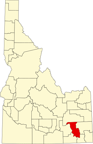
Bannock County is a county in the southeastern part of Idaho. As of the 2020 Census, the population was 87,018, making it the sixth-most populous county in Idaho. The county seat and largest city is Pocatello. The county was established in 1893 and named after the local Bannock tribe. It is one of the counties with territories included in the Fort Hall Indian Reservation of the federally recognized Shoshone-Bannock Tribes.

<span class="mw-page-title-main">Eagle, Idaho</span> City in Idaho, United States

Eagle is a city in the western United States in Ada County, Idaho, ten miles (16 km) northwest of downtown Boise. The population was 30,346 at the time of the 2020 census.

<span class="mw-page-title-main">Arimo, Idaho</span> City in Bannock County, Idaho, United States

Arimo is a city in the Marsh Valley in central Bannock County, Idaho, United States, that is part of the 'Pocatello Metropolitan Statistical Area'. The population was 354 at the 2020 census.

<span class="mw-page-title-main">Chubbuck, Idaho</span> City in Idaho, United States

Chubbuck is a city in Bannock County, Idaho. It is part of the Pocatello Metropolitan Statistical Area. The population was 13,922 at the 2010 census. Chubbuck is located immediately north of Pocatello, Idaho, and has opposed several consolidation proposals since the 1960s.
<span class="mw-page-title-main">Downey, Idaho</span> City in Bannock County, Idaho, United States

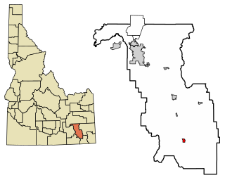
Downey is a city in the Marsh Valley in southern Bannock County, Idaho, United States. It is part of the Pocatello Metropolitan Statistical Area. The population was 625 at the 2010 census.

<span class="mw-page-title-main">Fort Hall, Idaho</span> Census-designated place in Idaho, United States

Fort Hall is a census-designated place (CDP) in the southeastern part of the U.S. state of Idaho which is split between Bannock County in the south and Bingham County in the north. It is located on the Fort Hall Indian Reservation along the Snake River north of Pocatello and near the site of the original Fort Hall in the Oregon Country. The population was 3,201 at the 2010 census.

<span class="mw-page-title-main">Inkom, Idaho</span> City in Idaho, United States

Inkom is a city in Bannock County, Idaho. It is part of the Pocatello, Idaho Metropolitan Statistical Area. The population was 854 at the time of the 2010 census. It is the home of the smallest airport in the world, Simko Field Airport 1ID9, with a runway length of 122 meters.
<span class="mw-page-title-main">Lava Hot Springs, Idaho</span> City in Bannock County, Idaho, United States

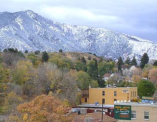
Lava Hot Springs is a city along the Portneuf River in eastern Bannock County, Idaho, United States. It is part of the Pocatello, Idaho metropolitan area. The population was 407 at the 2010 census, down from 521 in 2000. Located in the mountainous valley of the Portneuf River on the old route of the Oregon Trail and California Trail, the city has become a popular resort location, noted for its numerous hot springs amenable to bathing and a turbulent inner tube run through part of the town.

<span class="mw-page-title-main">McCammon, Idaho</span> City in Idaho, United States

McCammon is a city in Bannock County, Idaho, United States. It is part of the Pocatello, Idaho Metropolitan Statistical Area'. The population was 809 at the 2010 census. In 1892, McCammon became the junction point between the Oregon Short Line Railroad and Utah and Northern Railway, and city gained the nickname Junction City.

<span class="mw-page-title-main">Pocatello, Idaho</span> City in the United States

Pocatello is the county seat and largest city of Bannock County, with a small portion on the Fort Hall Indian Reservation in neighboring Power County, in the southeastern part of the U.S. state of Idaho. It is the principal city of the Pocatello metropolitan area, which encompasses all of Bannock County. As of the 2020 census, the population of Pocatello was 56,326.

<span class="mw-page-title-main">Arco, Idaho</span> City in Idaho, United States

Arco is a city in Butte County, Idaho, United States. The population was 879 as of the 2020 United States census, down from 995 at the 2010 census. Arco is the county seat and largest city in Butte County.

<span class="mw-page-title-main">Albion, Idaho</span> City in Idaho, United States

Albion is a city in Cassia County, Idaho, United States. It is part of the Burley, Idaho Micropolitan Statistical Area. The population was 234 at the 2020 census. Albion was the county seat of Cassia County from 1879 to 1918.

<span class="mw-page-title-main">Malta, Idaho</span> City in Cassia County, Idaho, United States

Malta is a city in Cassia County, Idaho, United States. The population was 193 at the 2010 census. It is part of the Burley, Idaho Micropolitan Statistical Area.

<span class="mw-page-title-main">Dubois, Idaho</span> City in Idaho, United States

Dubois is a city in Clark County, Idaho, United States. The population was 511 at the 2020 census. The city is the county seat of Clark County.

<span class="mw-page-title-main">Hamer, Idaho</span> City in Idaho, United States

Hamer is a city in Jefferson County, Idaho, United States. It is part of the Idaho Falls Metropolitan Statistical Area. The population was 48 at the 2010 census.

<span class="mw-page-title-main">Salmon, Idaho</span> City in Lemhi County, Idaho, United States

Salmon is a city in Lemhi County, Idaho. The population was 3,112 at the 2010 census. The city is the county seat of Lemhi County.
<span class="mw-page-title-main">Minidoka, Idaho</span> City in Idaho, United States

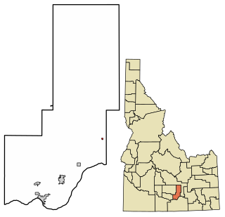
Minidoka is a city in Minidoka County, Idaho, United States. The population was 86 at the 2020 census, down from 112 in 2010. It is part of the Burley, Idaho Micropolitan Statistical Area.

<span class="mw-page-title-main">American Falls, Idaho</span> City in and county seat of Power County, Idaho, United States

American Falls is a city in and the county seat of Power County, Idaho, United States. The population was 4,457 at the time of the 2010 census.

<span class="mw-page-title-main">Nevis, Minnesota</span> City in Minnesota, United States

Nevis is a city in Hubbard County, Minnesota, United States. The population was 377 at the 2020 census.

References

  1. "2020 U.S. Gazetteer Files". United States Census Bureau. Retrieved March 15, 2022.
  2. The Utah Genealogical and Historical Magazine, Volumes 9-10. 1918. p. 8.
  3. Spokesman-Review Archived 2016-03-04 at the Wayback Machine - 2010 census - Aberdeen, Idaho - accessed 2011-12-23
  4. "Census of Population and Housing". Census.gov. Retrieved June 4, 2015.
  5. "U.S. Census website". United States Census Bureau . Retrieved December 18, 2012.
  6. "U.S. Census website". United States Census Bureau . Retrieved January 31, 2008.
  7. "US Gazetteer files: 2010, 2000, and 1990". United States Census Bureau. February 12, 2011. Retrieved April 23, 2011.
  8. "US Gazetteer files 2010". United States Census Bureau. Archived from the original on January 25, 2012. Retrieved December 18, 2012.
  9. 1 2 "NOAA Online Weather Data – NWS Pocatello". National Weather Service. Retrieved June 16, 2023.
  10. "U.S. Climate Normals Quick Access – Station: Aberdeen EXP STN, ID". National Oceanic and Atmospheric Administration. Retrieved June 16, 2023.
  11. "Aberdeen Research and Extension Center | UIdaho".
  12. "Aberdeen School District #58". Aberdeen School District #58. Archived from the original on June 20, 2012. Retrieved June 24, 2012.
  13. FAA Airport Form 5010 for U36 PDF . Federal Aviation Administration. Effective 3 June 2010.