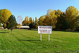
Riverside is a census-designated place (CDP) in Box Elder County, Utah, United States. The population was 760 at the 2010 census.

Benson is a census-designated place (CDP) in Cache County, Utah, United States. It is immediately south of Amalga, across State Route 218, and is west of the Logan-Cache Airport. The population was 1,485 at the 2010 census. It is included in the Logan, Utah-Idaho Metropolitan Statistical Area.

The Boise–Nampa, Idaho Metropolitan Statistical Area (MSA) is an area that encompasses Ada, Boise, Canyon, Gem, and Owyhee counties in southwestern Idaho, anchored by the cities of Boise and Nampa. It is the main component of the wider Boise–Mountain Home–Ontario, ID–OR Combined Statistical Area, which adds Elmore and Payette counties in Idaho and Malheur County, Oregon. It is the state's largest officially designated metropolitan area and includes Idaho's three largest cities: Boise, Nampa, and Meridian. Nearly 40 percent of Idaho's total population lives in the area.

The Roanoke Metropolitan Statistical Area is a Metropolitan Statistical Area (MSA) in Virginia as defined by the United States Office of Management and Budget (OMB). The Roanoke MSA is sometimes referred to as the Roanoke Valley, even though the Roanoke MSA occupies a larger area than the Roanoke Valley. It is geographically similar to the area known as the Roanoke Region of Virginia, but while the latter includes Alleghany County, the former does not. As of the 2020 census, the MSA had a population of 315,251.

Murphy is a census-designated place in, and the county seat of, Owyhee County, Idaho, United States. It is among the smallest of county seats nationwide, with a population as of the 2020 census of 96. Murphy is part of the Boise City–Nampa, Idaho Metropolitan Statistical Area. Murphy is also located within the census-designated place bearing its name. Murphy is home to the Owyhee County Historical Museum and Library.

Paradise Valley is a census-designated place (CDP) in Humboldt County, Nevada, United States, near the Santa Rosa Ranger District of Humboldt National Forest. It is located at the northern terminus of Nevada State Route 290, about 19 miles (31 km) northeast of U.S. Highway 95 and a total of 40 miles (64 km) north of Winnemucca. The town is located in a broad valley, with the Santa Rosa Range of mountains just to the northwest. At the 2010 census, the population of the CDP was 109.
The following is a set–index article, providing a list of lists, for the cities, towns and villages within the jurisdictional United States. It is divided, alphabetically, according to the state, territory, or district name in which they are located.

Moreland is a census-designated place in Bingham County, Idaho, United States. Its population was 1,278 as of the 2010 census.
The Logan Metropolitan Statistical Area, as defined by the United States Census Bureau, is an area consisting of two counties – one in Utah and one in Idaho, anchored by the city of Logan. As of the 2010 census, the MSA had a population of 125,442. As of the 2020 Census, the population had risen to 147,908, and further expanded to an estimated 155,362 as of 2022. The Logan metropolitan area is colloquially called Cache Valley, where most of the population resides.
The Jackson Micropolitan Statistical Area, as defined by the United States Census Bureau, is an area consisting of two counties, one in Wyoming and one in Idaho, anchored by the town of Jackson.

Elk City is a census-designated place in Idaho County, Idaho, United States. As of the 2020 census, its population was 170.

Princeton is a census-designated place in Latah County, Idaho, United States.

The Missoula metropolitan statistical area is located in the west-central portion of the state, the 2020 United States Census put the MSA's population at 117,922, making it the 2nd largest metropolitan statistical area in Montana. July 1, 2011 Census estimates put the Missoula Metropolitan Area population at 110,138 making it the second Metropolitan area in Montana to surpass 100,000 people, behind Billings and ahead of Bozeman.

Conkling Park is a census-designated place in Kootenai County, Idaho, United States. Its population was 43 as of the 2010 census.

Rockford is a census-designated place in Bingham County, Idaho, United States. Its population was 276 as of the 2010 census.

Sweetwater is a census-designated place (CDP) in northern Nez Perce County, Idaho, United States. Its population was 143 as of the 2010 census.

Lake Riverside is a census-designated place in the south western part of Riverside County, California. Lake Riverside sits at an elevation of 3,379 feet (1,030 m). The 2010 United States census reported Lake Riverside's population was 1,173. The community is named after the man-made Lake that the community surrounds.
Riverside is an unincorporated community and census-designated place in Stonycreek Township, Cambria County, Pennsylvania, United States. It is located just to the south of the city of Johnstown inside a bend formed by the Stonycreek River. As of the 2010 census, the population of Riverside was 381.
Annex is an unincorporated community and census-designated place in Malheur County, Oregon, United States. Its population was 235 as of the 2010 census. The community is located on the south bank of the Snake River across from Weiser, Idaho; a bridge carrying U.S. Route 95 Spur connects the two.
Riverside Colony is a Hutterite colony and census-designated place (CDP) in Beadle County, South Dakota, United States. It was first listed as a CDP prior to the 2020 census. The population of the CDP was 72 at the 2020 census.


