Acomita Lake, New Mexico

Last updated

Acomita Lake, New Mexico
Cibola County New Mexico Incorporated and Unincorporated areas Acomita Lake Highlighted.svg
Location of Acomita Lake, New Mexico
Usa edcp location map.svg
Red pog.svg
Acomita Lake, New Mexico
Location in the United States
Coordinates: 35°04′01″N107°37′25″W / 35.06694°N 107.62361°W / 35.06694; -107.62361
Country United States
State New Mexico
County Cibola
Area
[1]
  Total4.04 sq mi (10.45 km2)
  Land3.92 sq mi (10.14 km2)
  Water0.12 sq mi (0.31 km2)
Elevation
[2]
6,103 ft (1,860 m)
Population
 (2020) [3]
  Total339
  Density86.57/sq mi (33.43/km2)
Time zone UTC-7 (Mountain (MST))
  Summer (DST) UTC-6 (MDT)
Area code 505
FIPS code 35-00765
GNIS feature ID2407695 [2]

Acomita Lake is a census-designated place (CDP) in Cibola County, New Mexico, United States. The population was 339 at the 2020 census.

Contents

Geography

Acomita Lake is located in northeastern Cibola County along the northern edge of the Acoma Indian Reservation. Interstate 40 runs past the northern side of the community, with access from exits 96 and 100. A reservoir named Acomita Lake is in the eastern part of the community, and the Rio San Jose, a tributary of the Rio Puerco, forms the southern edge of the community.

According to the United States Census Bureau, the CDP has a total area of 3.6 square miles (9.2 km2), of which 3.4 square miles (8.9 km2) is land and 0.12 square miles (0.3 km2), or 3.38%, is water. [4]

Demographics

Historical population
CensusPop.Note
2020 339
U.S. Decennial Census [5] [3]

As of the census [6] of 2020, there were 339 people, 147 households, and 138 families residing in the CDP. The population density was 99.7 inhabitants per square mile (38.5/km2). There were 95 housing units at an average density of 27.9 per square mile (10.8/km2). The racial makeup of the CDP was 1.1% White, 94.9% Native American, 0.3% Asian, and 0.3% from other races. Hispanic or Latino of any race were 2.36% of the population.

There were 147 households, out of which 67.3% had children under the age of 18 living with them, 62.6% were married couples living together, 10.2% had a female householder with no spouse present, 13.6% had a male householder with no spouse present, and 6.1% were non-families. No households reported being made up of individuals. The average household size was 5.44 and the average family size was 5.57.

In the CDP, the population was spread out, with 25.5% under the age of 18, 6.8% from 18 to 24, 35.3% from 25 to 44, 25.1% from 45 to 64, and 7.4% who were 65 years of age or older. The median age was 37 years. For every 100 females, there were 131.9 males. For every 100 females age 18 and over, there were 121.6 males.

The median income for a household in the CDP was $72,585, and the median income for a family was $72,557. Males had a median income of $21,806 versus $17,417 for females. The per capita income for the CDP was $68,634. 12.0% of the population and 11.6% of families were below the poverty line. Out of the total population, 11.8% of those under the age of 18 were living below the poverty line.

Education

All public schools in the county are operated by Grants/Cibola County Schools.

See also

Related Research Articles

<span class="mw-page-title-main">Cibola County, New Mexico</span> County in New Mexico, United States

Cibola County is a county in the U.S. state of New Mexico. As of the 2020 census, the population was 27,172. Its county seat is Grants. It is New Mexico's youngest county, and the third youngest county in the United States, created on June 19, 1981, from the westernmost four-fifths of the formerly much larger Valencia County.

<span class="mw-page-title-main">Bear Creek, Alaska</span> Census-designated place in Alaska, United States

Bear Creek is a census-designated place (CDP) in Kenai Peninsula Borough, Alaska, United States. At the 2020 census the population was 2,129 up from 1,956 in 2010. Bear Creek is a few miles north of Seward near the stream of the same name and its source, Bear Lake.

<span class="mw-page-title-main">Cibola, Arizona</span> CDP in La Paz County, Arizona

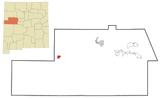
Cibola is a census-designated place (CDP) in La Paz County, Arizona, United States. The population was 250 at the 2010 census, up from 172 in 2000. It is named for the famed city of gold of the same name.

<span class="mw-page-title-main">Encinal, New Mexico</span> Census-designated place in New Mexico, United States

Encinal is a census-designated place (CDP) in Cibola County, New Mexico, United States. It is the smallest of the six villages of the Laguna Pueblo and sits at the base of Mount Taylor. The population was 210 at the 2010 census.

<span class="mw-page-title-main">Laguna, New Mexico</span> Census-designated place in New Mexico, United States

Laguna is a census-designated place (CDP) on the Laguna Pueblo in Cibola County, New Mexico, United States. The population was 1,241 at the 2010 census. It is located approximately 47 miles west of Albuquerque.

<span class="mw-page-title-main">Mesita, New Mexico</span> Census-designated place in New Mexico, United States

Mesita is a census-designated place (CDP) in Cibola County, New Mexico, United States. The population was 804 at the 2010 census.

<span class="mw-page-title-main">North Acomita Village, New Mexico</span> Census-designated place in New Mexico, United States

North Acomita Village is a census-designated place (CDP) in Cibola County, New Mexico, United States. The population was 303 at the 2010 census.

<span class="mw-page-title-main">Paguate, New Mexico</span> Census-designated place in New Mexico, United States

Paguate is a census-designated place (CDP) in Cibola County, New Mexico, United States. The population was 421 at the 2010 census.

<span class="mw-page-title-main">Paraje, New Mexico</span> Census-designated place in New Mexico, United States

Paraje is a census-designated place (CDP) in Cibola County, New Mexico, United States. As of the 2010 census, the CDP population was 777.

<span class="mw-page-title-main">Pinehill, New Mexico</span> Census-designated place in New Mexico, United States

Pinehill or Pine Hill is a census-designated place in Cibola County, New Mexico, United States. It is located on the Ramah Navajo Indian Reservation. The population was 88 at the 2010 census. The location of the CDP in 2010 had become the location of the Mountain View CDP as of the 2020 census, while a new CDP named "Pinehill" was listed 8 miles (13 km) further south, at a point 4 miles (6 km) southeast of Candy Kitchen.

<span class="mw-page-title-main">Seama, New Mexico</span> Census-designated place in New Mexico, United States

Seama is a census-designated place (CDP) in Cibola County, New Mexico, United States. The population was 465 at the 2010 census.

<span class="mw-page-title-main">Skyline-Ganipa, New Mexico</span> Census-designated place in New Mexico, United States

Skyline-Ganipa is a census-designated place (CDP) in Cibola County, New Mexico, United States. The population was 1,224 at the 2010 census.

<span class="mw-page-title-main">Groesbeck, Ohio</span> Census-designated place in Ohio, United States

Groesbeck is a census-designated place (CDP) in Hamilton County, Ohio, United States. The population was 7,365 at the 2020 census. It is a suburb of Cincinnati.

<span class="mw-page-title-main">Northbrook, Ohio</span> Census-designated place in Ohio, United States

Northbrook is a census-designated place (CDP) in Hamilton County, Ohio, United States. The population was 10,912 at the 2020 census.

<span class="mw-page-title-main">Northgate, Ohio</span> Census-designated place in Ohio, United States

Northgate is a census-designated place (CDP) in Colerain Township, Hamilton County, Ohio, United States. The population was 7,277 at the 2020 census.

<span class="mw-page-title-main">Sherwood, Hamilton County, Ohio</span> Census-designated place in Ohio, United States

Sherwood is a census-designated place (CDP) in Hamilton County, Ohio, United States. The population was 3,633 at the 2020 census.

<span class="mw-page-title-main">Oglala, South Dakota</span> CDP in South Dakota, United States

Oglala is a census-designated place (CDP) in West Oglala Lakota Unorganized Territory equivalent, Oglala Lakota County, South Dakota, United States. The population was 1,282 at the 2020 census. Its location is in the northwest of the Pine Ridge Indian Reservation.

<span class="mw-page-title-main">Merrifield, Virginia</span> Census-designated place in Virginia, United States

Merrifield is a census-designated place (CDP) in Fairfax County, Virginia, United States. The population was 20,488 at the 2020 census.

<span class="mw-page-title-main">Loveland Park, Ohio</span> Census-designated place in Ohio, United States

Loveland Park is a census-designated place (CDP) located in Symmes Township, Hamilton County and Deerfield Township, Warren County, in the southwestern part of the U.S. state of Ohio. The CDP is named after the city of Loveland. The population was 1,737 at the 2020 census.

<span class="mw-page-title-main">Kickapoo Tribal Center, Kansas</span> Unincorporated community in Brown County, Kansas

Kickapoo Tribal Center is an unincorporated community on the Kickapoo Reservation in Brown County, Kansas, United States. As of the 2020 census, the population of the community and nearby areas was 177, making it the most populous location within the reservation.

References

  1. "ArcGIS REST Services Directory". United States Census Bureau. Retrieved October 12, 2022.
  2. 1 2 U.S. Geological Survey Geographic Names Information System: Acomita Lake, New Mexico
  3. 1 2 "Census Population API". United States Census Bureau. Retrieved October 12, 2022.
  4. "Geographic Identifiers: 2010 Demographic Profile Data (G001): Acomita Lake CDP, New Mexico". U.S. Census Bureau, American Factfinder. Archived from the original on February 12, 2020. Retrieved October 17, 2014.
  5. "Census of Population and Housing". Census.gov. Retrieved June 4, 2016.
  6. "U.S. Census website". United States Census Bureau . Retrieved January 31, 2008.