Mesita, New Mexico

Last updated
Mesita, New Mexico
Cibola County New Mexico Incorporated and Unincorporated areas Mesita Highlighted.svg
Location of Mesita, New Mexico
Usa edcp location map.svg
Red pog.svg
Mesita, New Mexico
Location in the United States
Coordinates: 35°0′22″N107°19′0″W / 35.00611°N 107.31667°W / 35.00611; -107.31667 Coordinates: 35°0′22″N107°19′0″W / 35.00611°N 107.31667°W / 35.00611; -107.31667
Country United States
State New Mexico
County Cibola
Area
[1]
  Total7.49 sq mi (19.39 km2)
  Land7.47 sq mi (19.35 km2)
  Water0.01 sq mi (0.04 km2)
Elevation
5,669 ft (1,728 m)
Population
 (2020) [2]
  Total793
  Density106.14/sq mi (40.98/km2)
Time zone UTC-7 (Mountain (MST))
  Summer (DST) UTC-6 (MDT)
ZIP code
87026
Area code 505
FIPS code 35-48200
GNIS feature ID0923627

Mesita is a census-designated place (CDP) in Cibola County, New Mexico, United States. The population was 804 at the 2010 census. [3]

Contents

Geography

Mesita is located in eastern Cibola County at 35°0′22″N107°19′0″W / 35.00611°N 107.31667°W / 35.00611; -107.31667 (35.006053, -107.316732). [4] It is bordered to the northwest by Laguna. Interstate 40 passes through the community, with access from Exit 117. I-40 leads west 35 miles (56 km) to Grants, the Cibola County seat, and east 44 miles (71 km) to Albuquerque. The Rio San Jose, a tributary of the Rio Puerco, runs along the northeast side of the community.

According to the United States Census Bureau, the Mesita CDP has a total area of 10.7 square miles (27.7 km2), of which 0.02 square miles (0.04 km2), or 0.13%, is water. [3]

Demographics

Historical population
CensusPop.
2020 793
U.S. Decennial Census [5] [2]

As of the census [6] of 2000, there were 776 people, 214 households, and 188 families residing in the CDP. The population density was 72.5 people per square mile (28.0/km2). There were 228 housing units at an average density of 21.3 per square mile (8.2/km2). The racial makeup of the CDP was 1.03% White, 97.42% Native American, 0.77% from other races, and 0.77% from two or more races. Hispanic or Latino of any race were 2.96% of the population.

There were 214 households, out of which 46.3% had children under the age of 18 living with them, 51.4% were married couples living together, 29.0% had a female householder with no husband present, and 12.1% were non-families. 10.3% of all households were made up of individuals, and 3.3% had someone living alone who was 65 years of age or older. The average household size was 3.63 and the average family size was 3.88.

In the CDP, the population was spread out, with 36.0% under the age of 18, 10.1% from 18 to 24, 29.0% from 25 to 44, 19.1% from 45 to 64, and 5.9% who were 65 years of age or older. The median age was 28 years. For every 100 females, there were 90.7 males. For every 100 females age 18 and over, there were 86.8 males.

The median income for a household in the CDP was $24,444, and the median income for a family was $27,083. Males had a median income of $26,184 versus $21,364 for females. The per capita income for the CDP was $10,104. About 23.2% of families and 26.9% of the population were below the poverty line, including 37.1% of those under age 18 and 22.5% of those age 65 or over.

Education

All public schools in the county are operated by Grants/Cibola County Schools.

See also

Related Research Articles

<span class="mw-page-title-main">Cibola County, New Mexico</span> County in New Mexico, United States

Cibola County is a county in the U.S. state of New Mexico. As of the 2010 census, the population was 27,213. Its county seat is Grants. It is New Mexico's youngest county, and the third youngest county in the United States, created on June 19, 1981, from the westernmost four-fifths of the formerly much larger Valencia County.

<span class="mw-page-title-main">Cibola, Arizona</span> CDP in La Paz County, Arizona

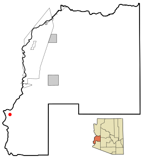
Cibola is a census-designated place (CDP) in La Paz County, Arizona, United States. The population was 250 at the 2010 census, up from 172 in 2000. It is named for the famed city of gold of the same name.

<span class="mw-page-title-main">Baywood-Los Osos, California</span> Unincorporated community in California, United States

Baywood-Los Osos is an unincorporated community in western San Luis Obispo County, California. The population was 14,351 in the 2000 census. It includes the communities of Los Osos, which is located near Morro Bay, Baywood Park, and the former community of Cuesta-by-the-Sea.

<span class="mw-page-title-main">Acomita Lake, New Mexico</span> Census-designated place in New Mexico, United States

Acomita Lake is a census-designated place (CDP) in Cibola County, New Mexico, United States. The population was 416 at the 2010 census.

<span class="mw-page-title-main">Encinal, New Mexico</span> Census-designated place in New Mexico, United States

Encinal is a census-designated place (CDP) in Cibola County, New Mexico, United States. It is the smallest of the six villages of the Laguna Pueblo and sits at the base of Mount Taylor. The population was 210 at the 2010 census. The feast day for Encinal is September 8.

<span class="mw-page-title-main">Laguna, New Mexico</span> Census-designated place in New Mexico, United States

Laguna is a census-designated place (CDP) in Cibola County, New Mexico, United States. The population was 1,241 at the 2010 census. It is located approximately 47 miles west of Albuquerque.

<span class="mw-page-title-main">Milan, New Mexico</span> Village in New Mexico, United States

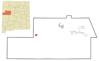
Milan is a village in Cibola County, New Mexico, United States. The population was 3,245 at the 2010 census.

<span class="mw-page-title-main">North Acomita Village, New Mexico</span> Census-designated place in New Mexico, United States

North Acomita Village is a census-designated place (CDP) in Cibola County, New Mexico, United States. The population was 303 at the 2010 census.

<span class="mw-page-title-main">Paguate, New Mexico</span> Census-designated place in New Mexico, United States

Paguate is a census-designated place (CDP) in Cibola County, New Mexico, United States. The population was 421 at the 2010 census.

<span class="mw-page-title-main">Paraje, New Mexico</span> Census-designated place in New Mexico, United States

Paraje is a census-designated place (CDP) in Cibola County, New Mexico, United States. As of the 2010 census, the CDP population was 777.

<span class="mw-page-title-main">Pinehill, New Mexico</span> Census-designated place in New Mexico, United States

Pinehill or Pine Hill is a census-designated place in Cibola County, New Mexico, United States. It is located on the Ramah Navajo Indian Reservation. The population was 88 at the 2010 census. The location of the CDP in 2010 had become the location of the Mountain View CDP as of the 2020 census, while a new CDP named "Pinehill" was listed 8 miles (13 km) further south, at a point 4 miles (6 km) southeast of Candy Kitchen.

<span class="mw-page-title-main">Seama, New Mexico</span> Census-designated place in New Mexico, United States

Seama is a census-designated place (CDP) in Cibola County, New Mexico, United States. The population was 465 at the 2010 census.

<span class="mw-page-title-main">Skyline-Ganipa, New Mexico</span> Census-designated place in New Mexico, United States

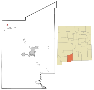
Skyline-Ganipa is a census-designated place (CDP) in Cibola County, New Mexico, United States. The population was 1,224 at the 2010 census.

<span class="mw-page-title-main">Salem, New Mexico</span> CDP in New Mexico, United States

Salem is a census-designated place (CDP) in Doña Ana County, New Mexico, United States. The population was 942 at the 2010 census. It is part of the Las Cruces Metropolitan Statistical Area.

<span class="mw-page-title-main">Ramah, New Mexico</span> CDP in New Mexico, United States

Ramah is a census-designated place (CDP) in McKinley County, New Mexico. The population was 407 at the time of 2000 census and 370 at the 2010 United States Census.

<span class="mw-page-title-main">Zuni Pueblo, New Mexico</span> Census-designated place in New Mexico, United States

Zuni Pueblo is a census-designated place (CDP) in McKinley County, New Mexico, United States. The population was 6,302 as of the 2010 Census. It is inhabited largely by members of the Zuni people (A:shiwi).

<span class="mw-page-title-main">Torreon, Sandoval County, New Mexico</span> Census-designate place in Sandoval County, New Mexico, United States

Torreon is a census-designated place (CDP) in Sandoval County, New Mexico, United States. The population was 297 at the 2000 census. It is part of the Albuquerque Metropolitan Statistical Area.

<span class="mw-page-title-main">La Puebla, New Mexico</span> CDP in New Mexico, United States

La Puebla is a census-designated place (CDP) in Santa Fe County, New Mexico, United States. It is part of the Santa Fe, New Mexico Metropolitan Statistical Area. The population was 1,296 at the 2000 census.

<span class="mw-page-title-main">Colonial Pine Hills, South Dakota</span> CDP in South Dakota, United States

Colonial Pine Hills is a census-designated place (CDP) and unincorporated community in Pennington County, South Dakota, United States. The population was 1,903 at the 2020 census.

<span class="mw-page-title-main">Nisqually Reservation</span> CDP in Washington, United States

The Nisqually Reservation, also known as Nisqually Indian Reservation is a federally recognized Indian reservation in Thurston County, Washington, United States. The population was 668 at the 2020 census.

References

  1. "ArcGIS REST Services Directory". United States Census Bureau. Retrieved October 12, 2022.
  2. 1 2 "Census Population API". United States Census Bureau. Retrieved Oct 12, 2022.
  3. 1 2 "Geographic Identifiers: 2010 Demographic Profile Data (G001): Mesita CDP, New Mexico". U.S. Census Bureau, American Factfinder. Archived from the original on February 12, 2020. Retrieved October 20, 2014.
  4. "US Gazetteer files: 2010, 2000, and 1990". United States Census Bureau. 2011-02-12. Retrieved 2011-04-23.
  5. "Census of Population and Housing". Census.gov. Retrieved June 4, 2016.
  6. "U.S. Census website". United States Census Bureau . Retrieved 2008-01-31.

Commons-logo.svg Media related to Mesita, New Mexico at Wikimedia Commons