Albert Street, Brisbane

Last updated

Albert Street

Albert-Street-Mall from-King-George-Square.jpg
Albert Street Mall from King George Square.
Albert Street, Brisbane
Australia Queensland location map.svg
Red pog.svg
Albert Street
Coordinates
General information
TypeStreet
Location Brisbane

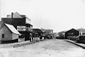
Albert Street is a street in the Brisbane central business district, Queensland, Australia. It was named after Prince Albert, the Prince Consort of Queen Victoria of the United Kingdom. [1] Albert Street railway station is being built directly beneath the street and is expected to open in 2026. The station precinct includes partial road closures as planned in the 2014 City Centre Master Plan, for the creation of a new public space. [2]

Contents

Geography

The street forms a key city axis. [3] The southern part of Albert Street is low-lying and prone to flooding; it was part of the historic Frog's Hollow district. The Brisbane City Council has a vision to turn Albert Street into a subtropical boulevard linking the Roma Street Parklands and Wickham Park with the City Botanic Gardens. [2] In the 2014 City Centre Master Plan, Albert Street is marked as a park to park link. [3] In the plan the street aims to cater for casual outdoor dining as well as pedestrian access to large scale events at the King George Square and Riverstage. [2]

History

Albert Street is one of the earliest streets in Brisbane. [4]

Albert Hall was an entertainment venue from 1901 to 1969 on the north side of Albert Street between Ann Street and Turbot Street, to the left of Albert Street Methodist (now Uniting) Church. [5] Albert Hall was replaced by the SGIO / Suncorp Building.

Albert Street originally ran from Alice Street to Wickham Terrace. The section between Adelaide Street and Ann Street was closed to traffic in 1968 and now forms part of King George Square in front of Brisbane City Hall. [6]

The section of Albert Street between Queen Street Mall and Adelaide Street has now been converted into part of the Mall, in connection with the busway tunnel from the Queen Street bus station to the King George Square busway station.

An underground railway station is expected to open in Albert Street in 2024 as part of the Cross River Rail project. [7]

In the 1940s, an American soldier batooned and injured his Australian counterpart here. [8]

Heritage listings

Albert Street has a number of heritage-listed sites, including:

Other notable buildings

At 102 Albert Street, the site of the now demolished Brisbane Festival Hall, is Festival Towers, an apartment building offering short-term accommodation.

123 Albert Street is an office building that was completed in 2011. It has achieved 6 stars on the Green Star environmental rating. [12]

Major intersections

See also

Related Research Articles

<span class="mw-page-title-main">Roma Street railway station</span> Railway station in Brisbane, Queensland

Roma Street railway station is located in the Brisbane central business district, Queensland, Australia. It is the junction station for the North Coast, Main, Gold Coast and NSW North Coast lines. The station is one of four inner city stations that form a core corridor through the centre of Brisbane.

<span class="mw-page-title-main">Fortitude Valley, Queensland</span> Suburb of Brisbane, Queensland, Australia

Fortitude Valley is an inner suburb of the City of Brisbane, the state capital of Queensland, Australia. In the 2021 census, Fortitude Valley had a population of 9,708 people. The suburb features two pedestrian malls at Brunswick Street Mall and Chinatown, and is one of the hubs of Brisbane's nightlife, renowned for its nightclubs, bars and adult entertainment.

<span class="mw-page-title-main">Brisbane City Hall</span> Civic building in Brisbane, Australia

Brisbane City Hall, in Brisbane, Queensland, Australia, is the seat of the Brisbane City Council. It is located adjacent to King George Square, where the rectangular City Hall has its main entrance. The City Hall also has frontages and entrances in both Ann Street and Adelaide Street. The building design is based on a combination of the Roman Pantheon, and St Mark's Campanile in Venice and is considered one of Brisbane's finest buildings. It was listed on the Register of the National Estate in 1978 and on the Queensland Heritage Register in 1992. It is also iconic for its Westminster chimes which sound on the quarter-hour.

<span class="mw-page-title-main">King George Square busway station</span>

King George Square busway station is located in Brisbane, Queensland, Australia serving the Brisbane central business district. It is located beneath King George Square and marks the start of the Northern Busway. The station has twelve stops on two platforms; access to these platforms is via an underground concourse which can be accessed from Ann Street or Adelaide Street. Passengers wait behind automatic doors on the stop that is assigned to their bus. It opened on 19 May 2008.

<span class="mw-page-title-main">Brisbane central business district</span> Suburb of Brisbane, Queensland, Australia

Brisbane City is the central suburb and central business district of Brisbane, the state capital of Queensland, Australia. It is colloquially referred to as the "Brisbane CBD" or "the city". It is located on a point on the northern bank of the Brisbane River, historically known as Meanjin, Mianjin or Meeanjin in the local Aboriginal Australian dialect. The triangular shaped area is bounded by the median of the Brisbane River to the east, south and west. The point, known at its tip as Gardens Point, slopes upward to the north-west where the city is bounded by parkland and the inner city suburb of Spring Hill to the north. The CBD is bounded to the north-east by the suburb of Fortitude Valley. To the west the CBD is bounded by Petrie Terrace, which in 2010 was reinstated as a suburb.

<span class="mw-page-title-main">Spring Hill, Queensland</span> Suburb of Brisbane, Queensland, Australia

Spring Hill is an inner northern suburb in the City of Brisbane, Queensland, Australia. In the 2016 census, Spring Hill had a population of 5,974 people.

<span class="mw-page-title-main">Queen Street, Brisbane</span> Street in Brisbanes CBD

Queen Street is the main street of Brisbane, the capital of Queensland, Australia. It is named after Queen Victoria of the United Kingdom.

<span class="mw-page-title-main">George Street, Brisbane</span> Street in Brisbane, Queensland

George Street is a major street located in the Brisbane CBD in Brisbane, Queensland, Australia.

<span class="mw-page-title-main">Adelaide Street, Brisbane</span> Street in Brisbane, Queensland

Adelaide Street is a major street in Brisbane, Queensland, Australia. It runs between and parallel to Queen Street and Ann Street.

<span class="mw-page-title-main">Ann Street, Brisbane</span> Street in Brisbane, Queensland

Ann Street runs parallel to Adelaide Street and is the northernmost street in the Brisbane CBD in Queensland, Australia. The street is named for Anne, Queen of Great Britain, as part of the CBD street naming series of female British royalty. It is a major thoroughfare, linking as a four-lane one-way street the suburb of Fortitude Valley in the northeast with the Riverside Expressway in the southwest; house numbers run the opposite direction.

<span class="mw-page-title-main">Edward Street, Brisbane</span> Street in Brisbane, Queensland, Australia

Edward Street is a busy thoroughfare in the Brisbane central business district, Queensland, Australia. It is a one-way street located between Albert Street and Creek Street, and runs from Upper Edward Street to Alice Street. It is named after Edward VII of the United Kingdom.

<span class="mw-page-title-main">Elizabeth Street, Brisbane</span> Street in Brisbane, Queensland

Elizabeth Street is a major street in the centre of the city in Brisbane, Queensland, Australia. The street was one of the earliest in Brisbane being established at the beginning of settlement in Brisbane as Moreton Bay penal settlement. Today, most of the street is fronted by low-level retail outlets, with an increase in mixed use skyscrapers being recently constructed.

<span class="mw-page-title-main">North Quay, Brisbane</span> Street in Brisbane, Queensland

North Quay is a location in the Brisbane central business district and the name of a street in the same area, running along the Brisbane River from an intersection near Makerston Street to the top of the Queen Street mall, linking the Victoria Bridge and the William Jolly Bridge along the river's northern bank. It was the site of Brisbane’s initial settlement, at a point where a stream flowing from Spring Hill provided fresh water, later collected in a reservoir on Tank Street.

<span class="mw-page-title-main">Creek Street, Brisbane</span> Major road in Brisbane, Australia

Creek Street is a major street in the central business district of Brisbane, Queensland, Australia. The street follows a one-way south–north direction, starting at the beginning of Charlotte Street and cutting through Elizabeth Street, Queen Street, Adelaide Street, and Ann Street before coming to an end at Turbot Street in the northern end of the CBD. Creek Street was named for the filled-in creek over which it was constructed, and is an exception to the convention of parallel streets in the CBD being named after male royals.

<span class="mw-page-title-main">Wheat Creek Culvert</span> Heritage-listed culvert in Brisbane, Queensland

Wheat Creek Culvert was a heritage-listed culvert at Adelaide Street, Brisbane City, Queensland, Australia. It was designed by Christopher Porter and built in 1861 by H C Love. It is also known as Big Creek Culvert. It was added to the Queensland Heritage Register on 24 January 2003, but was removed in June 2015 after it was destroyed to create the Inner Northern Busway. However, a short section was preserved as a feature in the King George Square busway station.

<span class="mw-page-title-main">Wickham Terrace Car Park</span> Heritage-listed car park in Brisbane, Queensland

Wickham Terrace Car Park is a heritage-listed multi-storey car park at 136 Wickham Terrace, Spring Hill, City of Brisbane, Queensland, Australia. It was designed by James Birrell and built from 1959 to 1960. It was added to the Queensland Heritage Register as Brisbane City Council Carpark on 13 January 1995.

<span class="mw-page-title-main">Moreton Bay Penal Settlement</span>

The Moreton Bay Penal Settlement operated from 1825 to 1842. It became the city of Brisbane, Queensland, Australia.

<span class="mw-page-title-main">Brisbane Dental Hospital and College</span> Heritage-listed hospital building in Brisbane, Queensland

Brisbane Dental Hospital and College is a heritage-listed former dental hospital at 168 Turbot Street, Brisbane City, Queensland, Australia. It was designed by Raymond C Nowland and built from 1938 to 1941 by the Queensland Department of Public Works. It was added to the Queensland Heritage Register on 23 April 1999.

<span class="mw-page-title-main">Roma Street, Brisbane</span> Street in Brisbane, Queensland

Roma Street is a major street in Brisbane, the capital of Queensland, Australia. It is named after Diamantina Bowen, the wife of the first Governor of Queensland, George Bowen.

Turbot Street runs parallel to Ann Street and is on the northern side of the Brisbane CBD in Queensland, Australia. It is a major thoroughfare, linking as a three-to-five lane one-way street with the Riverside Expressway in the southwest to the suburb of Fortitude Valley in the northeast; address numbers run the same direction. It is a one-way pair with Ann Street.

References

  1. "What's the story behind the men's and women's street names in Brisbane's CBD?". ABC News. 20 December 2017. Archived from the original on 28 November 2018. Retrieved 31 July 2021.
  2. 1 2 3 "Cross River Rail Business Case August 2017" (PDF). Government of Queensland. pp. 130, 131. Archived (PDF) from the original on 23 October 2021. Retrieved 23 October 2021.
  3. 1 2 "City Centre Master Plan 2014" (PDF). Brisbane City Council. pp. 41, 44. Archived (PDF) from the original on 23 October 2021. Retrieved 24 October 2021.
  4. "Early Streets of Brisbane (entry 645611)". Queensland Heritage Register . Queensland Heritage Council. Retrieved 8 December 2016.
  5. Bartlett, George S & Bartlett, Aubrey George & Archive CD Books Australia 2009, Greater Brisbane area : atlases and street directories : set of 4 1931-c1948, Archive CD Books Australia, [Modbury, S. Aust.]
  6. "King George Square". Brisbane Heritage Register. Brisbane City Council . Retrieved 31 July 2021.
  7. "Cross River Rail to dominate Queensland election". The Courier Mail. News Corp. 17 June 2017. Archived from the original on 22 December 2020. Retrieved 19 June 2017.
  8. Raymond Evans and Jacqui Donegan, "The Battle of Brisbane", Politics and Culture.[ full citation needed ]
  9. "Albert Park (South) Air Raid Shelter (entry 602474)". Queensland Heritage Register . Queensland Heritage Council. Retrieved 19 June 2013.
  10. "Perry House (entry 600103)". Queensland Heritage Register . Queensland Heritage Council. Retrieved 19 June 2013.
  11. "Albert Street Uniting Church (entry 600066)". Queensland Heritage Register . Queensland Heritage Council. Retrieved 19 June 2013.
  12. "123 Albert Street – Building profile – Overview". Dexus Property Group. Archived from the original on 25 April 2012. Retrieved 22 July 2012.

Commons-logo.svg Media related to Albert Street, Brisbane at Wikimedia Commons