Buford is an unincorporated community and census-designated place (CDP) in Lancaster County, South Carolina, United States. It was first listed as a CDP in the 2020 census with a population of 398. It lies at the intersection of South Carolina Highways 9 and 522.
Pauline is an unincorporated community and census-designated place (CDP) in Spartanburg County, South Carolina, United States. It was first listed as a CDP in the 2020 census with a population of 209.
Dixie Union is an unincorporated community and census-designated place (CDP) in Ware County, Georgia, United States. It lies north of Waycross on U.S. Route 1 and 23. The community is part of the Waycross Micropolitan Statistical Area.
Grandy is an unincorporated community and census-designated place (CDP) in Currituck County, North Carolina, USA. It was first listed as a CDP in the 2020 census with a population of 2,776. It is located along US 158 between the Currituck Sound and the North River.

Barnardsville is an unincorporated community and census-designated place (CDP) in Buncombe County, North Carolina, United States. It was first listed as a CDP in the 2020 census with a population of 559.
Smithtown is an unincorporated community and census-designated place (CDP) in northern Yadkin County, North Carolina, United States. It was first listed as a CDP in the 2020 census with a population of 224.

Springdale is an unincorporated community and census-designated place (CDP) in Gaston County, North Carolina, United States. It was first listed as a CDP in the 2020 census with a population of 1,203. It is bordered on the west and south by the City of Gastonia, on the east by the town of Ranlo, and on the north by the unincorporated community of Monterey Park.
Long Creek is an unincorporated community and census-designated place (CDP) in western Oconee County, South Carolina, United States. It was first listed as a CDP in the 2020 census with a population of 96.
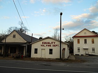
Equality is a census-designated place in Coosa County, Alabama, United States. It was first named as a CDP in the 2020 Census which listed a population of 150. The Equality post office serves the ZIP Code of 36026, and its delivery area includes rural land to the south in Elmore County.

Hamer is an unincorporated community and census-designated place (CDP) in Dillon County, South Carolina, United States. It was first listed as a CDP in the 2020 census with a population of 820.
Little Rock is an unincorporated community and census-designated place (CDP) in Dillon County, South Carolina, United States. Per the 2020 census, the population was 658.
Lobeco is an unincorporated community and census-designated place (CDP) located in Beaufort County, South Carolina, United States. Per the 2020 census, the population was 292.
Milwaukee is an unincorporated community and census-designated place (CDP) in Northampton County, North Carolina, United States. It was first listed as a CDP in the 2020 census with a population of 157.

Adams Run is an unincorporated community and census-designated place (CDP) in Charleston County, South Carolina, United States. It was first listed as a CDP in the 2020 census with a population of 421.
La France is an unincorporated community and census-designated place (CDP) in Anderson County, South Carolina. It was first listed as a CDP in the 2020 census with a population of 476.
Grover is an unincorporated community and census-designated place (CDP) in Dorchester County, South Carolina, United States. It was first listed as a CDP in the 2020 census with a population of 297.

Jackson Springs is an unincorporated community and census-designated place (CDP) in Moore County, North Carolina, United States. It was first listed as a CDP in the 2020 census with a population of 154.
Crouse is an unincorporated community and census-designated place (CDP) in Lincoln County, North Carolina, United States. It was first listed as a CDP in the 2020 census with a population of 322. Crouse has a post office with ZIP code 28033.

Elliott is an unincorporated community and census-designated place (CDP) in Lee County, South Carolina, United States. It was first listed as a CDP in the 2020 census with a population of 370.
Cash is an unincorporated community and census-designated place (CDP) in Chesterfield County, in the U.S. state of South Carolina. It was first listed as a CDP in the 2020 census with a population of 445.

