Lowell, North Carolina

Last updated

Lowell, North Carolina
NCMap-doton-Lowell.PNG
Location of Lowell, North Carolina
Coordinates: 35°14′59″N81°06′07″W / 35.24972°N 81.10194°W / 35.24972; -81.10194
CountryFlag of the United States.svg United States
StateFlag of North Carolina.svg  North Carolina
County Gaston
Incorporated1879
Government
  MayorSandy Railey
Area
[1]
  Total3.68 sq mi (9.53 km2)
  Land3.67 sq mi (9.52 km2)
  Water0.01 sq mi (0.02 km2)
Elevation
[2]
712 ft (217 m)
Population
 (2020)
  Total3,654
  Density994.29/sq mi (383.94/km2)
Time zone UTC−5 (Eastern (EST))
  Summer (DST) UTC−4 (EDT)
ZIP code
28098
Area code 704
FIPS code 37-39480 [3]
GNIS feature ID2404966 [2]
Website www.lowellnc.com

Lowell is a small city in Gaston County, North Carolina, United States, located east of Gastonia. The population was 3,526 at the 2010 census. [4]

Contents

Geography

According to the United States Census Bureau, the city has a total area of 2.7 square miles (6.9 km2), of which 0.004 square miles (0.01 km2), or 0.21%, is water. [4] The South Fork Catawba River borders Lowell on the north, and the city is part of the Cramerton Watershed.

History

Lowell was incorporated in 1879. It was named after Lowell, Massachusetts, in hopes the city would become a similar textile center. The settlement dates back to 1848, when the Woodlawn Mill [5] was built on the South Fork Catawba River. When grading was done for the Atlanta and Richmond Air-Line Railway in 1870 and a small depot was built in the community, it was given the name "Wright's Station", because the nearest resident was William Wright. [6] [7]

Demographics

Historical population
CensusPop.Note
1880 35
1900 290
1910 876202.1%
1920 1,15131.4%
1930 1,66444.6%
1940 1,8269.7%
1950 2,31326.7%
1960 2,78420.4%
1970 3,30718.8%
1980 2,917−11.8%
1990 2,704−7.3%
2000 2,662−1.6%
2010 3,52632.5%
2020 3,6543.6%
U.S. Decennial Census [8]

2020 census

Lowell racial composition [9]
RaceNumberPercentage
White (non-Hispanic)2,58270.66%
Black or African American (non-Hispanic)42411.6%
Native American 130.36%
Asian 772.11%
Other/Mixed 2346.4%
Hispanic or Latino 3248.87%

As of the 2020 United States census, there were 3,654 people, 1,305 households, and 855 families residing in the city.

2000 census

As of the census [3] of 2000, there were 2,662 people, 1,085 households, and 748 families residing in the city. The population density was 1,011.8 inhabitants per square mile (390.7/km2). There were 1,137 housing units at an average density of 432.2 per square mile (166.9/km2). The racial makeup of the city was 91.40% White, 6.46% African American, 0.23% Native American, 0.64% Asian, 0.19% from other races, and 1.09% from two or more races. Hispanic or Latino of any race were 1.31% of the population.

There were 1,085 households, out of which 30.1% had children under the age of 18 living with them, 48.5% were married couples living together, 15.1% had a female householder with no husband present, and 31.0% were non-families. 26.4% of all households were made up of individuals, and 12.1% had someone living alone who was 65 years of age or older. The average household size was 2.41 and the average family size was 2.88.

In the city, the age distribution of the population shows 23.0% under the age of 18, 7.4% from 18 to 24, 30.7% from 25 to 44, 22.0% from 45 to 64, and 16.9% who were 65 years of age or older. The median age was 39 years. For every 100 females, there were 85.4 males. For every 100 females age 18 and over, there were 81.6 males.

The median income for a household in the city was $33,586, and the median income for a family was $39,143. Males had a median income of $30,750 versus $24,063 for females. The per capita income for the city was $15,809. About 10.1% of families and 11.0% of the population were below the poverty line, including 15.4% of those under age 18 and 6.5% of those age 65 or over.

Government

Lowell is governed by a mayor and a five-member city council. It is run by a full-time City Manager. Lowell operates its own Police Department. Fire protection is provided by the Lowell Volunteer Fire Department (Station 17).

Lowell is in South Point Township.

Education

Public education in Lowell is administered by the Gaston County Schools public school system. The public schools in Lowell are Lowell Elementary School, Kindergarten through Grade 5, and Holbrook Middle School, Grades 6–8.

Most of Lowell is in the attendance district for Lowell Elementary School. Southeastern parts of the city are in the attendance district for McAdenville Elementary School in McAdenville, and a small area in southwestern Lowell is in the attendance distinct for Gardner Park Elementary School in Gastonia. All of the city is in the attendance district for Holbrook Middle School.

High school-age students attend Ashbrook High School in Gastonia.

New middle school and high school facilities are currently under construction at the Lowell campus. In the meantime, the school has been renting facilities for the middle school and high school programs at the former campus of Sacred Heart College in Belmont since 1994.

The Lowell Branch of the Gaston County Public Library serves this community. [10]

Transportation

The primary east–west highway passing through Lowell is Interstate 85. Other important highways include U.S. Route 29/U.S. Route 74 (Wilkinson Blvd./Franklin Blvd.) and North Carolina Highway 7 (McAdenville Rd./3rd St./Main St./1st St./Lowell Rd.).

Freight rail service is provided by the Norfolk Southern Railway. While Amtrak's passenger train also follows the Norfolk Southern main line, the nearest station is in Gastonia.

Points of interest

Notable people

Related Research Articles

<span class="mw-page-title-main">Chester County, South Carolina</span> County in South Carolina, United States

Chester County is a county located in the U.S. state of South Carolina. As of the 2020 census, its population was 32,294. Its county seat is Chester.

<span class="mw-page-title-main">Northampton County, North Carolina</span> County in North Carolina, United States

Northampton County is a county located in the U.S. state of North Carolina. As of the 2020 census, the population was 17,471. Its county seat is Jackson.

<span class="mw-page-title-main">Lincoln County, North Carolina</span> County in North Carolina, United States

Lincoln County is a county located in the U.S. state of North Carolina. As of the 2020 census, the population was 86,810, making it the most populous "Lincoln County" in the United States. Its county seat is Lincolnton.

<span class="mw-page-title-main">Gaston County, North Carolina</span> County in North Carolina, United States

Gaston County is a county in the U.S. state of North Carolina. As of the 2020 census, the population was 227,943. The county seat is Gastonia. Dallas served as the original county seat from 1846 until 1911.

<span class="mw-page-title-main">Catawba County, North Carolina</span> County in North Carolina, United States

Catawba County is a county in the U.S. state of North Carolina. As of the 2020 census, the population was 160,610. Its county seat is Newton, and its largest community is Hickory.

<span class="mw-page-title-main">Granite Falls, North Carolina</span> Town in North Carolina, United States

Granite Falls is a town in Caldwell County, North Carolina, United States. The population was 4,722 at the 2010 census. It is part of the Hickory–Lenoir–Morganton Metropolitan Statistical Area.

<span class="mw-page-title-main">Catawba, North Carolina</span> Town in North Carolina, United States

Catawba is a town in Catawba County, North Carolina, United States. The population was 603 at the 2010 census. It is part of the Hickory–Lenoir–Morganton Metropolitan Statistical Area. As with the county, the name recalls the Catawba people, the indigenous people who once inhabited the area.

<span class="mw-page-title-main">Belmont, North Carolina</span> City in North Carolina, United States

Belmont is a small suburban city in Gaston County, North Carolina, United States, located about 13 miles (21 km) west of uptown Charlotte and 9 miles (14 km) east of Gastonia. The population was 10,076 at the 2010 census. Once known as Garibaldi Station, it was named for the New York banker August Belmont. Belmont is home to Belmont Abbey College.

<span class="mw-page-title-main">Bessemer City, North Carolina</span> City in North Carolina, United States

Bessemer City is a small suburban city in Gaston County, North Carolina, United States. The population is 5,340. The city is approximately 6 miles (10 km) northwest of Gastonia and 25 miles (40 km) west of Charlotte. It was settled in 1756 and founded in 1893.

<span class="mw-page-title-main">Cramerton, North Carolina</span> Town in North Carolina, United States

Cramerton is a small town in Gaston County, North Carolina, United States. It is a suburb of Charlotte and located east of Gastonia. The population was 4,165 at the 2010 census. A well-known feature is the Cramer Mountain gated development, featuring homes around an 18-hole golf course at Cramer Mountain Country Club.

<span class="mw-page-title-main">Dallas, North Carolina</span> Town in North Carolina, United States

Dallas is a town in Gaston County, North Carolina, United States, and a suburb of Charlotte, located north of Gastonia. The population was 4,488 at the 2010 census. It was named for George M. Dallas, Vice President of the United States under James K. Polk.

<span class="mw-page-title-main">Gastonia, North Carolina</span> City in North Carolina, United States

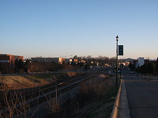
Gastonia is the most populous city in and county seat of Gaston County, North Carolina, United States. It is the second-largest satellite city of the Charlotte area, behind Concord. The population was 80,411 in the 2020 census, up from 71,741 in 2010. Gastonia is the 13th most populous city in North Carolina. It is part of the Charlotte-Concord-Gastonia, NC-SC Metropolitan Statistical Area, which is part of the Charlotte-Concord, NC-SC Combined Statistical Area.

<span class="mw-page-title-main">High Shoals, North Carolina</span> City in North Carolina, United States

High Shoals is a city in Gaston County, North Carolina, United States, named for the high rocky shoal across the Catawba River. The population was 696 at the 2010 census.

<span class="mw-page-title-main">McAdenville, North Carolina</span> Town in North Carolina, United States

McAdenville is a small town in Gaston County, North Carolina, United States. It is a suburb of Charlotte and located east of Gastonia. The population was 890 at the 2020 census.

<span class="mw-page-title-main">Mount Holly, North Carolina</span> City in North Carolina, United States

Mount Holly is a small suburban city in northeastern Gaston County, North Carolina, United States. The city is situated just west of the Catawba River, north of Interstate 85, south of North Carolina State Highway 16, and west of Charlotte. The population was 17,703 at the 2020 census, up from 13,656 in 2010.

<span class="mw-page-title-main">Lincolnton, North Carolina</span> City in North Carolina, United States

Lincolnton is a city in Lincoln County, North Carolina, United States within the Charlotte metropolitan area. The population was 10,486 at the 2010 census. Lincolnton is northwest of Charlotte, on the South Fork of the Catawba River. The city is the county seat of Lincoln County.

<span class="mw-page-title-main">Clover, South Carolina</span> Town in South Carolina, United States

Clover is a town in York County, South Carolina, United States. It is located in the greater Charlotte metropolitan area. As of 2020, the population was at 6,671 within the town limits. Clover is twinned with the Northern Irish town of Larne on County Antrim's East Coast.

<span class="mw-page-title-main">Kings Mountain, North Carolina</span> City in North Carolina, United States

Kings Mountain is a small suburban city within the Charlotte metropolitan area in Cleveland and Gaston counties, North Carolina, United States. Most of the city is in Cleveland County, with a small eastern portion in Gaston County. The population was 10,296 at the 2010 census.

<span class="mw-page-title-main">North Carolina Highway 7</span> State highway in Gaston County, North Carolina, US

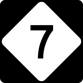
North Carolina Highway 7 (NC 7) is a primary state highway in the U.S. state of North Carolina. Entirely within Gaston County, it connects the towns of Lowell, McAdenville, and Belmont with the city of Gastonia.

Gaston County Schools is a public school district located in Gaston County, North Carolina. With 30,046 students enrolled in 56 schools as of the 2021–22 academic year, it is the tenth largest public school district in North Carolina.

References

  1. "ArcGIS REST Services Directory". United States Census Bureau. Retrieved September 20, 2022.
  2. 1 2 U.S. Geological Survey Geographic Names Information System: Lowell, North Carolina
  3. 1 2 "U.S. Census website". United States Census Bureau. Archived from the original on December 27, 1996. Retrieved January 31, 2008.
  4. 1 2 "Geographic Identifiers: 2010 Demographic Profile Data (G001): Lowell city, North Carolina". U.S. Census Bureau, American Factfinder. Archived from the original on February 12, 2020. Retrieved March 27, 2013.
  5. "NC Business History - NC Textile Mills Pre-1860". Archived from the original on August 14, 2015. Retrieved July 16, 2015.
  6. http://www.belmontchamber.com/lowell.html Archived 2008-07-04 at the Wayback Machine . Retrieved on 2008-07-04
  7. http://www.lowellnc.com/history.htm.Retrieved%5B%5D on 2008-07-04
  8. "Census of Population and Housing". Census.gov. Archived from the original on April 26, 2015. Retrieved June 4, 2015.
  9. "Explore Census Data". data.census.gov. Archived from the original on December 20, 2021. Retrieved December 20, 2021.
  10. "Lowell Branch". Archived from the original on February 1, 2014. Retrieved January 23, 2014.
  11. "Error". edocs.deq.nc.gov. Archived from the original on February 9, 2019. Retrieved February 8, 2019.
  12. Aheron, Piper Peters (2001). Gastonia and Gaston County, North Carolina. Arcadia Publishing. p. 66. ISBN   0-7385-0673-7.