Alto, New Mexico | |
|---|---|
 Spencer Theater near Alto, May 2009 | |
 Alto  Alto | |
| Coordinates: 33°23′55″N105°40′51″W / 33.39861°N 105.68083°W | |
| Country | United States |
| State | New Mexico |
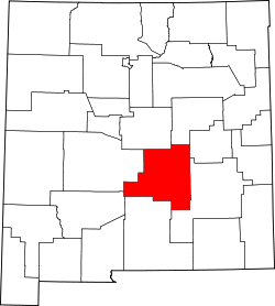
| County | Lincoln |
| Time zone | UTC-7 (Mountain (MST)) |
| • Summer (DST) | UTC-6 (MDT) |
| ZIP code | 88312 [1] |
| Area code | 575 |
| GNIS feature ID | 903117 [2] |
Alto is an unincorporated community in Lincoln County, New Mexico, United States. [2]