Capitan, New Mexico

Last updated

Capitan
Capitan, New Mexico
BTKTrail thru CapitanNM.jpg
The Billy the Kid Trail through Capitan
Lincoln County New Mexico Incorporated and Unincorporated areas Capitan Highlighted.svg
Location of Capitan, New Mexico
Usa edcp location map.svg
Red pog.svg
Capitan
Location in the United States
Coordinates: 33°32′38″N105°34′59″W / 33.54389°N 105.58306°W / 33.54389; -105.58306
Country United States
State New Mexico
County Lincoln
Area
[1]
  Total3.26 sq mi (8.44 km2)
  Land3.26 sq mi (8.44 km2)
  Water0.00 sq mi (0.00 km2)
Elevation
6,350 ft (1,950 m)
Population
 (2020) [2]
  Total1,391
  Density426.82/sq mi (164.78/km2)
Time zone UTC-7 (Mountain (MST))
  Summer (DST) UTC-6 (MDT)
ZIP code
88316
Area code 575
FIPS code 35-11800
GNIS feature ID0923574
Website villageofcapitan.org
Aerial view of Capitan in 1941 New Mexico - Bonito thrrough Captain - NARA - 68144791 (cropped).jpg
Aerial view of Capitan in 1941

Capitan is a village in Lincoln County, New Mexico, United States, located north of the Lincoln National Forest between the Capitan and Sacramento Mountains at an elevation of 6,350 feet (1,950 m). The population was 1,489 at the 2010 census. Capitan was founded in the 1890s and incorporated in 1941.

Contents

Geography

According to the United States Census Bureau, Capitan has a total area of 3.2 square miles (8.3 km2), all land. The community is surrounded by high desert mountains and New Mexico cedar, pinon and juniper trees.

Climate

Climate data for Capitan, New Mexico
MonthJanFebMarAprMayJunJulAugSepOctNovDecYear
Record high °F (°C)73
(23)
73
(23)
79
(26)
85
(29)
94
(34)
101
(38)
98
(37)
97
(36)
91
(33)
85
(29)
79
(26)
71
(22)
101
(38)
Mean daily maximum °F (°C)49
(9)
53
(12)
59
(15)
68
(20)
76
(24)
84
(29)
83
(28)
81
(27)
76
(24)
68
(20)
57
(14)
49
(9)
67
(19)
Mean daily minimum °F (°C)23
(−5)
25
(−4)
29
(−2)
35
(2)
43
(6)
49
(9)
54
(12)
53
(12)
47
(8)
38
(3)
29
(−2)
23
(−5)
37
(3)
Record low °F (°C)−4
(−20)
−6
(−21)
−2
(−19)
8
(−13)
25
(−4)
33
(1)
42
(6)
41
(5)
30
(−1)
8
(−13)
−11
(−24)
−15
(−26)
−15
(−26)
Average precipitation inches (mm)0.64
(16)
0.79
(20)
0.63
(16)
0.53
(13)
1.17
(30)
1.55
(39)
3.49
(89)
3.51
(89)
2.21
(56)
1.25
(32)
1.08
(27)
1.00
(25)
17.85
(452)
Average snowfall inches (cm)7
(18)
6.8
(17)
4.7
(12)
1.3
(3.3)
0.2
(0.51)
0
(0)
0
(0)
0
(0)
0
(0)
0.9
(2.3)
1.9
(4.8)
9.2
(23)
32
(80.91)
Source 1: [3]
Source 2: [4]

Demographics

Historical population
CensusPop.Note
1940 932
1950 575−38.3%
1960 552−4.0%
1970 439−20.5%
1980 76273.6%
1990 84210.5%
2000 1,44371.4%
2010 1,4893.2%
2020 1,391−6.6%
U.S. Decennial Census [5] [2]

As of the census [6] of 2000, there were 1,443 people, 605 households, and 416 families residing in the village. The population density was 450.9 inhabitants per square mile (174.1/km2). There were 717 housing units at an average density of 224.0 per square mile (86.5/km2). The racial makeup of the village was 83.57% White, 0.55% African American, 1.46% Native American, 0.55% Asian, 0.07% Pacific Islander, 7.76% from other races, and 2.08% from two or more races. Hispanic or Latino of any race were 19.20% of the population.

There were 605 households, out of which 26.4% had children under the age of 18 living with them, 56.0% were married couples living together, 9.8% had a female householder with no husband present, and 31.2% were non-families. 27.4% of all households were made up of individuals, and 10.4% had someone living alone who was 65 years of age or older. The average household size was 2.39 and the average family size was 2.91.

In the village, the population was spread out, with 24.9% under the age of 18, 5.9% from 18 to 24, 22.6% from 25 to 44, 29.9% from 45 to 64, and 16.6% who were 65 years of age or older. The median age was 42 years. For every 100 females, there were 97.4 males. For every 100 females age 18 and over, there were 93.4 males.

The median income for a household in the village was $27,188, and the median income for a family was $32,115. Males had a median income of $23,500 versus $16,902 for females. The per capita income for the village was $15,062. About 8.3% of families and 13.0% of the population were below the poverty line, including 13.7% of those under age 18 and 12.1% of those age 65 or over.

Transportation

Major Highways

Smokey Bear

Tahoe National Forest Fire Engine 731 and Crew at Smokey Bear Viewpoint in June 1990 (temporarily assigned to Lincoln National Forest) with the Capitan Mountains and Capitan Gap in the distance. Capitan village is in the valley between the Mountains and the Viewpoint. Capitan gap.jpg
Tahoe National Forest Fire Engine 731 and Crew at Smokey Bear Viewpoint in June 1990 (temporarily assigned to Lincoln National Forest) with the Capitan Mountains and Capitan Gap in the distance. Capitan village is in the valley between the Mountains and the Viewpoint.

In spring of 1950, a badly burned black bear cub was rescued from a large forest fire at Capitan Gap in the Capitan Mountains. First called Hotfoot Teddy, he was later renamed Smokey and became the real-life version of the United States Forest Service mascot Smokey Bear. Smokey was later sent to the National Zoo in Washington D.C., where he lived for 26 years. Upon his death on November 9, 1976, [7] Smokey's remains were returned by the government to Capitan and buried at what is now the Smokey Bear Historical Park. [8]

Related Research Articles

<span class="mw-page-title-main">Torrance County, New Mexico</span> County in New Mexico, United States

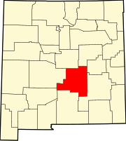
Torrance County is a county located in the center of the U.S. state of New Mexico. As of the 2020 census, the population was 15,045. The county seat is Estancia.

<span class="mw-page-title-main">Sierra County, New Mexico</span> County in New Mexico, United States

Sierra County is a county located in the U.S. state of New Mexico. As of the 2020 Census, the population was 11,576. Its county seat is Truth or Consequences.

<span class="mw-page-title-main">Roosevelt County, New Mexico</span> County in New Mexico, United States

Roosevelt County is a county located in the U.S. state of New Mexico. As of the 2020 census, the population was 19,191. Its county seat is Portales. The county was created in 1903 from Chaves and Guadalupe counties and named for the then-current President of the United States, Theodore Roosevelt. The county's eastern border is the Texas state line.

<span class="mw-page-title-main">Luna County, New Mexico</span> County in New Mexico, United States

Luna County(Spanish: Condado de Luna) is a county located in the U.S. state of New Mexico. As of the 2020 census, the population was 25,427. Its county seat is Deming. This county abuts the Mexican border. Luna County comprises the Deming, NM Micropolitan Statistical Area.

<span class="mw-page-title-main">Lincoln County, New Mexico</span> County in New Mexico, United States

Lincoln County is a county in the U.S. state of New Mexico. As of the 2020 census, the population was 20,269. Its county seat is Carrizozo, while its largest community is Ruidoso.

<span class="mw-page-title-main">Grant County, New Mexico</span> County in New Mexico, United States

Grant County is a county located in the U.S. state of New Mexico. At the 2020 census, the population was 28,185. Its county seat is Silver City. The county was founded in 1868 and named for Ulysses S. Grant, the 18th President of the United States.
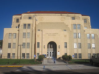
<span class="mw-page-title-main">Chaves County, New Mexico</span> County in New Mexico, United States

Chaves County is a county in New Mexico, United States. As of the 2020 census, the population was 65,157. Its county seat is Roswell. Chaves County was named for Colonel Jose Francisco Chaves, a military leader there during the Civil War and later in Navajo campaigns. The county was created by the New Mexico Territorial Legislature on February 25, 1889, out of land from Lincoln County.

Breitung Township is a township in Saint Louis County, Minnesota, United States. The population was 605 at the 2010 census.

<span class="mw-page-title-main">Isleta Village Proper, New Mexico</span> Census-designated place in New Mexico, United States

Isleta Village Proper is a census-designated place (CDP) in Bernalillo County, New Mexico, United States. The population was 491 at the 2010 census. It is part of the Albuquerque Metropolitan Statistical Area.

<span class="mw-page-title-main">Ruidoso Downs, New Mexico</span> City in New Mexico, United States

Ruidoso Downs is a city in Lincoln County, New Mexico, United States, located within the Lincoln National Forest. The population was 1,824 at the 2000 census and 2,815 at the 2010 census. Originally incorporated as a village, it became a city in May 2002. Known locally as "the Downs", Ruidoso Downs is a suburb of adjacent Ruidoso and is a part of the Ruidoso Micropolitan Statistical Area. The city, located along U.S. Route 70, is named after the Ruidoso Downs Race Track, which is located in the city along with the Billy the Kid Casino and the Hubbard Museum of the American West.

<span class="mw-page-title-main">Navajo, New Mexico</span> Census-designated place in McKinley County, New Mexico, United States

Navajo is a census-designated place (CDP) on the Navajo Nation in McKinley County, New Mexico, United States. The population was 2,097 at the 2000 census. Navajo is the most Navajo town in the United States, with 95.04% of residents having full or partial Navajo ancestry.

<span class="mw-page-title-main">Cloudcroft, New Mexico</span> Village in Otero County, New Mexico, United States

Cloudcroft is a village in Otero County, New Mexico, United States, and is located within the Lincoln National Forest. The population was 750 at the 2020 census.

<span class="mw-page-title-main">Mescalero, New Mexico</span> Census-designated place in New Mexico, United States

Mescalero is a census-designated place (CDP) in Otero County, New Mexico, United States, located on the Mescalero Apache Reservation. The population was 1,338 at the 2010 census.

<span class="mw-page-title-main">Pecos, New Mexico</span> Village in New Mexico, United States

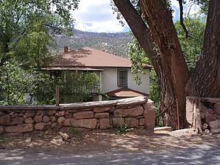
Pecos is a village in San Miguel County, New Mexico, United States. The population was 1,392 at the 2010 census, shrinking slower than other parts of San Miguel County, partly because Pecos is within commuting distance of Santa Fe. The village is built along the Pecos River, which flows from the north out of the Santa Fe National Forest. Notable locations nearby include Pecos National Historical Park, Glorieta Pass, Pecos Benedictine Monastery, and Lisboa Springs Trout Hatchery. It is also an entry point for hunting, fishing, hiking and camping in the Pecos Wilderness. The closest metropolitan area is the Santa Fe metropolitan area, approximately 26 miles (42 km) to the west.

<span class="mw-page-title-main">Cuba, New Mexico</span> Village in Sandoval County, New Mexico, United States

Cuba is a village in Sandoval County, New Mexico, United States. As of the 2010 census, the village population was 735. It is part of the Albuquerque Metropolitan Statistical Area.

<span class="mw-page-title-main">Jemez Springs, New Mexico</span> Village in Sandoval County, New Mexico, United States

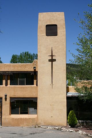
Jemez Springs is a village in Sandoval County, New Mexico, United States. The population was 250 at the 2010 census. Named for the nearby Pueblo of Jemez, the village is the site of Jemez State Monument and the headquarters of the Jemez Ranger District. The village and nearby locations in the Jemez Valley are the site of hot springs and several religious retreats.

<span class="mw-page-title-main">Pueblo of Sandia Village, New Mexico</span> Village in Sandoval County, New Mexico, US

Pueblo of Sandia Village is a census-designated place (CDP) in Sandoval County, New Mexico, United States. The population was 344 at the 2000 census. It is part of the Albuquerque Metropolitan Statistical Area.

<span class="mw-page-title-main">San Ysidro, Sandoval County, New Mexico</span> Village in Sandoval County, New Mexico, United States

San Ysidro is a village in Sandoval County, New Mexico, United States. The population was 193 at the 2010 census. It is part of the Albuquerque Metropolitan Statistical Area.

<span class="mw-page-title-main">Williamsburg, New Mexico</span> Village in New Mexico, United States

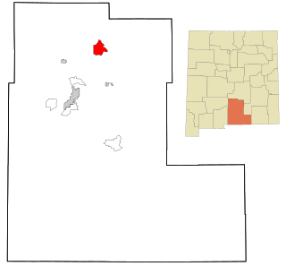
Williamsburg is a village in Sierra County, New Mexico, United States. The population was 462 at the 2020 census. The village, though small, is located adjacent to Truth or Consequences, and has essentially become a suburb. Though the town is experiencing moderate growth now, especially along I-25, in the near future there is a high possibility of its becoming a booming bedroom community for lakesiders from Elephant Butte.

<span class="mw-page-title-main">Encino, New Mexico</span> Village in New Mexico, United States

Encino is a village in Torrance County, New Mexico, United States. The population was 82 at the 2010 census. It is part of the Albuquerque Metropolitan Statistical Area.

References

  1. "ArcGIS REST Services Directory". United States Census Bureau. Retrieved October 12, 2022.
  2. 1 2 "Census Population API". United States Census Bureau. Retrieved October 12, 2022.
  3. "Historic Averages for Ruidoso, New Mexico" . Retrieved June 22, 2017.
  4. "Climate Capitan - New Mexico and Weather" . Retrieved June 22, 2017.
  5. "Census of Population and Housing". Census.gov. Retrieved June 4, 2015.
  6. "U.S. Census website". United States Census Bureau . Retrieved January 31, 2008.
  7. http://nationalzoo.si.edu/Publications/ZooGoer/2002/6/smokey.cfm Archived June 19, 2010, at the Wayback Machine
  8. "Welcome to Smokey Bear Historical Park". smokeybearpark.com. New Mexico Energy, Minerals and Natural Resources Department. Retrieved January 30, 2014.