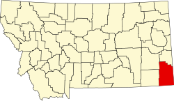
Alzada, Montana

Last updated

Alzada
Alzada MT Post Office.jpg
Alzada Post Office, July 2011
USA Montana location map.svg
Red pog.svg
Alzada
Usa edcp location map.svg
Red pog.svg
Alzada
Coordinates: 45°01′14″N104°24′46″W / 45.02056°N 104.41278°W / 45.02056; -104.41278 [1]
Country United States
State Montana
County Carter
Area
[2]
  Total0.51 sq mi (1.33 km2)
  Land0.51 sq mi (1.33 km2)
  Water0.00 sq mi (0.00 km2)
Elevation
[1]
3,438 ft (1,048 m)
Population
 (2020)
  Total25
  Density48.64/sq mi (18.79/km2)
Time zone UTC-7 (Mountain (MST))
  Summer (DST) UTC-6 (MDT)
ZIP codes
59311
Area code 406
FIPS code 30-01300
GNIS feature ID2583785 [1]

Alzada (also known as Stoneville and Telegraph Point) is a census-designated place in southern Carter County, Montana, United States. [1] As of the 2010 census it had a population of 29. [3] It is located at the intersection of U.S. Route 212 with Montana Secondary Highways 323 and 326, near the Wyoming and South Dakota borders. The Little Missouri River flows northwards to the west of the community. Alzada is in the Mountain Time Zone.

Contents

History

Alzada was first established in 1878, by 9th U.S. Infantry soldiers as Camp Devin, on the Deadwood, Dakota Territory to Fort Keogh, Montana Territory telegraph line. It was called the Little Missouri River Telegraph Station, and manned by soldiers of the 7th U.S. Cavalry. Then it was named Stoneville, after the local bartender Lou Stone. [4] It served as a stagecoach stop between Deadwood and Miles City, Montana. It was the site of a gun battle in 1884 between local authorities and rustlers known as the Axleby gang. [5] The town's name was changed from Stoneville in 1885, because of confusion with another similarly named community. The name "Alzada" came from an early settler named Laura Alzada Shelden. [6] Later settlers of the area were largely homesteaders.

In 1890, Private Peter Thompson, a 7th Cavalry survivor and recipient of the Medal of Honor for the Battle of the Little Bighorn, moved from Lead, Dakota Territory, with his brother William and homesteaded north of Alzada on the Little Missouri River at Nine Mile Creek.[ citation needed ]

Alzada was briefly in the news in September 1997, when a B-1 bomber crashed nearby.[ citation needed ]

Climate

According to the Köppen Climate Classification system, Alzada has a semi-arid climate, abbreviated "BSk" on climate maps. [7]

There is a weather station located in the nearby community of Albion. [8] [9]

Climate data for Albion 1 N, Montana, 1991–2020 normals, 1945-2020 extremes: 3312ft (1009m)
MonthJanFebMarAprMayJunJulAugSepOctNovDecYear
Record high °F (°C)67
(19)
73
(23)
81
(27)
91
(33)
98
(37)
106
(41)
108
(42)
107
(42)
104
(40)
95
(35)
80
(27)
69
(21)
108
(42)
Mean maximum °F (°C)50.4
(10.2)
54.1
(12.3)
67.9
(19.9)
77.2
(25.1)
86.0
(30.0)
92.0
(33.3)
99.4
(37.4)
98.0
(36.7)
94.7
(34.8)
81.4
(27.4)
67.2
(19.6)
52.4
(11.3)
99.9
(37.7)
Mean daily maximum °F (°C)28.7
(−1.8)
31.7
(−0.2)
42.8
(6.0)
53.3
(11.8)
64.1
(17.8)
74.9
(23.8)
84.4
(29.1)
83.0
(28.3)
72.9
(22.7)
55.7
(13.2)
42.1
(5.6)
30.9
(−0.6)
55.4
(13.0)
Daily mean °F (°C)16.0
(−8.9)
18.6
(−7.4)
28.6
(−1.9)
38.8
(3.8)
49.6
(9.8)
59.9
(15.5)
67.4
(19.7)
65.4
(18.6)
54.9
(12.7)
40.0
(4.4)
27.5
(−2.5)
17.4
(−8.1)
40.3
(4.6)
Mean daily minimum °F (°C)3.3
(−15.9)
5.6
(−14.7)
14.4
(−9.8)
24.2
(−4.3)
35.2
(1.8)
44.8
(7.1)
50.4
(10.2)
47.7
(8.7)
37.0
(2.8)
24.4
(−4.2)
13.0
(−10.6)
3.8
(−15.7)
25.3
(−3.7)
Mean minimum °F (°C)−17.5
(−27.5)
−13.6
(−25.3)
−3.3
(−19.6)
13.0
(−10.6)
23.3
(−4.8)
36.3
(2.4)
44.0
(6.7)
39.4
(4.1)
27.4
(−2.6)
11.5
(−11.4)
−4.4
(−20.2)
−13.8
(−25.4)
−25.7
(−32.1)
Record low °F (°C)−39
(−39)
−37
(−38)
−36
(−38)
−4
(−20)
8
(−13)
26
(−3)
33
(1)
28
(−2)
12
(−11)
−15
(−26)
−30
(−34)
−38
(−39)
−39
(−39)
Average precipitation inches (mm)0.27
(6.9)
0.48
(12)
1.03
(26)
1.62
(41)
3.14
(80)
3.03
(77)
1.90
(48)
1.95
(50)
1.09
(28)
1.32
(34)
0.31
(7.9)
0.42
(11)
16.56
(421.8)
Average snowfall inches (cm)2.60
(6.6)
7.30
(18.5)
5.70
(14.5)
3.00
(7.6)
1.40
(3.6)
0.00
(0.00)
0.00
(0.00)
0.00
(0.00)
0.00
(0.00)
1.60
(4.1)
3.30
(8.4)
3.70
(9.4)
28.6
(72.7)
Source 1: NOAA [10]
Source 2: XMACIS (temp records & monthly max/mins) [11]

Demographics

Historical population
CensusPop.Note
2020 25
U.S. Decennial Census [12]

See also

Related Research Articles

<span class="mw-page-title-main">Montana</span> U.S. state

Montana is a state in the Mountain West subregion of the Western United States. It is bordered by Idaho to the west, North Dakota and South Dakota to the east, Wyoming to the south, and the Canadian provinces of Alberta, British Columbia, and Saskatchewan to the north. It is the fourth-largest state by area, the eighth-least populous state, and the third-least densely populated state. Its capital is Helena, while the most populous city is Billings. The western half of the state contains numerous mountain ranges, while the eastern half is characterized by western prairie terrain and badlands, with smaller mountain ranges found throughout the state.

<span class="mw-page-title-main">Williams County, North Dakota</span> County in North Dakota, United States

Williams County is located on the western border of the U.S. state of North Dakota, next to Montana. As of the 2020 census, the population was 40,950. making it the fifth-most populous county in North Dakota. Its county seat is Williston.

<span class="mw-page-title-main">Emmons County, North Dakota</span> County in North Dakota, United States

Emmons County is a county in the U.S. state of North Dakota. As of the 2020 census, the population was 3,301. Its county seat has been Linton since 1899.

<span class="mw-page-title-main">Fallon County, Montana</span> County in Montana, United States

Fallon County is a county located in the U.S. state of Montana. As of the 2020 census, the population was 3,049. Its county seat is Baker. The county was created in 1913 from a portion of Custer County. It is named for Benjamin O'Fallon, a nephew of Captain William Clark and an Indian agent for the upper Missouri region from 1823 to 1827.

<span class="mw-page-title-main">Carter County, Montana</span> County in Montana, United States

Carter County is a county located in the U.S. state of Montana. As of the 2020 census, the population was 1,415, making it the seventh-least populous county in Montana. The county seat is Ekalaka.

<span class="mw-page-title-main">Culbertson, Montana</span> Town in Montana, United States

Culbertson is a town in Roosevelt County, Montana, United States. The population was 753 at the 2020 census.

<span class="mw-page-title-main">Plentywood, Montana</span> City in Montana, United States

Plentywood is a city in and the county seat of Sheridan County, Montana, United States. The population was 1,669 at the 2020 census.

<span class="mw-page-title-main">Baker, Montana</span> City in Montana, United States

Baker is a city in and the county seat of Fallon County, Montana, United States. The population was 1,802 at the 2020 census.

<span class="mw-page-title-main">Mandan, North Dakota</span> Morton County Seat

Mandan is a city on the eastern border of Morton County and the eighth-most populous city in North Dakota. Founded in 1879 on the west side of the upper Missouri River, it was designated in 1881 as the county seat of Morton County. The population was 24,206 at the 2020 census. Across the Missouri River from Bismarck, Mandan is a core city of the Bismarck–Mandan Metropolitan Statistical Area.

<span class="mw-page-title-main">Marmarth, North Dakota</span> City in North Dakota, United States

Marmarth is the largest city in Slope County in the U.S. State of North Dakota with a population of 101 as of 2020 census. It is situated in the southwestern part of Slope County, along the Bowman County line in the southwestern part of North Dakota, just seven miles east of the Montana border. Marmarth was founded as a railroad town along the Milwaukee Road from Seattle, WA to Chicago, IL. By 1920, Marmarth had over 1,300 residents. The town's population declined during most of the 20th century and was only 101 in 2021. There is one restaurant and one bar still located in Marmarth in 2013.

<span class="mw-page-title-main">Yankton, South Dakota</span> City in South Dakota, United States

Yankton is a city in and the county seat of Yankton County, South Dakota, United States.

Hammond is an unincorporated community in Carter County, Montana, United States. It is located approximately 30 miles (48 km) southeast of the town of Broadus along U.S. Highway 212. Its elevation is 3,711 feet.

<span class="mw-page-title-main">The Dakotas</span> Region in the United States

The Dakotas is a collective term for the U.S. states of North Dakota and South Dakota. It has been used historically to describe the Dakota Territory, and is still used for the collective heritage, culture, geography, fauna, sociology, economy, and cuisine of the two states.

<span class="mw-page-title-main">Index of Montana-related articles</span>

The following is an alphabetical list of articles related to the U.S. state of Montana.

Powderville, also Elkhorn Crossing is an unincorporated community in northeastern Powder River County, Montana, United States, along the Powder River. It is a small cluster of buildings that lies along local roads northeast of the town of Broadus, the county seat of Powder River County. Its elevation is 2,828 feet (862 m).

<span class="mw-page-title-main">Montana Territory in the American Civil War</span> Civil War role of the future U.S. state of Montana

The area that eventually became the U.S. state of Montana played little direct role in the American Civil War. The closest the Confederate States Army ever came to the area was New Mexico and eastern Kansas, each over a thousand miles away. There was not even an organized territory using "Montana" until the Montana Territory was created on May 26, 1864, three years after the Battle of Fort Sumter. In 1861, the area was divided between the Dakota Territory and the Washington Territory, and in 1863, it was part of the Idaho Territory.

<span class="mw-page-title-main">Hinsdale, Montana</span> Census-designated place & Unincorporated community in Montana, United States

Hinsdale is an unincorporated community and census-designated place in Valley County, Montana, United States. The town's population was 217 and the community's population as a whole was 583 as of the 2010 census. The community is located on the Milk River and U.S. Route 2, with Montana Highway 537 headed north out of town and South Bench Road crossing the railroad tracks and running south of town. Hinsdale has a post office with ZIP code 59241.

<span class="mw-page-title-main">Churchill, Montana</span> CDP in Montana, United States

Churchill is a census-designated place (CDP) in Gallatin County, Montana, United States. The population was 1,030 at the 2020 census. It is part of the Bozeman, MT Micropolitan Statistical Area. It was formerly part of the Amsterdam-Churchill CDP.

Camp Devin was a temporary United States Army camp established on June 30, 1878 during the building of the Fort Keogh-Deadwood Telegraph Line. It was named for Brevet Major General Thomas C. Devin, and abandoned in late 1878.

References

  1. 1 2 3 4 U.S. Geological Survey Geographic Names Information System: Alzada, Montana
  2. "ArcGIS REST Services Directory". United States Census Bureau. Retrieved September 5, 2022.
  3. "Geographic Identifiers: 2010 Demographic Profile Data (G001): Alzada CDP, Montana". U.S. Census Bureau, American Factfinder. Archived from the original on February 12, 2020. Retrieved October 8, 2014.
  4. Carkeek Cheney, Roberta (1983). Names on the Face of Montana. Missoula, Montana: Mountain Press Publishing Company. p. 5. ISBN   0-87842-150-5.
  5. https://www.historynet.com/valentines-day-shootout-at-stoneville/
  6. Aarstad, Rich, Ellie Arguimbau, Ellen Baumler, Charlene Porsild, and Brian Shovers. "Montana Place Names from Alzada to Zortman" Archived 2009-10-08 at the Wayback Machine . Montana Historical Society Press.
  7. Climate Summary for Alzada, Montana
  8. "Data of Meteorological Station Albion 1 N, Montana". geographic.org. Retrieved December 28, 2023.
  9. "Albion (in Carter County, MT) Populated Place Profile". HomeTownLocator. Retrieved December 28, 2023.
  10. "Albion 1 N, Montana 1991-2020 Monthly Normals" . Retrieved December 28, 2023.
  11. "xmACIS". National Oceanic and Atmospheric Administration. Retrieved December 28, 2023.
  12. "Census of Population and Housing". Census.gov. Retrieved June 4, 2016.

Commons-logo.svg Media related to Alzada, Montana at Wikimedia Commons