Post Office
Capitol had a post office from 1891–1982. Residents who have a Capitol address receive their mail from the neighboring post office of Camp Crook, South Dakota.

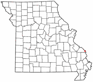
Capitol is a populated place in Carter County, Montana, United States. [1]
Capitol is located at 45°26′10″N104°03′54″W / 45.43611°N 104.065°W . Its elevation is 3,183 ft (970 m). [1]
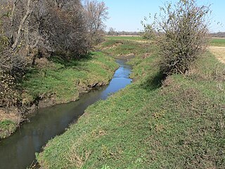
Capitol was named after Capitol Rock, a prominent landmark in the nearby Long Pine Hills. [2] Capitol is located on the Little Missouri River and close to the South Dakota border.
Capitol had a post office from 1891–1982. Residents who have a Capitol address receive their mail from the neighboring post office of Camp Crook, South Dakota.
A church named 'Little Missouri Lutheran Church' is located near Capitol. The congregation celebrated its 125th anniversary in 2014. The church was established 5 months before Montana became a state.
Capitol Cemetery is located northeast of town on Little Missouri Road. The Little Missouri Lutheran Church Cemetery is located behind the current church location.

Williams County is located on the western border of the U.S. state of North Dakota, next to Montana. As of the 2020 census, the population was 40,950. making it the fifth-most populous county in North Dakota. Its county seat is Williston.

Fallon County is a county located in the U.S. state of Montana. As of the 2020 census, the population was 3,049. Its county seat is Baker. The county was created in 1913 from a portion of Custer County. It is named for Benjamin O'Fallon, a nephew of Captain William Clark and an Indian agent for the upper Missouri region from 1823 to 1827.

Carter County is a county located in the U.S. state of Montana. As of the 2020 census, the population was 1,415, making it the seventh-least populous county in Montana. The county seat is Ekalaka.

Ismay is a town in Custer County, Montana, United States. There is a post office at Ismay, and a church, and no other businesses or services. The population was 17 at the 2020 census. The town is the least-populous incorporated municipality in the state of Montana.

Ballantine is a census-designated place (CDP) in Yellowstone County, Montana, United States. It lies approximately nine miles (14 km) northeast of Billings on Interstate 94. The population was 346 at the 2000 census. Ballantine, along with the communities of Pompey's Pillar, Worden, and Huntley, is part of the Huntley Project, an irrigation district created by the United States Bureau of Reclamation. The majority of Ballantine's population lives on scattered farms and ranches surrounding the actual townsite.
Wittenberg is an unincorporated community in Brazeau Township in eastern Perry County, Missouri, United States. It is located on the Mississippi River, 14 miles (23 km) southeast of Perryville. Wittenberg is situated in the Brazeau Bottoms on Brazeau Creek opposite Grand Tower, Illinois, and Tower Rock, the latter a landmark island in the Mississippi River.

America's 11 Most Endangered Places or America's 11 Most Endangered Historic Places is a list of places in the United States that the National Trust for Historic Preservation considers the most endangered. It aims to inspire Americans to preserve examples of architectural and cultural heritage that could be "relegated to the dustbins of history" without intervention.

The Montana District is one of the 35 districts of the Lutheran Church – Missouri Synod (LCMS), and comprises the state of Montana. It also includes one congregation in Idaho and one congregation in North Dakota. The Montana District includes approximately 67 congregations and missions, subdivided into 6 circuits, as well as 18 preschools and 7 elementary schools. Baptized membership in district congregations is approximately 15,000, making it one of the two smallest districts along with the Wyoming District, which is roughly equal in size; a merger of the two districts was proposed in 2006.
Rock Creek is a 19.1-mile-long (30.7 km) tributary of the Elkhorn River that flows south of Wisner and enters the Elkhorn one mile west of Beemer. The railway water stop and original plats where the village of Beemer is now located were named "Rock Creek" before Beemer was incorporated as a village in 1886.
Barrineau Park is an unincorporated community in Escambia County, Florida, United States. It is approximately 5 miles (8.0 km) west of Molino and a few miles from the Perdido River. It is a rural community of low hills, farms, creeks and woods.
The Dakota Prairie Grasslands (DPG) was formed in 1998. It consists of four U.S. Forest Service Ranger District offices that manage four National Grasslands:
Sioux National Forest was a National Forest (NF) established by Executive Order 908 on July 1, 1908. The order called for the consolidation of the following national forests and forest units into a single entity:

Cecil Township is a civil township in Bottineau County in the U.S. state of North Dakota. As of the 2000 census, its population was 28.
Walsh is an unincorporated community located in the town of Porterfield, in Marinette County, Wisconsin, United States.

Blooming is an unincorporated community in Washington County, Oregon, United States near the Tualatin River, about two miles south of Cornelius. Its elevation is 190 feet. There are several plant nurseries in the area.

Montra is an unincorporated community in Jackson Township, Shelby County, Ohio, United States. Established in the middle of the nineteenth century, the small community is prominent because of a landmark church, Emanuel Lutheran Church of Montra.
Perche Township is one of ten townships in Boone County, Missouri, USA. As of the 2012, its population was 4,037. The village of Harrisburg is the only incorporated settlement inside the township.
Java is a ghost town in Richland County, Montana, United States, located near Mondak. Named for its first postmaster, Anton Jevnager, who owned a grocery and hardware store in the community when its post office was established in 1907, Java straddles the border with North Dakota, and was noteworthy among local North Dakota residents as the home of the Blind Pig Saloon on the Montana side.
Paragon is a former community that was located in Cedar County, NE about 4.5 miles northeast of Hartington, NE. It was called a community because its cemetery, school, mill, post office and store were located within a radius of about one mile of one another. The Paragon Cemetery is the only part of the community remaining today.
Nohly is an unincorporated place in Richland County, Montana on the Missouri River and on a BNSF Railway line (originally the Great Northern Railway. The Library of Congress holds a collection of photographs of a vertical lift bridge in Nohly that spans the Missouri River, variously called the Snowden Bridge, Nohly Bridge, and Great Northern Railroad Bridge, built in 1913 for the Great Northern with subsequent construction work in 1925.
Municipalities and communities of Carter County, Montana, United States | ||
|---|---|---|
| Town | 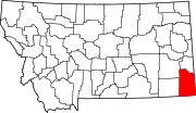 | |
| CDP | ||
| Other communities | ||
| Indian reservation | ||
| Footnotes | ‡This populated place also has portions in an adjacent county or counties | |
| | This Carter County, Montana state location article is a stub. You can help Wikipedia by expanding it. |