
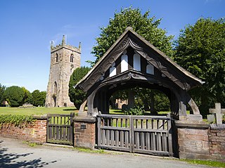
Woore is a village and civil parish in the north east of Shropshire, England, of about 3,950 acres. It had a population of 1,004 in the 2001 Census, rising to 1,069 at the 2011 Census, by which time the number of households has increased by about 20%. The name means "boundary" in ancient Celtic or Anglo-Saxon ("Oure"), and this fits nicely with the fact that it is on the boundary with both the counties of Cheshire and Staffordshire. The parish is the most northerly in Shropshire.
Alrewas(awl-ree-was) is a village and civil parish in the Lichfield District of Staffordshire, England.

Whittington is a village and civil parish which lies approximately 3 miles south east of Lichfield Lichfield district of Staffordshire, England. According to the 2001 census it had a population of 2,591, increasing to 2,603 at the 2011 Census. The parish council is a joint one with Fisherwick. The Coventry Canal borders the village to the north and east.

Stretton is a large village and civil parish in Staffordshire, England. It is situated on the northern outskirts of Burton upon Trent and is effectively a suburb of that town. The name is Old English and means Street Town and comes it being on the Roman road called Ryknild Street. The population of the parish at the 2001 census was 8,355, increasing to 8,611 at the 2011 Census.
Norbury is a village and civil parish in the Borough of Stafford, in west Staffordshire, England. The population as taken at the 2011 census was 371.

Alstonefield is a village and civil parish in the Peak District National Park and the Staffordshire Moorlands district of Staffordshire, England about 7 miles (11 km) north of Ashbourne, 10 miles (16 km) east of Leek and 16 miles (26 km) south of Buxton. The parish had a population of 274 according to the 2001 census, increasing to 304 at the 2011 census.
Rocester is a village and civil parish in the East Staffordshire district of Staffordshire, England. Its name is spelt Rowcestre in the Domesday Book. It is located on the Derbyshire border.

Bainton is a village and civil parish in the Peterborough Unitary Authority area of Cambridgeshire, England. Bainton is on the southern edge of the Welland valley and lies 7.4 miles (11.9 km) north-west of Peterborough and 4 miles (6.4 km) east of Stamford. Ashton is a neighbouring hamlet and lies approximately 1 mile (1.6 km) south-east of Bainton within the same civil parish. At the time of the 2001 census, the parish's population was 305 people and by the 2011 census the parish's population was 290 people.
Balterley is a village and civil parish in the borough of Newcastle-under-Lyme in Staffordshire, England. According to the 2001 census it had a population of 204, increasing to 221 at the 2011 census. The parish borders Cheshire to the north, and the village is about six miles south-east of Crewe in Cheshire.

Barthomley is a village and ancient parish, and is now a civil parish in the unitary authority of Cheshire East and the ceremonial county of Cheshire, England. According to the 2001 and the 2011 census' the parish had a population of 202. The village is situated near junction 16 of the M6 motorway and by the border with Staffordshire. It is about three miles south-west of Alsager.
Seighford is a village and civil parish about 3 miles (5 km) west of Stafford in Staffordshire, England. The population of this civil parish at the 2011 census was 1,793. The ford across a small stream is the origin of the village's toponym. The village has a red brick Church of England parish church, St Chad's, and a 16th-century Tudor mansion.
Cannock Wood is a village and civil parish in the Cannock Chase district of Staffordshire, England. The village is situated around 4 miles (6.4 km) east of Cannock, the same distance south of Rugeley, and 2 miles (3.2 km) north of Burntwood. According to the 2011 Census, the parish had a population of 1,031, a decrease from 1,052 in the 2001 Census.

Gayton is a small rural village and civil parish in Staffordshire, located approximately 1 mile from the A51 between Stone and Stafford. In 2001 it had 167 residents , with 1 letter box, one bus stop, and new village hall. The post box is owned now by the village as is the telephone booth. The post code for Gayton properties normally start with ST18.
Anslow Gate is a village in Staffordshire, England, situated to the west of Anslow on the road to Hanbury. According to the 2001 census, the parish of Anslow, which includes Anslow Gate, had a population of 669, increasing to 805 at the 2011 census.
Weston is a village and civil parish. within the English county of Staffordshire. The parish is in the Local Authority of Stafford.

Hollington is a village in the Staffordshire Moorlands in English county of Staffordshire. There are several villages of this same name, and there is a Hollington, Derbyshire a few miles to the east in Derbyshire. The population taken at the 2011 census was 212.
Checkley is a village and civil parish in the district of Staffordshire Moorlands in the English county of Staffordshire.

Hilderstone is a village and a civil parish in the English county of Staffordshire.

Fulford is a village and civil parish about 5 miles north east of Stone, in the Stafford district, in the county of Staffordshire, England. In 2011 the built-up area had a population of 650 and the parish had 5931. The village is on one of the tributaries of the River Blythe. The parish is one of the largest in the Stafford district. The parish touches Forsbrook, Hilderstone, Stone Rural, Barlaston and Draycott in the Moors. Fulford is the highest point in the Stafford district and varies between 650 and 730 feet above sea level.
Anslow is a civil parish in the district of East Staffordshire, Staffordshire, England. The parish contains eight listed buildings that are recorded in the National Heritage List for England. All the listed buildings are designated at Grade II, the lowest of the three grades, which is applied to "buildings of national importance and special interest". The parish contains the village of Anslow and the surrounding countryside. The listed buildings consist of two small country houses and associated structures, a church, and a thatched cottage.

