Antelope, South Dakota

Last updated

Antelope, South Dakota
CDP
Todd County South Dakota Incorporated and Unincorporated areas Antelope Highlighted.svg
Location in Todd County and the state of South Dakota
Coordinates: 43°18′31″N100°37′50″W / 43.30861°N 100.63056°W / 43.30861; -100.63056
Country United States
State South Dakota
Counties Todd
Area
  Total2.3 sq mi (5.9 km2)
  Land2.3 sq mi (5.9 km2)
  Water0 sq mi (0 km2)
Elevation
[1]
2,602 ft (793 m)
Population
 (2020)
  Total830
  Density359.1/sq mi (140/km2)
GNIS feature ID2393317 [1]

Antelope is a census-designated place (CDP) in Todd County, South Dakota, United States. The population was 830 at the 2020 census. [2]

Contents

Geography

According to the United States Census Bureau, the CDP has a total area of 2.3 square miles (6.0 km2), of which 2.3 square miles (6.0 km2) is land and 0.44% is water.

Demographics

Historical population
CensusPop.Note
1990 744
2000 86716.5%
2010 826−4.7%
2020 8300.5%
U.S. Decennial Census

As of the census [3] of 2000, there were 867 people, 225 households, and 177 families residing in the CDP. The population density was 379.7 inhabitants per square mile (146.6/km2). There were 233 housing units at an average density of 102.0 per square mile (39.4/km2). The racial makeup of the CDP was 2.19% White, 96.89% Native American, and 0.92% from two or more races. Hispanic or Latino of any race were 2.65% of the population.

There were 225 households, out of which 52.9% had children under the age of 18 living with them, 25.3% were married couples living together, 42.2% had a female householder with no husband present, and 21.3% were non-families. 16.9% of all households were made up of individuals, and 8.9% had someone living alone who was 65 years of age or older. The average household size was 3.80 and the average family size was 4.24.

In the CDP, the population was spread out, with 47.8% under the age of 18, 10.3% from 18 to 24, 23.3% from 25 to 44, 11.5% from 45 to 64, and 7.2% who were 65 years of age or older. The median age was 19 years. For every 100 females, there were 91.0 males. For every 100 females age 18 and over, there were 84.1 males.

The median income for a household in the CDP was $8,125, and the median income for a family was $11,923. Males had a median income of $15,167 versus $17,273 for females. The per capita income for the CDP was $4,105. About 62.4% of families and 65.9% of the population were below the poverty line, including 72.1% of those under age 18 and 63.4% of those age 65 or over.

Related Research Articles

<span class="mw-page-title-main">Jeddito, Arizona</span> CDP in Navajo County, Arizona

Jeddito is a census-designated place (CDP) in Navajo County, Arizona, United States. The population was 293 at the 2010 census.

<span class="mw-page-title-main">Littlerock, California</span> Census-designated place in California, United States

Littlerock is a census-designated place in California United States. The population was 1,377 at the 2010 census, down from 1,402 at the 2000 census. The Littlerock, and Sun Village community, which is typically referred to as Littlerock, has a population around 15,000. According to the Greater Antelope Valley Economic Alliance report of 2009, the Palmdale / Lancaster urban area has a population of 483,998, which Littlerock is a part of.

<span class="mw-page-title-main">Quartz Hill, California</span> Census-designated place in California, United States

Quartz Hill is a census-designated place (CDP) in Los Angeles County, California, United States. The population was 10,912 at the 2010 census, up from 9,890 at the 2000 census. The name is also shared with the neighboring district areas of its border cities, Palmdale, and Lancaster. Quartz Hill was once home to the Quartz Hill Airport. According to the Greater Antelope Valley Economic Alliance report of 2009, the Palmdale / Lancaster urban area of which Quartz Hill is a part, has a population of 483,998.

<span class="mw-page-title-main">Naval Academy, Maryland</span> Census-designated place in Maryland, United States

Naval Academy is a census-designated place (CDP) in Anne Arundel County, Maryland, United States, which covers the campus of the United States Naval Academy. The population was 4,802 at the 2010 census.

<span class="mw-page-title-main">Fort Thompson, South Dakota</span> CDP in South Dakota, United States

Fort Thompson is a census-designated place (CDP) in Buffalo County, South Dakota, United States. The population was 1,282 at the 2010 census, making it the largest settlement on the Crow Creek Reservation.

<span class="mw-page-title-main">Little Eagle, South Dakota</span> CDP in South Dakota, United States

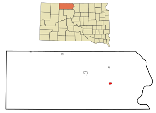
Little Eagle is a census-designated place (CDP) in Corson County, South Dakota, United States. The population was 319 at the 2010 census.

<span class="mw-page-title-main">St. Charles, South Dakota</span> CDP in South Dakota, United States

St. Charles or Saint Charles is a census-designated place (CDP) in Gregory County, South Dakota, United States. The population was 15 at the 2020 census.

<span class="mw-page-title-main">Kaylor, South Dakota</span> CDP in South Dakota, United States

Kaylor is a census-designated place (CDP) in Hutchinson County, South Dakota, United States. The population was 30 at the 2020 census.

<span class="mw-page-title-main">North Spearfish, South Dakota</span> Census-designated place in South Dakota, United States

North Spearfish is a census-designated place (CDP) in Lawrence County, South Dakota, United States. The population was 2,366 at the 2020 census.

<span class="mw-page-title-main">Ashland Heights, South Dakota</span> CDP in South Dakota, United States

Ashland Heights is a census-designated place (CDP) and unincorporated community in Pennington County, South Dakota, United States. The population was 678 at the 2020 census.

<span class="mw-page-title-main">Colonial Pine Hills, South Dakota</span> CDP in South Dakota, United States

Colonial Pine Hills is a census-designated place (CDP) and unincorporated community in Pennington County, South Dakota, United States. The population was 1,903 at the 2020 census.

<span class="mw-page-title-main">Green Valley, South Dakota</span> CDP in South Dakota, United States

Green Valley is a census-designated place (CDP) and unincorporated community in Pennington County, South Dakota, United States. The population was 1,051 at the 2020 census.

<span class="mw-page-title-main">Rapid Valley, South Dakota</span> CDP in South Dakota, United States

Rapid Valley is a census-designated place (CDP) and unincorporated community in Pennington County, South Dakota, United States, and a suburb of Rapid City. The population was 8,098 at the 2020 census. Rapid Valley has been a retreat for people living in Rapid City due to its low crime, cheap land, and views of the Black Hills. Rapid Valley is home to many industrial and financial businesses, and is the headquarters for many corporations specializing in transport and engineering.

<span class="mw-page-title-main">Oglala, South Dakota</span> CDP in South Dakota, United States

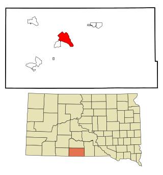
Oglala is a census-designated place (CDP) in West Oglala Lakota Unorganized Territory equivalent, Oglala Lakota County, South Dakota, United States. The population was 1,282 at the 2020 census. Its location is in the northwest of the Pine Ridge Indian Reservation.

<span class="mw-page-title-main">Parmelee, South Dakota</span> CDP in South Dakota, United States

Parmelee also Wósoso is a census-designated place (CDP) in Todd County, South Dakota, United States, which lies within the Rosebud Indian Reservation. The population was 606 at the 2020 census.

<span class="mw-page-title-main">Rosebud, South Dakota</span> CDP in South Dakota, United States

Rosebud also Sicanġu is a census-designated place (CDP) in Todd County, South Dakota, United States. The population was 1,455 at the 2020 census.

<span class="mw-page-title-main">Spring Creek, South Dakota</span> CDP in South Dakota, United States

Spring Creek is a census-designated place (CDP) in Todd County, South Dakota, United States. The population was 236 at the 2020 census.

<span class="mw-page-title-main">White Horse, South Dakota</span> CDP in South Dakota, United States

White Horse also Šuŋgská oyáŋke is a census-designated place (CDP) in Todd County, South Dakota, United States. The population was 234 at the 2020 census.

<span class="mw-page-title-main">Antelope Valley-Crestview, Wyoming</span> Census-designated place in Wyoming, United States

Antelope Valley-Crestview was a census-designated place (CDP) in Campbell County, Wyoming, United States. The population was 1,658 at the 2010 census. Antelope Valley-Crestview was annexed by the nearby city of Gillette at the beginning of 2018.

Antelope Hills is a census-designated place in Natrona County, Wyoming, United States. It is part of the Casper, Wyoming Metropolitan Statistical Area. The population was 97 at the 2010 census.

References

  1. 1 2 U.S. Geological Survey Geographic Names Information System: Antelope, South Dakota
  2. "U.S. Census Bureau: Antelope CDP, South Dakota". www.census.gov. United States Census Bureau. Retrieved December 22, 2021.
  3. "U.S. Census website". United States Census Bureau . Retrieved January 31, 2008.