Bibb County is a county in the central portion of the U.S. state of Alabama. The county is included in the ARC's definition of Appalachia. As of the 24th decennial 2020 census, its population was 22,293. The county seat is Centreville. The county is named in honor of William W. Bibb (1781–1820), the Governor of Alabama Territory (1817–1819) and the first Governor of Alabama. He is also the namesake for Bibb County, Georgia, where he began his political career. It is a "prohibition" or dry county; however, a few towns have become "wet" by allowing the sale of alcoholic beverages: Woodstock, West Blocton, Centreville, and Brent. The Bibb County Courthouse is located in the county seat of Centreville.
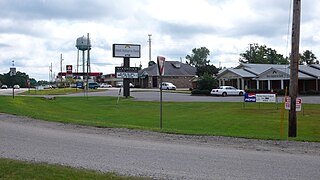
Centreville is a city in Bibb County, Alabama, United States. At the 2020 census, the population was 2,800. The city is the county seat of Bibb County.
Antioch is a small unincorporated community in Clarke County, Alabama, United States, located south of Grove Hill along US Highway 43. It has several small churches and a fire department.
Woodstock is a town in Bibb and Tuscaloosa counties in the U.S. state of Alabama. Formerly known as North Bibb, by referendum in August 2000, the town adopted the name of a long-established local unincorporated community and, as of October 1, 2000, is now known officially as "Woodstock". As of the 2010 census, the population of the town was 1,428.

The Brierfield Furnace, also known as the Bibb Naval Furnace and Brierfield Ironworks, is a historic district in Brierfield, Alabama, encompassed by Brierfield Ironworks Historical State Park. The district covers 486 acres (197 ha) and includes one building and nine sites. It was listed on the National Register of Historic Places on November 20, 1974.

Arcola is a ghost town on the Black Warrior River in what is now Hale County, formerly Marengo County, Alabama. Named to honor the French victory during the Battle of Arcola, it was established in the early 1820s by former French Bonapartists as part of their Vine and Olive Colony, after they were forced to abandon their first town at Demopolis and many found Aigleville unsuitable. The first settler at the site was Frederic Ravesies, who established himself at what later became the Hatch Plantation. Although never more than a village, Arcola became the largest settlement in the colony. Beginning in the 1830s American settlers moved into the area and purchased most of the former French land grants, primarily using Arcola as a river landing. By the 1850s the French settlement had disappeared, replaced by a community of adjoining plantations.
Active is an unincorporated community in Bibb County, Alabama, United States.
Almond, also known as Flat Rock, is an unincorporated community in Randolph County, Alabama, United States.
Ada is an unincorporated community in Montgomery County, Alabama, United States. Ada is located at the intersection of U.S. Route 331 and Alabama State Route 94, 20 miles (32 km) south of Montgomery.
Abel is an unincorporated community in Cleburne County, in the U.S. state of Alabama.
Adams Crossroads is an unincorporated community in Cherokee County, Alabama, United States.
Eoline is an unincorporated community in Bibb County, Alabama, United States. Eoline is located on U.S. Route 82, 8.1 miles (13.0 km) northwest of Centreville. During the 2011 Super Outbreak, the Eoline Fire Department was totaled by an EF3 tornado.

Marvel is an unincorporated community in Bibb County, Alabama, United States.
Antioch, also known as Hilton, is an unincorporated community in Covington County, Alabama, United States.
Ardilla is an unincorporated community in Houston County, Alabama, United States. Ardilla is located along Alabama State Route 53, 1 mile southeast of Ross Clark Circle in Dothan.
Ava is an unincorporated community in Randolph County, Alabama, United States.
Argo is an unincorporated community in Walker County, Alabama, United States. Argo is located on U.S. Route 78, 4.7 miles (7.6 km) northwest of Sumiton.
Abercrombie is an unincorporated community in Bibb County, in the U.S. state of Alabama.
Coleanor, also known as Coal-Eleanor, is an unincorporated community in Bibb County, Alabama, United States.