Ardleigh Gravel Pit

Last updated
Ardleigh Gravel Pit
Site of Special Scientific Interest
Ardleigh Gravel Pit 4.JPG
Area of Search Essex
Grid reference TM 055281
TM 052281
Interest Geological
Area 1.2 hectares
Notification 1992
Location map Magic Map

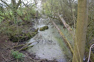
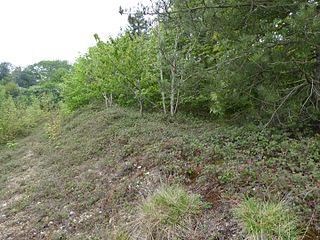
Ardleigh Gravel Pit is a 1.2 hectare geological Site of Special Scientific Interest south of Ardleigh in Essex. [1] [2] It is a Geological Conservation Review site. [3]

Site of Special Scientific Interest Conservation designation denoting a protected area in the United Kingdom

A Site of Special Scientific Interest (SSSI) in Great Britain or an Area of Special Scientific Interest (ASSI) in the Isle of Man and Northern Ireland is a conservation designation denoting a protected area in the United Kingdom and Isle of Man. SSSI/ASSIs are the basic building block of site-based nature conservation legislation and most other legal nature/geological conservation designations in the United Kingdom are based upon them, including national nature reserves, Ramsar sites, Special Protection Areas, and Special Areas of Conservation. The acronym "SSSI" is often pronounced "triple-S I".

Ardleigh village in United Kingdom

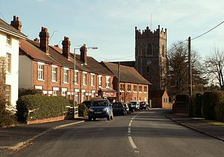
Ardleigh is a village and civil parish in Essex, England. It is situated approximately 4 miles (6 km) northeast from the centre of Colchester and 26 miles (42 km) northeast from the county town of Chelmsford.

The Geological Conservation Review (GCR) is produced by the UK's Joint Nature Conservation Committee and is designed to identify those sites of national and international importance needed to show all the key scientific elements of the geological and geomorphological features of Britain. These sites display sediments, rocks, minerals, fossils, and features of the landscape that make a special contribution to an understanding and appreciation of Earth science and the geological history of Britain, which stretches back more than three billion years. The intention of the project, which was devised in 1974 by George Black and William Wimbledon working for the Governmental advisory agency, the Nature Conservancy Council (NCC), was activated in 1977. It aimed to provide the scientific rationale and information base for the conservation of geological SSSIs (Sites of Special Scientific Interest, protected under British law. The NCC and country conservation agencies were established in 1990 when JNCC became established and took over responsibility for managing the GCR site assessment process, and publishing accounts of accepted sites.

The site exposes a succession of Pleistocene levels, with an interglacial between two glacial periods. The interglacial may date back 700,000 years. The site has plant microfossils rare or unique in Britain, and according to Natural England's description in 1992, it may become the type site for a previously unrecognised British early middle Pleistocene interglacial. [1] [4]

The Pleistocene is the geological epoch which lasted from about 2,588,000 to 11,700 years ago, spanning the world's most recent period of repeated glaciations. The end of the Pleistocene corresponds with the end of the last glacial period and also with the end of the Paleolithic age used in archaeology.

Interglacial interval of time within an ice age that is marked by warmer temperatures

An interglacial period is a geological interval of warmer global average temperature lasting thousands of years that separates consecutive glacial periods within an ice age. The current Holocene interglacial began at the end of the Pleistocene, about 11,700 years ago.

Natural England is a non-departmental public body in the United Kingdom sponsored by the Department for Environment, Food and Rural Affairs. It is responsible for ensuring that England's natural environment, including its land, flora and fauna, freshwater and marine environments, geology and soils, are protected and improved. It also has a responsibility to help people enjoy, understand and access the natural environment.

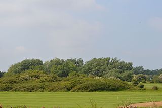
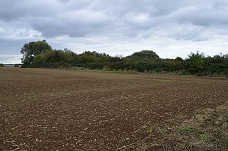
The site is divided into two areas. The main one is L-shaped, forming the sloping south-east and north-east borders of a water filled pit. A footpath between Slough Lane and Park Farm runs along its north-east boundary. East of the main site is a small linear feature which as been filled in. It is on private land with no public access.

Related Research Articles

Bramerton Pits

Bramerton Pits is a 0.7-hectare (1.7-acre) geological Site of Special Scientific Interest north of the village of Bramerton in Norfolk on the southern banks of the River Yare. It is a Geological Conservation Review site.

Colne Estuary biological and geological Site of Special Scientific Interest near Brightlingsea in Essex

Colne Estuary is a 2915 hectare biological and geological Site of Special Scientific Interest near Brightlingsea in Essex. It is also a Nature Conservation Review site, a National Nature Reserve, a Ramsar wetland site of international importance, a Special Protection Area, a Special Area of Conservation, and a Geological Conservation Review site. Three areas in the site are managed by the Essex Wildlife Trust, Colne Point, Fingringhoe Wick and Howlands Marsh.

Swanscombe Heritage Park

Swanscombe Skull Site or Swanscombe Heritage Park is a 3.9 hectares geological Site of Special Scientific Interest in Swanscombe in north-west Kent. It contains two Geological Conservation Review sites, and a National Nature Reserve. The park lies in a former gravel quarry, Barnfield Pit.

Allington Quarry

Allington Quarry is a 0.8-hectare (2.0-acre) geological Site of Special Scientific Interest north of Maidstone in Kent. It is a Geological Conservation Review site.

Wansunt Pit

Wansunt Pit is a 1.9 hectare geological Site of Special Scientific Interest in Dartford Heath between Crayford in the London Borough of Bexley and Dartford in Kent. It is also a Geological Conservation Review site. It is important geologically because it exposes the Dartford Heath Gravel, and the relationship of this exposure to the Swanscombe sequence and the Thames Terraces is a controversial issue in Thames Pleistocene studies. The site is part of Braeburn Park, a nature reserve managed by the London Wildlife Trust.

Moor Mill Quarry, West

Moor Mill Quarry, West is a 0.16 hectare geological Site of Special Scientific Interest in How Wood in Hertfordshire. The local planning authority is St Albans City and District Council. It was notified in 1992 as representing the former Moor Mill Quarry SSSI, which was lost to landfill operations. It is listed by the Geological Conservation Review.

Fern House Gravel Pit

Fern House Gravel Pit is a 1.3 hectare geological Site of Special Scientific Interest in Fern, near Bourne End in Buckinghamshire. It is also a Geological Conservation Review site.

Halls Quarry

Hall's Quarry is a 0.8 hectare geological Site of Special Scientific Interest north-west of Ugley Green in Essex. It is a Geological Conservation Review site.

Purfleet Chalk Pits

Purfleet Chalk Pits is a 10.7 hectare geological Site of Special Scientific Interest in Purfleet in Essex. It is a Geological Conservation Review site.

Wivenhoe Gravel Pit

Wivenhoe Gravel Pit is a 2.1 hectare geological Site of Special Scientific Interest north of Wivenhoe in Essex. It is a Geological Conservation Review site.

Clacton Cliffs and Foreshore

Clacton Cliffs and Foreshore is a 26.1 hectare geological Site of Special Scientific Interest in Clacton-on-Sea in Essex. It is a Geological Conservation Review site.

Marks Tey Brickpit

Marks Tey Brickpit is a 29.5 hectare geological Site of Special Scientific Interest in Marks Tey in Essex. It is a Geological Conservation Review site.

Newney Green Pit

Newney Green Pit is a 0.07 hectare geological Site of Special Scientific Interest west of Writtle in Essex. It is a Geological Conservation Review site.

Eye Gravel Pit

Eye Gravel Pit is a 0.4 hectare geological Site of Special Scientific Interest in Eye Green in Cambridgeshire. It is a Geological Conservation Review site, and part of it overlaps Eye Green Local Nature Reserve.

Flixton Quarry

Flixton Quarry is a 0.7 hectare geological Site of Special Scientific Interest south-west of Bungay in Suffolk. It is a Geological Conservation Review site.

Hoxne Brick Pit

Hoxne Brick Pit is a 1.3 hectare geological Site of Special Scientific Interest in Hoxne in Suffolk. It is a Geological Conservation Review site.

Creeting St Mary Pits

Creeting St Mary Pits is a 5.4 hectare geological Site of Special Scientific Interest south Creeting St Mary in Suffolk. It is a Geological Conservation Review site.

Waldringfield Pit

Waldringfield Pit is a 0.8 hectare geological Site of Special Scientific Interest between Martlesham Heath and Waldringfield in Suffolk. It is a Geological Conservation Review site.

Sturry Pit

Sturry Pit is a 0.7 hectares geological Site of Special Scientific Interest north-east of Canterbury in Kent. It is a Geological Conservation Review site.

References

  1. 1 2 "Ardleigh Gravel Pit citation" (PDF). Sites of Special Scientific Interest. Natural England. Archived from the original (PDF) on 3 March 2016. Retrieved 8 May 2016.
  2. "Map of Ardleigh Gravel Pit". Sites of Special Scientific Interest. Natural England. Retrieved 8 May 2016.
  3. "Ardleigh Gravel Pit (Martells Quarry) (Quaternary of the Thames)". Joint Nature Conservation Committee. Retrieved 8 May 2016.
  4. "Ardleigh Gravel Pit SSSI (Martells Quarry)". The Essex Field Club. Retrieved 8 May 2016.

Coordinates: 51°54′50″N0°59′10″E / 51.914°N 0.986°E / 51.914; 0.986

Geographic coordinate system Coordinate system

A geographic coordinate system is a coordinate system that enables every location on Earth to be specified by a set of numbers, letters or symbols. The coordinates are often chosen such that one of the numbers represents a vertical position and two or three of the numbers represent a horizontal position; alternatively, a geographic position may be expressed in a combined three-dimensional Cartesian vector. A common choice of coordinates is latitude, longitude and elevation. To specify a location on a plane requires a map projection.