
The Essex Wildlife Trust (EWT) is one of 46 wildlife trusts which cover the United Kingdom. The EWT was founded in 1959, and it describes itself as Essex's leading conservation charity, which aims to protect wildlife for the future and the people of the county. As of January 2017, it has over 34,000 members and runs 87 nature reserves, 2 nature parks and 11 visitor centres.

Rainham Marshes is an RSPB nature reserve in the east of London, adjacent to the Thames Estuary in Purfleet, Thurrock and the London Borough of Havering. In 2000, the area of land was bought from the Ministry of Defence, who used it as a test firing range. With no activity for several years, the nature reserve was officially opened to the public in 2006. It has maintained much of its medieval landscape, and is the largest area of wetland on the upper parts of the Thames Estuary.

Burham Marsh nature reserve is an 11 hectare tidal Reed bed on the River Medway 5 miles northwest of Maidstone. It is just east of Snodland but being on the east bank of the river it is accessed via Burham. It is part the Holborough to Wouldham Marshes Site of Special Scientific Interest.

Ingrebourne Marshes are a 74.8 hectare biological Site of Special Scientific Interest in Hornchurch in the London Borough of Havering. Ingrebourne Valley Local Nature Reserve includes a small part of the SSSI west of the River Ingrebourne. The site is managed by the Essex Wildlife Trust

Hazlewood Marshes is a 64 hectare nature reserve west of Aldeburgh in Suffolk. It is managed by the Suffolk Wildlife Trust. It is in the Alde-Ore Estuary biological Site of Special Scientific Interest.

Canvey Wick is a 93.2 hectare Site of Special Scientific Interest at the south-west corner of Canvey Island in Essex. It is owned by The Land Trust and 18.5 hectares is managed by the Royal Society for the Protection of Birds and Buglife as a nature reserve, who are working to bring more of the area under management and to improve public access.

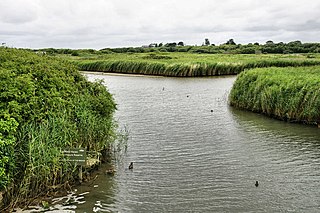
The Crouch and Roach Estuaries are a 1729 hectare biological Site of Special Scientific Interest (SSSI) at the mouth of the Crouch and Roach rivers in Essex. The Crouch part of the SSSI stretches from near Battlesbridge to Foulness Island, and the Roach from Rochford to the junction with the Crouch. Part of the site is in the Mid-Essex Coast Special Protection Area under the EC Directive on the Conservation of Wild Birds, and a Ramsar wetland site of international importance. It is also part of the Essex Estuaries Special Area of Conservation. An area of 65 hectares is managed by the Essex Wildlife Trust as the Lion Creek and Lower Raypits nature reserve and 8 hectares at Woodham Fen, both of which are managed by the Essex Wildlife Trust. A small area is also a geological SSSI, The Cliff, Burnham-on-Crouch.

Mucking Flats and Marshes is a 311.6 biological Site of Special Scientific Interest east of Tilbury in Essex. It is part of the Thames Estuary and Marshes Ramsar site. and Special Protection Area

Globe Pit is a 0.4-hectare (0.99-acre) geological Site of Special Scientific Interest in Little Thurrock in Essex. It is a Geological Conservation Review site.

Holehaven Creek is a 272.9-hectare (674-acre) biological Site of Special Scientific Interest (SSSI) between Canvey Island and Corringham in Essex.

Upper Colne Marshes is a 114.1-hectare (282-acre) biological Site of Special Scientific Interest south and west of Wivenhoe in Essex. It lies along stretches of the River Colne and Roman River.

Howlands Marsh is a 29.9-hectare (74-acre) nature reserve north-east of St Osyth in Essex. It is managed by the Essex Wildlife Trust. It is part of the Colne Estuary Site of Special Scientific Interest Special Protection Area and Ramsar site, and the Blackwater Flats and Marshes Nature Conservation Review site.

Lion Creek and Lower Raypits is a 65.2 hectare nature reserve east of Canewdon in Essex. It is part of the Crouch and Roach Estuaries Site of Special Scientific Interest, and is owned and managed by the Essex Wildlife Trust.

Preston Marshes is a 43.4-hectare (107-acre) biological Site of Special Scientific Interest east of Canterbury in Kent.

South Thames Estuary and Marshes is a 5,289-hectare (13,070-acre) biological Site of Special Scientific Interest which stretches between Gravesend and the mouth of the River Medway in Kent. Part of it is a Nature Conservation Review site, Grade I, and part is a Royal Society for the Protection of Birds nature reserve. It is part of the Thames Estuary and Marshes Ramsar internationally important wetland site and Special Protection Area under the European Union Directive on the Conservation of Wild Birds.
Holborough Marshes is a 35-hectare (86-acre) nature reserve on the outskirts of Snodland, south-west of Chatham in Kent. It is managed by Kent Wildlife Trust. It is part of Holborough to Burham Marshes Site of Special Scientific Interest.

Adur Estuary is a 62.2-hectare (154-acre) biological Site of Special Scientific Interest on the western outskirts of Shoreham-by-Sea in West Sussex. Part is a Royal Society for the Protection of Birds nature reserve.

Hurst Castle and Lymington River Estuary is a 1,077.3-hectare (2,662-acre) biological and geological Site of Special Scientific Interest near Lymington in Hampshire. It is a Nature Conservation Review site and two areas are Geological Conservation Review sites. Three areas are local nature reserves, Boldre Foreshore, Sturt Pond and Lymington and Keyhaven Marshes; the latter site is managed by the Hampshire and Isle of Wight Wildlife Trust. Part of it is North Solent National Nature Reserve. It is part of Solent and Southampton Water Ramsar site and Special Protection Area. Parts of it are in Solent Maritime and Solent and Isle of Wight Lagoons Special Areas of Conservation.
Titchfield Haven is a 134.5-hectare (332-acre) biological Site of Special Scientific Interest north-west of Gosport in Hampshire. Most of it is a local nature reserve and a national nature reserve. It is part of Solent and Southampton Water Ramsar site and Special Protection Area.
