Argusville, North Dakota

Last updated

Argusville, North Dakota
Argusville High School - Argusville, North Dakota 10-13-2007.jpg
Former Argusville High School, demolished in 2023
ND Cass County Argusville.svg
Location of Argusville, North Dakota
Coordinates: 47°03′00″N96°56′35″W / 47.05000°N 96.94306°W / 47.05000; -96.94306
CountryUnited States
State North Dakota
County Cass
Founded1881
Government
   Mayor Darren Wetzel
Area
[1]
  Total4.00 sq mi (10.37 km2)
  Land4.00 sq mi (10.37 km2)
  Water0.00 sq mi (0.00 km2)
Elevation
[2]
886 ft (270 m)
Population
 (2020) [3]
  Total480
  Estimate 
(2022) [4]
476
  Density119.94/sq mi (46.31/km2)
Time zone UTC-6 (Central (CST))
  Summer (DST) UTC-5 (CDT)
ZIP code
58005
Area code 701
FIPS code 38-03020
GNIS feature ID1035914 [2]
Website cityofargusville.com

Argusville is a city in Cass County, North Dakota, United States. The population was 480 at the 2020 census. [3] Increasing from 147 two decades earlier due to a huge housing boom from 2004 to 2008. Argusville was founded in 1881.

Contents

History

Argusville was platted in 1881, when the railroad was extended to that point. [5] The city most likely derived its name from a local newspaper, the Daily Argus. [6] A post office was established at Argusville in 1881, and remained in operation until 1982. [7]

Geography

According to the United States Census Bureau, the city has a total area of 4.01 square miles (10.39 km2), all land. [8]

Demographics

Historical population
CensusPop.Note
1930 115
1940 14526.1%
1950 126−13.1%
1960 118−6.3%
1970 1180.0%
1980 14724.6%
1990 1619.5%
2000 147−8.7%
2010 475223.1%
2020 4801.1%
2022 (est.)476 [4] −0.8%
U.S. Decennial Census [9]
2020 Census [3]

2010 census

As of the census of 2010, there were 475 people, 151 households, and 128 families living in the city. The population density was 118.5 inhabitants per square mile (45.8/km2). There were 152 housing units at an average density of 37.9 per square mile (14.6/km2). The racial makeup of the city was 97.9% White, 0.2% African American, 1.5% Native American, and 0.4% from two or more races.

There were 151 households, of which 58.9% had children under the age of 18 living with them, 76.8% were married couples living together, 4.0% had a female householder with no husband present, 4.0% had a male householder with no wife present, and 15.2% were non-families. 11.3% of all households were made up of individuals, and 3.3% had someone living alone who was 65 years of age or older. The average household size was 3.15 and the average family size was 3.42.

The median age in the city was 31.7 years. 38.7% of residents were under the age of 18; 3.7% were between the ages of 18 and 24; 38.1% were from 25 to 44; 15.1% were from 45 to 64; and 4.4% were 65 years of age or older. The gender makeup of the city was 53.3% male and 46.7% female.

2000 census

As of the census of 2000, there were 147 people, 62 households, and 45 families living in the city, though the town had a housing boom from 2004 to 2009. The population density was 36.8 inhabitants per square mile (14.2/km2). There were 65 housing units at an average density of 16.3 per square mile (6.3/km2). The racial makeup of the city was 100.00% White. Hispanic or Latino of any race were 0.68% of the population.

There were 62 households, out of which 32.3% had children under the age of 18 living with them, 71.0% were married couples living together, 1.6% had a female householder with no husband present, and 27.4% were non-families. 21.0% of all households were made up of individuals, and 1.6% had someone living alone who was 65 years of age or older. The average household size was 2.37 and the average family size was 2.76.

In the city, the population was spread out, with 21.1% under the age of 18, 5.4% from 18 to 24, 32.0% from 25 to 44, 32.0% from 45 to 64, and 9.5% who were 65 years of age or older. The median age was 40 years. For every 100 females, there were 107.0 males. For every 100 females age 18 and over, there were 114.8 males.

The median income for a household in the city was $44,750, and the median income for a family was $53,750. Males had a median income of $31,786 versus $26,071 for females. The per capita income for the city was $19,984. None of the population and none of the families were below the poverty line.

Transportation

Amtrak’s Empire Builder , which operates between Seattle/Portland and Chicago, passes through the town on BNSF tracks, but makes no stop. The nearest station is located in Fargo, 16 miles (26 km) to the south.

Related Research Articles

<span class="mw-page-title-main">Boy River, Minnesota</span> City in Minnesota, United States

Boy River is a city in Cass County, Minnesota, United States. The population was 47 at the 2010 census. It is part of the Brainerd Micropolitan Statistical Area.

<span class="mw-page-title-main">Lake Shore, Minnesota</span> City in Minnesota, United States

Lake Shore is a city in Cass County, Minnesota, United States. The population was 1,056 at the 2020 census. It is part of the Brainerd Micropolitan Statistical Area.

<span class="mw-page-title-main">Pillager, Minnesota</span> City in Minnesota, United States

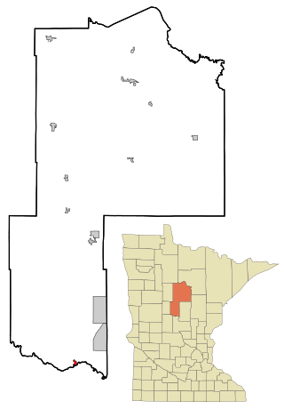
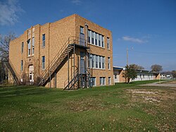
Pillager is a city in Cass County, Minnesota, United States. Its population was 469 at the 2010 census. It is part of the Brainerd Micropolitan Statistical Area.

<span class="mw-page-title-main">Belton, Missouri</span> City in Missouri, United States

Belton is a city in northwestern Cass County, Missouri, United States. The population was 23,116 at the 2010 census.

<span class="mw-page-title-main">Freeman, Missouri</span> City in Missouri, United States

Freeman is a city in Cass County, Missouri, United States. The population was 482 at the 2010 census. It is part of the Kansas City metropolitan area.

<span class="mw-page-title-main">Harrisonville, Missouri</span> City in Missouri, United States

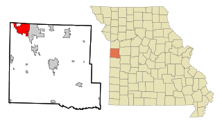
Harrisonville is a city in Cass County, Missouri, United States. The population was 10,121 at the 2020 census. It is the county seat of Cass County. It is part of the Kansas City metropolitan area.

<span class="mw-page-title-main">Lake Winnebago, Missouri</span> City in Missouri, United States

Lake Winnebago is a city in Cass County, Missouri, United States. The population was 1,131 at the 2010 census. It is part of the Kansas City metropolitan area.

<span class="mw-page-title-main">Alvo, Nebraska</span> Village in Nebraska, United States

Alvo is a village in Cass County, Nebraska, United States. The population was 115 at the 2020 census.

<span class="mw-page-title-main">Greenwood, Nebraska</span> Village in Nebraska, United States

Greenwood is a village in northwest Cass County, Nebraska, United States. The population was 595 at the 2020 census.

<span class="mw-page-title-main">Manley, Nebraska</span> Village in Nebraska, United States

Manley is a village in Cass County, Nebraska, United States. The population was 167 at the 2020 census.

<span class="mw-page-title-main">Federal Dam, Minnesota</span> City in Minnesota, United States

Federal Dam is a city in Cass County, Minnesota, United States, near Leech Lake. The population was 110 at the 2010 census. It is part of the Brainerd Micropolitan Statistical Area.

<span class="mw-page-title-main">Ayr, North Dakota</span> City in North Dakota, United States

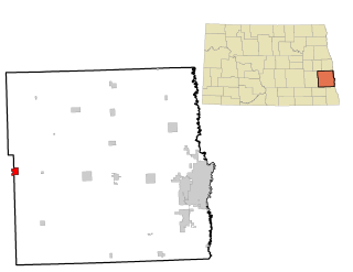
Ayr is a city in Cass County, North Dakota, United States. The population was 11 at the 2020 census. Ayr was founded in 1883.

<span class="mw-page-title-main">Briarwood, North Dakota</span> City in North Dakota, United States

Briarwood is a city in Cass County, North Dakota, United States. The population was 57 at the 2020 census. Briarwood was founded in 1973. It is a suburb directly adjacent to the city of Fargo.

<span class="mw-page-title-main">Davenport, North Dakota</span> City in North Dakota, United States

Davenport is a city in Cass County, North Dakota, United States. The population was 256 at the 2020 census. Davenport was founded in 1882.

<span class="mw-page-title-main">Harwood, North Dakota</span> City in North Dakota, United States

Harwood is a city in Cass County, North Dakota, United States. The population was 794 at the 2020 census. It has become a bedroom community of the nearby Fargo-Moorhead area. Harwood was founded in 1881.

<span class="mw-page-title-main">Horace, North Dakota</span> City in North Dakota, United States

Horace is a city in Cass County, North Dakota, United States. As of the 2020 census, the population was 3,085.

<span class="mw-page-title-main">Leonard, North Dakota</span> City in North Dakota, United States

Leonard is a city in Cass County, North Dakota, United States. The population was 248 at the 2020 census. Leonard was founded in 1881.

<span class="mw-page-title-main">North River, North Dakota</span> City in North Dakota, United States

North River is a city in Cass County, North Dakota, United States. The population was 55 at the 2020 census. North River was founded in 1973. It is a suburb/bedroom community directly adjacent to the city of Fargo.

<span class="mw-page-title-main">Prairie Rose, North Dakota</span> City in North Dakota, United States

Prairie Rose is a city in Cass County, North Dakota, United States. The population was 56 at the 2020 census. The city is an enclave suburb of Fargo. Prairie Rose was founded in 1975 and it was incorporated in 1978. There are 21 homes in the city.

<span class="mw-page-title-main">Tower City, North Dakota</span> City in North Dakota, United States

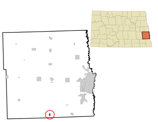
Tower City is a city in Barnes and Cass counties in the State of North Dakota. The population was 268 at the 2020 census.

References

  1. "ArcGIS REST Services Directory". United States Census Bureau. Retrieved September 20, 2022.
  2. 1 2 U.S. Geological Survey Geographic Names Information System: Argusville, North Dakota
  3. 1 2 3 "Explore Census Data". United States Census Bureau . Retrieved October 22, 2023.
  4. 1 2 "City and Town Population Totals: 2020-2022". United States Census Bureau. October 22, 2023. Retrieved October 22, 2023.
  5. Hoheisel, Tim; Nielsen, Andrew R. (2007). Cass County. Arcadia Publishing. p. 47. ISBN   978-0-7385-4145-7.
  6. Federal Writers' Project (1938). North Dakota, a Guide to the Northern Prairie State. WPA. p. 194. ISBN   978-1-62376-033-5.
  7. "Cass County". Jim Forte Postal History. Retrieved October 24, 2015.
  8. "US Gazetteer files 2010". United States Census Bureau. Archived from the original on January 12, 2012. Retrieved June 14, 2012.
  9. United States Census Bureau. "Census of Population and Housing" . Retrieved July 21, 2013.