Arlington Heights, Los Angeles

Last updated
Arlington Heights
Arlington Heights.jpg
Arlington Heights neighborhood sign
located at the intersection of
Arlington Avenue and Washington Boulevard
Location map Los Angeles.png
Red pog.svg
Arlington Heights
Location in Central Los Angeles
Coordinates: 34°02′32″N118°19′08″W / 34.04222°N 118.31889°W / 34.04222; -118.31889
Country United States
State California
City Los Angeles

Arlington Heights is a neighborhood in Central Los Angeles, California.

Contents

History

Origin

In July 1904, the Los Angeles Evening Express reported the sale of a sixty acre tract known as Arlington Heights for the price of $75,000. The parcel fronted Pico Street and Washington Streets with the Sixteenth Street car line running through the tract. It noted that the property was to be sub-divided and the streets "finely improved". [1] By 1906, sub-divided lots were listed with selling prices from $995 to $2900. [2]

In 1910, the Arlington Heights Improvement Association announced that they spent $16,000 to purchase 10 lots (between Washington and Eighteenth Street) to put up a school that would cost an additional $25,000. [3]

Demolition threat

In February 1988, Mount Vernon Junior High was considering an expansion that would have torn down 29 homes in the neighborhood. At that time, the Los Angeles Times described Arlington Heights as an "Inner City Oasis". The school district was considering one of two options: demolition of existing homes or adding new stories to existing buildings. [4] The following month, the Times reported that the expansion plan had been shelved and homes would not be taken. Homeowners said that they still planned to seek historic status for their homes to prevent future condemnation should the district change position. [5]

Renaming of Mount Vernon Junior High

In the 1990s, there was a movement to rename Mount Vernon Junior High after Wyatt Earp of O.K. Corral fame. The school is located on the site of the gunfighter’s last home at 4004 W. 17th Street. At the time, then-councilman Nate Holden said “I like the sound of ‘Wyatt Earp Junior High.’” Holden's proposal ran into opposition and was later dropped. In 2006, the school was renamed after attorney Johnnie L. Cochran Jr. and 17th Street was rechristened as Johnnie Cochran Vista. Cochran had attended Mount Vernon and had been a member of the debating team. [6]

Geography

Per Council File: 02-2353, adopted on October 30, 2002, the City of Los Angeles defined Arlington Heights as the area bounded by the west side of Arlington Avenue, the east side of Crenshaw Boulevard, the north side of Washington Boulevard and the south side of Pico Boulevard. [7] At that time, The Los Angeles Department of Transportation was instructed to install neighborhood signs at the following locations: Arlington and Pico Boulevard (southwest corner), Arlington Avenue and Washington Boulevard (northeast corner), Crenshaw and Washington Boulevards (northeast corner), Crenshaw and Venice Boulevards (southeast corner), Crenshaw and Pico Boulevards (southeast corner), Arlington Avenue and Venice Boulevard (northwest corner). [7]

The neighborhood of Country Club Park is located north of Pico Boulevard. Angelus Vista is located east of Arlington Avenue. The neighborhoods of Victoria Park and Lafayette Square are located west of Crenshaw Boulevard. West Adams Terrace is to the south.

The Los Angeles Times Mapping L.A.project definition of Arlington Heights includes the adjacent neighborhoods of Country Club Park, Western Heights and Angelus Vista. [8] [9]

Population

"Arlington Heights Terrace" The Los Angeles Times, February 9, 1913 Arlington Heights Terrace.jpg
"Arlington Heights Terrace" The Los Angeles Times, February 9, 1913

The following statistics apply only to the area defined by the Los Angeles Times Mapping L.A. project:

The 2000 U.S. census counted 22,096 residents in the 1.03-square-mile neighborhood—an average of 21,423 people per square mile, among the highest population densities in the county. In 2008, the city estimated that the population had increased to 23,330. The median age for residents was 31, about average for both the city and the county. [8]

Arlington Heights was said to be "highly diverse" [10] when compared to the city at large. The ethnic breakdown in 2000 was: Latinos, 56.6%; blacks, 24.5%; Asians, 12.9%; whites, 4.7%; and others, 1.2%. Mexico (34,9%) and El Salvador (20.2%) were the most common places of birth for the 49.8% of the residents who were born abroad, a figure that was considered high in comparison with foreign-born in the city as a whole. [8]

The median household income in 2008 dollars was $31,421, considered low for both the city and the county. The percentage of households earning $20,000 or less was high, compared to the county at large. The household size of three people was just about average for Los Angeles. Renters occupied 81.6% of the housing units, and home- or apartment owners the rest. [8]

The percentages of never-married men (42.4%) and never-married women (35.9%) were among the county's highest. The census found 1,165 families headed by single parents, the 23.5% rate being considered high for both the city and the county. [8]

Arlington Heights residents aged 25 and older holding a four-year degree amounted to 13.9% of the population in 2000, about average for both the city and the county, although there was a high percentage of residents with less than a high school diploma. [8]

Historic-Cultural Monuments

Landmarks and attractions

Parks and recreation

Public libraries

The neighborhood is served by the Los Angeles Public Library system. There is one branch in Arlington Heights.

Public schools

Johnnie L. Cochran Jr. Middle School J Cochran Jr Middle School.jpg
Johnnie L. Cochran Jr. Middle School

Notable residents

Related Research Articles

<span class="mw-page-title-main">Fairfax Avenue</span> Street in the city of Los Angeles, California

Fairfax Avenue is a street in the north central area of the city of Los Angeles, California, United States. It runs from La Cienega Boulevard in Culver City at its southern end to Hollywood Boulevard in Hollywood on its northern end. From La Cienega Boulevard to Sunset Boulevard, it separates the Westside from the central part of the city along with Venice Boulevard, La Cienega Boulevard, Hauser Boulevard, San Vicente Boulevard, South Cochran Avenue, Wilshire Boulevard, 6th Street, Cochran Avenue, 4th Street, La Brea Avenue, Fountain Avenue and Sunset Boulevard.

<span class="mw-page-title-main">Palms, Los Angeles</span> Neighborhood of Los Angeles, California,

Palms is a community in the Westside region of Los Angeles, California, founded in 1886 and the oldest neighborhood annexed to the city, in 1915. The 1886 tract was marketed as an agricultural and vacation community. Today it is a primarily residential area, with many apartment buildings, ribbons of commercial zoning and a single-family residential area in its northwest corner. As of the 2000 census the population of Palms was 42,545.

Beverlywood is a neighborhood in the Westside of the city of Los Angeles, California.

<span class="mw-page-title-main">Mar Vista, Los Angeles</span> Neighborhood of Los Angeles in California, United States of America

Mar Vista is a neighborhood on the Westside of Los Angeles, California. In 1927, Mar Vista became the 70th community to be annexed to Los Angeles. It was designated as an official city neighborhood in 2006.

<span class="mw-page-title-main">Pico-Union, Los Angeles</span> Neighborhood of Los Angeles in California, United States of America

Pico-Union is a neighborhood in Central Los Angeles, California. The name "Pico-Union" refers to the neighborhood that surrounds the intersection of Pico Boulevard and Union Avenue. Located immediately west of Downtown Los Angeles, it is home to over 40,000 residents.

<span class="mw-page-title-main">Leimert Park, Los Angeles</span> Neighborhood of Los Angeles in California, United States

Leimert Park is a neighborhood in the South Los Angeles region of Los Angeles, California.

<span class="mw-page-title-main">West Adams, Los Angeles</span> Neighborhood of Los Angeles in California, United States

West Adams is a neighborhood in the South Los Angeles region of Los Angeles, California. The area is known for its large number of historic buildings, structures and notable houses and mansions. It contains several Historic Preservation Overlay Zones as well as designated historic districts.

<span class="mw-page-title-main">Harvard Heights, Los Angeles</span> Neighborhood of Los Angeles in California, United States

Harvard Heights is a neighborhood in Central Los Angeles, California. It lies within a municipally designated historic preservation overlay zone designed to protect its architecturally significant single-family residences, including the only remaining Greene and Greene house in Los Angeles.

<span class="mw-page-title-main">Jefferson Park, Los Angeles</span> Neighborhood of Los Angeles in California, United States

Jefferson Park is a neighborhood in the South Los Angeles region of the City of Los Angeles, California. There are fourteen Los Angeles Historic-Cultural Monuments in the neighborhood, and in 1987, the 1923 Spanish Colonial Revival Jefferson Branch Library was added to the National Register of Historic Places. A portion of the neighborhood is a designated Historic Preservation Overlay Zone (HPOZ).

<span class="mw-page-title-main">Del Rey, Los Angeles</span> Neighborhood of Los Angeles in California, United States of America

Del Rey is a neighborhood in the Westside of Los Angeles, surrounded on three sides by Culver City, California. Within it lie a police station, the largest public housing complex on the Westside, a public middle school and six public elementary schools. It is served by a neighborhood council and a residents association. Del Rey, with a 32,000+ population, has a large number of military veterans.

Mid-Wilshire is a neighborhood in the central region of Los Angeles, California. It is known for the Los Angeles County Museum of Art, the Petersen Automotive Museum, and the Miracle Mile shopping district.

<span class="mw-page-title-main">Mid City, Los Angeles</span> Neighborhood of Los Angeles in California, United States of America

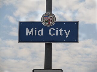
Mid City is a neighborhood in Central Los Angeles, California.

<span class="mw-page-title-main">Vermont Square, Los Angeles</span> Neighborhood of Los Angeles in California, United States

Vermont Square is a neighborhood in Los Angeles, California, within the South Los Angeles region. The Vermont Square Branch library, a designated Historic–Cultural Monument, is located in the community.

<span class="mw-page-title-main">Lafayette Square, Los Angeles</span> Neighborhood of Los Angeles in California, United States of America

LaFayette Square is a historic semi-gated neighborhood in the central region of Los Angeles, California.

<span class="mw-page-title-main">Hyde Park, Los Angeles</span> Neighborhood of Los Angeles in California, United States

Hyde Park is a neighborhood in the South region of Los Angeles, California. Formerly a separate city, it was consolidated with Los Angeles in 1923.

<span class="mw-page-title-main">University Park, Los Angeles</span> Neighborhood of Los Angeles in California, United States

University Park is a 1.17 square miles (3.0 km2) neighborhood in the South Los Angeles region of Los Angeles, California. It is the home of the University of Southern California (USC), Mount St. Mary's College and Hebrew Union College. Additionally, the neighborhood is the home of the historic Shrine Auditorium.

<span class="mw-page-title-main">Exposition Park, Los Angeles</span> Neighborhood in California, US

Exposition Park is a neighborhood in the south region of Los Angeles, California. It is home to Exposition Park, which includes the Los Angeles Memorial Coliseum, BMO Stadium, Exposition Rose Garden and three museums: the California African American Museum, the California Science Center and the Natural History Museum of Los Angeles County. It is also home to a Science Center Academy.

<span class="mw-page-title-main">Vermont Vista, Los Angeles</span> Neighborhood of Los Angeles in California, United States

Vermont Vista is a neighborhood in Los Angeles, California, within the South Los Angeles area.

<span class="mw-page-title-main">Angelus Vista, Los Angeles</span> Neighborhood of Los Angeles in California, United States

Angelus Vista is a neighborhood in Los Angeles, California. There is one Los Angeles Historic-Cultural Monument in neighborhood.

References

  1. "Good Price for Acreage". Los Angeles Evening Express. July 9, 1904. Retrieved 17 February 2023.
  2. "Lots! Lots! Lots!". Los Angeles Herald. June 21, 1906. Retrieved 18 February 2023.
  3. "City Briefs". Los Angeles Evening Post-Record. January 28, 1910.
  4. Puig, Claudia (March 15, 1988). "Inner-City Oasis Fights to Save Homes". Los Angeles Times . Retrieved 17 February 2023.
  5. "Plan to Take 29 Homes for More School Space Halted". Los Angeles Times . March 19, 1988.
  6. 1 2 Harvey, Steve (August 8, 2010). "A lawman, a lawyer and a junior high". Los Angeles Times . Retrieved 18 February 2023.
  7. 1 2 "Arlington Heights". LAcity.org. Retrieved 24 April 2020.
  8. 1 2 3 4 5 6 "Arlington Heights," Mapping L.A., Los Angeles Times
  9. "Central L.A.," Mapping L.A., Los Angeles Times
  10. Diversity "measures the probability that any two residents, chosen at random, would be of different ethnicities. If all residents are of the same ethnic group it's zero. If half are from one group and half from another it's .50." —Los Angeles Times
  11. Anderson, Tre'vell (10 June 2016). "A new documentary explores the roots of Jewel's Catch One, one of L.A.'s first black gay discos - Los Angeles Times". Los Angeles Times .
  12. "Washington Irving Pocket Park". LAParks.org. 2 September 2014. Retrieved 18 February 2023.
  13. "Wesson and Community Enjoy Grand Opening of Washington Irving Pocket Park". Los Angeles Sentinel. July 21, 2022. Retrieved 17 February 2023. "This pocket park is really cool because it's adjacent to the library."... Renovating the 13-acres space cost $710,000, which is a much-needed investment, according to the councilmember,
  14. "James Hanley Obituary". Los Angeles Times . April 4, 1916. p. 11. Retrieved 18 February 2023.
  15. Location of the Hanley home on Mapping L.A.