List of districts and neighborhoods in Los Angeles

Last updated

This is a list of notable districts and neighborhoods within the city of Los Angeles in the U.S. state of California, present and past. It includes residential and commercial industrial areas, historic preservation zones, and business-improvement districts, but does not include sales subdivisions, tract names, homeowners associations, and informal names for areas. The guiding precept is Wikipedia:Notability (geographic features)#Geographic regions, areas and places.

Contents

Regions

Regions
Crescenta Valley
Downtown
Eastside
Harbor Area
Greater Hollywood
Northeast LA
Northwest LA
San Fernando Valley
South LA
Westside
Central Los Angeles & Wilshire area

Current neighborhoods

AE

FL

MS

TY

Historic Preservation Overlay Zones

Government districts

Previous neighborhoods

Other

See also

Related Research Articles

<span class="mw-page-title-main">Beverly Hills, California</span> Urban City in California, United States

Beverly Hills is a city located in Los Angeles County, California, United States. A notable and historic suburb of Los Angeles, it is located just southwest of the Hollywood Hills, approximately 12.2 miles (19.6 km) northwest of downtown Los Angeles. Beverly Hills' land area totals to 5.71 square miles (14.8 km2), and is entirely surrounded by the city of Los Angeles. According to the 2020 census, the city has a population of 32,701; marking a decrease of 1,408 from the 2010 census count of 34,109.

<span class="mw-page-title-main">Fairfax Avenue</span> Street in the city of Los Angeles, California

Fairfax Avenue is a street in the north central area of the city of Los Angeles, California, United States. It runs from La Cienega Boulevard in Culver City at its southern end to Hollywood Boulevard in Hollywood on its northern end. From La Cienega Boulevard to Sunset Boulevard, it separates the Westside from the central part of the city along with Venice Boulevard, La Cienega Boulevard, Hauser Boulevard, San Vicente Boulevard, South Cochran Avenue, Wilshire Boulevard, 6th Street, Cochran Avenue, 4th Street, La Brea Avenue, Fountain Avenue and Sunset Boulevard.

The Los Angeles Westside is an urban region in western Los Angeles County, California, United States. It has no official definition, but sources like LA Weekly and the Mapping L.A. survey of the Los Angeles Times place the region on the western side of the Los Angeles Basin south of the Santa Monica Mountains.

West Los Angeles is an area within the city of Los Angeles, California, United States. The residential and commercial neighborhood is divided by the Interstate 405 freeway, and each side is sometimes treated as a distinct neighborhood, mapped differently by different sources. Each lies within the larger Westside region of Los Angeles County.

Carthay is a half-square-mile neighborhood in Central Los Angeles, California. It contains Carthay Circle, Carthay Square and South Carthay. There are three Los Angeles Historic Preservation Overlay Zones in Carthay.

<span class="mw-page-title-main">East Hollywood, Los Angeles</span> Neighborhood of Los Angeles in California, United States

East Hollywood is a densely populated neighborhood of 78,000+ residents that is part of the Hollywood area of the central region of Los Angeles, California. It is notable for being the site of Los Angeles City College, Barnsdall Park, and a hospital district. There are seven public and five private schools, a Los Angeles Public Library branch, and three hospitals. Almost two-thirds of the people living there were born outside the United States, and 90% were renters. In 2000, the neighborhood had high percentages of never-married people and single parents.

<span class="mw-page-title-main">Carthay Circle, Los Angeles</span> Neighborhood of Los Angeles in California, United States of America

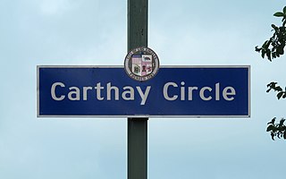
Carthay Circle is a neighborhood in the Mid-City West region of Central Los Angeles, California. Originally named Carthay Center, the neighborhood was later renamed after the famed Carthay Circle Theatre.

<span class="mw-page-title-main">Historic Filipinotown, Los Angeles</span> Neighborhood of Los Angeles in California, United States of America

Historic Filipinotown is a neighborhood in the city of Los Angeles.

<span class="mw-page-title-main">Wilshire Boulevard</span> Major thoroughfare in the metropolitan Los Angeles area, United States

Wilshire Boulevard (['wɪɫ.ʃɚ]) is a prominent 15.83 mi (25.48 km) boulevard in the Los Angeles area of Southern California, extending from Ocean Avenue in the city of Santa Monica east to Grand Avenue in the Financial District of downtown Los Angeles. One of the principal east–west arterial roads of Los Angeles, it is also one of the major city streets through the city of Beverly Hills. Wilshire Boulevard runs roughly parallel to Santa Monica Boulevard from Santa Monica to the west boundary of Beverly Hills. From the east boundary, it runs a block south of Sixth Street to its terminus.

<span class="mw-page-title-main">Elysian Park, Los Angeles</span> Neighborhood in Los Angeles, California

Elysian Park is a neighborhood in Central Los Angeles, California, United States. The city park, Elysian Park, and Dodger Stadium are within the neighborhood, as are an all-boys Catholic high school and an elementary school.

Mid-Wilshire is a neighborhood in the central region of Los Angeles, California. It is known for the Los Angeles County Museum of Art, the Petersen Automotive Museum, and the Miracle Mile shopping district.

Central Los Angeles is the historical urban region of the City of Los Angeles, California.

<span class="mw-page-title-main">San Vicente Boulevard</span> Street in Western Los Angeles running southeast of Beverly Hills, United States

San Vicente Boulevard is a major northwest-southeast thoroughfare located in the western portion of the metropolitan area of Los Angeles, CA.

<span class="mw-page-title-main">Olympic Boulevard (Los Angeles)</span> Major arterial road in Los Angeles, California

Olympic Boulevard is a major arterial road in Los Angeles, California. It stretches from Ocean Avenue on the western end of Santa Monica to East Los Angeles—farther than Wilshire Boulevard and most other streets.

Pico Boulevard is a major Los Angeles street that runs from the Pacific Ocean at Appian Way in Santa Monica to Central Avenue in Downtown Los Angeles, California, United States. It is named after Pío Pico, the last Mexican governor of Alta California.

<span class="mw-page-title-main">Mid-City West, Los Angeles</span> Los Angeles neighborhood in Central LA

Mid-City West is an area in the western part of Central Los Angeles that is served by the Mid City West Neighborhood Council. It contains the neighborhoods of Beverly–Fairfax, Beverly Grove, Burton Way, Carthay Circle, Melrose, Miracle Mile and Park La Brea.

<span class="mw-page-title-main">Los Angeles's 2nd City Council district</span> American legislative district

Los Angeles's 2nd City Council district is one of the fifteen districts in the Los Angeles City Council. It is currently represented by Democrat Paul Krekorian since 2009, after he won the special election to finish Wendy Greuel's term.

<span class="mw-page-title-main">Northwest Los Angeles</span> Region of Los Angeles, California, United States

Northwest Los Angeles or Northwest of Downtown is a group of neighborhoods near the central area of Los Angeles, California that are north and west of the city center of Los Angeles, California. This name for the area has been in use off and on for over 100 years, originally applying to Angelino Heights and gradually shifting northwesterly as those areas were built out.

<span class="mw-page-title-main">Beverly Grove, Los Angeles</span> District and neighborhood of Los Angeles, California, US

Beverly Grove is an area within the Beverly–Fairfax neighborhood in the Mid-City West region of Los Angeles, California.

References

  1. 1 2 3 4 5 6 7 8 9 10 11 12 13 14 15 16 17 18 19 20 21 22 23 24 25 26 27 28 29 30 31 32 33 34 35 36 37 38 39 40 41 42 43 44 45 46 47 48 49 50 51 52 53 54 55 56 57 58 59 60 61 62 63 64 65 66 67 68 69 70 71 72 73 74 75 76 77 78 79 80 81 82 83 84 85 86 87 88 89 90 91 92 93 94 95 96 97 98 99 100 101 102 103 104 The Thomas Guide: Los Angeles County, Rand McNally (2004), pages N and O
  2. 1 2 3 4 5 6 7 8 9 10 11 12 13 14 15 16 17 18 19 20 21 22 23 24 25 26 27 28 29 30 31 32 33 34 35 36 37 38 39 40 41 42 43 44 45 46 47 48 49 50 51 52 53 54 55 "Neighborhood Signs LAcity.org". Archived from the original on July 9, 2019. Retrieved April 24, 2020.
  3. 1 2 3 4 5 6 7 8 9 10 11 12 13 14 15 16 17 18 19 20 21 22 23 24 25 26 27 28 29 30 31 32 33 34 35 36 37 38 39 40 41 42 43 44 45 46 47 48 49 50 51 52 53 54 55 56 57 58 59 60 61 62 63 64 65 66 67 68 69 70 71 72 73 74 75 76 77 78 79 80 81 82 83 84 85 86 87 88 89 90 91 92 93 94 95 96 97 98 99 100 101 102 103 104 105 106 107 108 109 "Neighborhoods", Mapping L.A., Los Angeles Times
  4. 1 2 3 4 5 6 7 8 9 2012-2013 Official Visitors Map, Los Angeles Tourism & Convention Board, 2012
  5. Caitlin Liu, "Neighbors Rally to Holden's Side on Charges of Non-Residency", Los Angeles Times, May 30, 1989, Page B-8 ("a quiet residential neighborhood")
  6. Pauline O'Connor (July 10, 2008). "Neighborhoods / Beachwood Canyon". Los Angeles Times . Archived from the original on December 29, 2017.
  7. "Matea Gold, "Resident of Quiet Enclave Picket Parties at Mansion", Los Angeles Times, Metro Section, Page 1, October 5, 1996 "neighborhood high above the Beverly Hills Hotel"
  8. Martha Groves (November 20, 2008). "Hollywood stars sue over access to a neighborhood gate". Los Angeles Times . Retrieved November 20, 2008.
  9. Mary Moore, "Part of Brentwood Allowed to Become Gated Community", Los Angeles Times, June 4, 1995, Los Angeles Times, image 181 ("the first established neighborhood in Los Angeles to be enclosed with security fences")
  10. "Archive blogs". Los Angeles Times.
  11. Cohen, Allison B. (February 27, 2005). "A touch of magic in the city" via LA Times.
  12. Usher, Nikki (August 12, 2004). "Where Spanakopita Rubs Elbows With Chile Relleno" . Retrieved March 15, 2022. The state Assembly officially designated the area the "Byzantine-Latino Quarter" in 1997 and the Department of Transportation erected street markers in the area.
  13. Michael Krikorian, "Los Angeles: Asphalt Jungle or Green Meadow", Los Angeles Times, January 5, 2004, page B-3
  14. "Civic Center". Downtown LA Walks. Archived from the original on February 26, 2012. Retrieved November 1, 2012.
  15. Rees, Brenda (April 24, 2000). "Evolution of a '50s Dream". Los Angeles Times. Archived from the original on August 26, 2013. Retrieved March 19, 2010.
  16. "How a hijacked listing for one of L.A.'s most expensive homes led to a $60-million lawsuit". Los Angeles Times. April 26, 2019.
  17. Sam Byker, "The Sticks or the City? Well, Both", Los Angeles Times, July 15, 2007, image 84 ("The neighborhood, named Elysian Heights")
  18. Communications, Emmis (December 5, 2004). "Los Angeles Magazine". Emmis Communications via Google Books.
  19. Montoya, Carina Monica (2009). Los Angeles's Historic Filipinotown. Arcadia Publishing. p. 96. ISBN   978-0-7385-6954-3.
  20. "Kyle Wagner's Road Tripper: Los Angeles". The Denver Post . April 21, 2007. Retrieved November 12, 2008.
  21. Leslie Ann Wiggins, "Charming, With A Fabled Past", Los Angeles Times, March 23, 2008, image 82 ("L.A.'s Los Feliz neighborhood of Franklin Hills")
  22. Ruth Ryon, "Mediterranean-Style Villa Is Fit for a Diva", Los Angeles Times,June 16, 2002, image 84 ("Hollywood Dell Hillside Neighborhood")
  23. "Downtown Industrial District Business Improvement District Engineer's Report" (PDF). clerk.lacity.org. Los Angeles City Clerk. May 2014. Retrieved January 28, 2020.
  24. "Historic L.A. Jewelry District building to become offices again". Los Angeles Times. February 6, 2015.
  25. The Los Angeles Times 01 Oct 1995, page Page 209 "Homes: Neighborhoods' Craftsman-Style Houses", "Los Angeles Times", October 1, 1995, image 209] ("one of several neighborhoods")
  26. "Ladera". Mike Bonin.
  27. "Keeping a Bit of L.A. Wild", Los Angeles Times, October 16, 2015, page A-14
  28. "Little Armenia Designation". www.littlearmenia.com.
  29. "To Fairfax and on to Ethiopia". Los Angeles Times. February 12, 2006.
  30. "L.A.'s Little Italy, Uncovered", CultureTrip
  31. Richard C, Paddock, "Mandeville Canyon Going All-Out Against Developers", Los Angeles Times, January 5, 1978, page WS-1
  32. John L. Mitchell, "Beach Walk OKd Despite Traffic Fears", Los Angeles Times, August 12, 1979, page CS-5
  33. Cohen, Allison B. (October 3, 2004). "It's barely on the map, and that's fine". Los Angeles Times. Archived from the original on August 14, 2023.
  34. Fiore, Faye (November 28, 1990). "Settlement Reached Over Sinking Homes : Monterey Hills: More than two dozen insurance companies and Los Angeles will pay $62.5 million to the residents of the condominium community". Los Angeles Times.
  35. "The Los Angeles Times 05 Feb 1940, page 18". Newspapers.com.
  36. ""Nichols Canyon", Curbed Los Angeles".
  37. "Lankershim Boulevard", LATimes.com (video)
  38. "SurveyLA: Venice Community Plan Area" (PDF). Retrieved September 14, 2020.
  39. "Remembering Old Chinatown". www.lapl.org.
  40. Rasmussen, Cecilia. "Hidden Hollywood sign uncovers history". Los Angeles Times.
  41. "The Scout: What's new on Pico Boulevard". Los Angeles Times. July 13, 2012.
  42. "Neighborhood List - Mapping L.A. - Los Angeles Times".
  43. '"Spanish style still defines central pocket" by Martha Groves (Los Angeles Times, 26 February 2006)
  44. "Council File File No. 11-2057" (PDF). LACity.org. Retrieved September 10, 2020.
  45. Robert Pierson, "Rustic Canyon — a Picturesque Stroll Amid Homes of the Artsy", Los Angeles Times, November 21, 1987, page D-1
  46. Hal Boyle (June 14, 1947). "Skid Row; The West's Bowery". Evening Independent. p. 10.
  47. Monte Morin, "Community Tries to Gain Back Respect", Los Angeles Times, September 26, 1999, image 64 ("screen the neighborhood from the highway")
  48. "A Brief History of Sonoratown, L.A.'s Lost Barrio". January 18, 2012.
  49. "Spaulding Square", Los Angeles City Office of Historic Resources
  50. "The Los Angeles Times 13 Sep 2007, page Page 91". Newspapers.com.
  51. DiMassa, Cara Mia (May 11, 2009). "Where peafowl don't run afoul". Los Angeles Times. Archived from the original on June 7, 2023.
  52. "Holmes Shannon House" (PDF). Cultural Heritage Commission. Los Angeles Department of City Planning. June 12, 2007. Retrieved May 25, 2013.
  53. Sam Hall Kaplan: LA Lost & Found, New York 1987, p. 109.
  54. David Ferrell, "Life in the Underbelly of L.A.", Los Angeles Times, November 9, 1992, page 1
  55. Philipp Gollner, Tiny Community of Westdale Marks 40 Years as Oasis of Small-Town Life, The Los Angeles Times, November 22, 1987
  56. Diane Wedner, "Neighborly Advice: Western Heights: Taking Over From Titans", Los Angeles Times, September 16, 2007, page K-4
  57. Mothner, Linda Beth (January 7, 1996). "Westside Village Reveals Rustic Past". Los Angeles Times. Retrieved June 12, 2013.
  58. Martha Groves, Seeking shoppers in Westwood Village, Los Angeles Times, May 6, 2008.
  59. "Wilshire Park", Los Angeles City Office of Historic Resources
  60. Monte Morin, "A Look Ahead: Activists Are Stepping Up Efforts on Their New Cause and Meeting Strong Business Opposition", Los Angeles Times, August 23, 1999, page 1
  61. Spitz, H. May. Canyon homes and that famous ZIP code." Los Angeles Times , 11 July 2004.
  62. Nita Lelyveld, "A Key Part of Film History", Los Angeles Times, March 1, 2015, image 64 ("when the neighborhood was called Edendale")