Monterey Hills, Los Angeles

Last updated
Monterey Hills
Our Lady of Guadalupe Catholic Church, Rose Hill, Los Angeles.JPG
Our Lady of Guadalupe Church
Location map Los Angeles.png
Red pog.svg
Monterey Hills
Location within Central Los Angeles
Coordinates: 34°6′0″N118°11′0″W / 34.10000°N 118.18333°W / 34.10000; -118.18333
Country United States
State California
County Los Angeles
City Los Angeles
Time zone UTC-8 (PST)
  Summer (DST) UTC-7 (PDT)
Website www.montereyhills.org

Monterey Hills is a neighborhood in Los Angeles, California.

Contents

Development history

The Monterey Hills Redevelopment Project, adopted by City Council on July 29, 1971, includes the development of a well planned residential community that provides a variety of housing opportunities for families and individuals from all income levels and the preservation of the physical integrity of the site. Twenty-one condominium and rental complexes totaling 1,781 units have been built in the project area. In the late 1980s, some developments experienced varying degrees of soil settlement, and certain buildings showed signs of structural distress.

From 1989-1990 The Monterey Hills Development on whole was the subject of the longest civil jury trial in Los Angeles County History due to land subsidence. The Castro firm sued the massive 200-unit Eaton Crest project in Monterey Hills, a structure that was constructed on an unstable 100-foot-deep (30 m) backfill. The Los Angeles Times reported that the $62,500,000 award was one of the largest settlements to ever involve the city. [1]

Lawsuits filed by homeowner associations against the Agency and others resulted in a Global Settlement Agreement in 1991. Necessary soil, structural and cosmetic repairs are now the responsibility of individual homeowner associations to be paid by the Global Settlement Fund. Subsequent to the Global Settlement, one additional project, the 16-unit Bradley Court Condominiums, has been completed. [2]

Despite its rocky past, the Monterey Hills neighborhood has enjoyed steadily rising property values, thanks in large part to Southern California's Real Estate boom circa 2001–2005. Most, if not all, of the severe structural subsidence issues that previously afflicted almost all of the associations built in the area have since been remedied and continue to be updated and maintained from funds still held in trust from the Global Settlement fund.

Geography

The neighborhood is located about 4 miles ENE of Downtown Los Angeles and about 3 miles from Pasadena off the 110 Freeway. It is surrounded by El Sereno to the southeast, Hermon to the north, Montecito Heights to the southwest and South Pasadena to the northeast. Monterey Hills is part of the Arroyo Seco Neighborhood Council (ASNC). [3]

Events

Community Organizations

The Monterey Hills Federation which was formed by the dues-paying member Home Owner Associations (HOAs) to represent the interests of Monterey Hills with the city, county, and state. The Monterey Hills Federation was instrumental in bringing a private security company in, POST Patrol, to provide nightly patrols of the community and participating HOAs. When the Bradley Court complex was in planning stages, the Monterey Hills Federation advocated strongly against another large complex and was able to get the complex built at the current number of 16 units as opposed to the initial 100+ units. Initial plans were to place a 7-11 type convenience store at the top of the Hill but the Monterey Hills Federation successfully advocated for a park instead. Budd Wiener Park stands in the center of Monterey Hills and serves as a central gathering place for the residents and hosts the annual Monterey Hills Jazz Festival, Movies in the Park, and various Monterey Hills Fairs. The Monterey Hills Federation has sponsored The View and The Monterey Hills Outlook community news letters.

The Arroyo Seco Neighborhood Council Monterey Hills Local Issues Committee was stood up as an official body of the ASNC to relay back community feedback to the neighborhood council. Traditionally, most of the members of the local issues committee have also been members of the Monterey Hills Federation.

Both organizations meet monthly on the 2nd Thursday of the month at the Marshall Villas Recreation Room. The Local Issues Meeting meets at 7pm and the Federation meets at 8pm. These meetings are usually attended by the LA City Council District 14 field deputy, LAPD Senior Lead Officer, and Post Patrol who all make reports and answer community concerns.

As of 2015, the Monterey Hills Federation is sponsoring a Community Emergency Response Team (CERT) for building awareness and emergency preparedness in Monterey Hills.

Parks and recreation

34°05′09″N118°11′27″W / 34.08587°N 118.190876°W / 34.08587; -118.190876

Related Research Articles

<span class="mw-page-title-main">Condominium</span> Form of ownership of real property

A condominium is an ownership regime in which a building is divided into multiple units that are either each separately owned, or owned in common with exclusive rights of occupation by individual owners. These individual units are surrounded by common areas that are jointly owned and managed by the owners of the units. The term can be applied to the building or complex itself, and is sometimes applied to individual units. The term "condominium" is mostly used in the US and Canada, but similar arrangements are used in many other countries under different names.

<span class="mw-page-title-main">Mount Washington, Los Angeles</span> Neighborhoods of Los Angeles in County of Los Angeles, California, United States

Mount Washington is a historic neighborhood in the San Rafael Hills of Northeast Los Angeles, California. Founded in 1909, it includes the Southwest Museum, the world headquarters of the Self-Realization Fellowship, and Eldred Street, one of the three steepest streets in the United States.

<span class="mw-page-title-main">Arroyo Seco Parkway</span> Highway in California

The Arroyo Seco Parkway, also known as the Pasadena Freeway, is one of the oldest freeways built in the United States. The parkway connects Los Angeles with Pasadena alongside the Arroyo Seco seasonal river. It is notable not only for being an early freeway, mostly opened in 1940, but for representing the transitional phase between early parkways and later freeways. It conformed to modern standards when it was built, but is now regarded as a narrow, outdated roadway. A 1953 extension brought the south end to the Four Level Interchange in downtown Los Angeles and a connection with the rest of the freeway system.

<span class="mw-page-title-main">Arroyo Seco (Los Angeles County)</span> Seasonal watercourse and human settlement in US

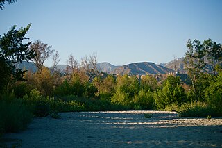
The Arroyo Seco, meaning "dry stream" in Spanish, is a 24.9-mile-long (40.1 km) seasonal river, canyon, watershed, and cultural area in Los Angeles County, California. The area was explored by Gaspar de Portolà who named the stream Arroyo Seco as this canyon had the least water of any he had seen. During this exploration he met the Chief Hahamog-na (Hahamonga) of the Tongva Indians.

<span class="mw-page-title-main">University Hills, Los Angeles</span> Neighborhood of Los Angeles in California, United States

University Hills is a neighborhood on the East Side of Los Angeles, California. It consists of the residential areas surrounding California State University, Los Angeles.

<span class="mw-page-title-main">El Sereno, Los Angeles</span> Neighborhood of Los Angeles in California, United States

El Sereno is a Los Angeles neighborhood in the Eastside Los Angeles region of Los Angeles County, California.

<span class="mw-page-title-main">Montecito Heights, Los Angeles</span> Neighborhood of Los Angeles in California, United States

Montecito Heights is a neighborhood in the Northeast Los Angeles region of Los Angeles, California. The population in 2000 was estimated at 16,768.

<span class="mw-page-title-main">Hermon, Los Angeles</span> Neighborhood of Los Angeles in California, United States

Hermon is a neighborhood in the northeast area of Los Angeles. It was established in 1903 and became part of Los Angeles in 1912.

<span class="mw-page-title-main">Brentwood, Austin, Texas</span> Neighborhood in Austin, Texas, United States

Brentwood is a neighborhood in central Austin, Texas.

<span class="mw-page-title-main">Beverly Park, Los Angeles</span> Neighborhoods of Los Angeles, California, United States of America

Beverly Park, divided into North Beverly Park and South Beverly Park, is a gated community in Los Angeles, California primarily known for its large houses and famous residents. It is between Mulholland Drive and Sunset Boulevard and Coldwater Canyon Drive and Beverly Glen Boulevard, east of the Beverly Glen neighborhood.

<span class="mw-page-title-main">Cypress Park, Los Angeles</span> Neighborhood of Los Angeles

Cypress Park is a densely populated neighborhood of 10,000+ residents in Northeast Los Angeles, California. Surrounded by hills on three sides, it sits in the valley created by the Los Angeles River and the Arroyo Seco. It is the site of the Rio de Los Angeles State Park, the Los Angeles River Bike Path and other recreational facilities. It hosts one private and four public schools.

<span class="mw-page-title-main">Heritage Square station</span> Los Angeles Metro Rail station

Heritage Square station is an at-grade light rail station on the A Line of the Los Angeles Metro Rail system. It is located at the intersection of French Avenue and Pasadena Avenue in the western Montecito Heights neighborhood of Los Angeles.

<span class="mw-page-title-main">Southwest Museum station</span> Los Angeles Metro Rail station

Southwest Museum station is an at-grade light rail station on the A Line of the Los Angeles Metro Rail system. It is located near the intersection of Marmion Way at Museum Drive in the Mount Washington neighborhood of Los Angeles. The station opened on July 26, 2003, as part of the original Gold Line, then known as the "Pasadena Metro Blue Line" project.

<span class="mw-page-title-main">Garvanza, Los Angeles</span> Neighborhood of Los Angeles in California, United States

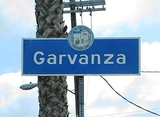
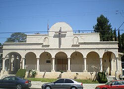
Garvanza is a neighborhood in northeast Los Angeles. Fourteen Los Angeles Historic-Cultural Monuments are located in the neighborhood.

<span class="mw-page-title-main">Rancho San Rafael</span> Spanish land grant issued to José María Verdugo in 1784

Rancho San Rafael was a 36,403-acre (147.32 km2) Spanish land grant in the San Rafael Hills, bordering the Los Angeles River and the Arroyo Seco in present-day Los Angeles County, southern California, given in 1784 to Jose Maria Verdugo.

<span class="mw-page-title-main">Northeast Los Angeles</span> District in Los Angeles, California, United States

Northeast Los Angeles is a 17.18 sq mi (44.5 km2) region of Los Angeles County, comprising seven neighborhoods within Los Angeles. The area is home to Occidental College located in Eagle Rock.

<span class="mw-page-title-main">Ernest E. Debs Regional Park</span>

Ernest E. Debs Regional Park is a large open space nature reserve and regional park in the Montecito Hills neighborhood of central-northeast Los Angeles, California.

<span class="mw-page-title-main">Hahamongna, California</span>

Hahamongna and Hahamog-na are two historic Tongva village sites. They are located in the Verdugo Mountains of Southern California and bear the name of the local band of indiginous Tongva, "Hahamog'na." The sites are located in present-day Pasadena and Glendale in Los Angeles County, California. Hahamongna was one of the largest Tongva villages in the greater San Fernando Valley area, along with Cahuenga, Tujunga, and Siutcanga.

References

  1. "Settlement Reached Over Sinking Homes : Monterey Hills: More than two dozen insurance companies and Los Angeles will pay $62.5 million to the residents of the condominium community". Los Angeles Times . 28 November 1990.
  2. "CRA/LA - About the Project Area". crala.org.
  3. "Arroyo Seco Neighborhood Council Homepage". www.asnc.us.
  4. "Council File 99-1020" (PDF). LACity.org. May 14, 2003. Retrieved 20 June 2021.
  5. "Budd Weiner Park". LAParks.org. 6 August 2014. Retrieved 20 June 2021.