
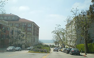
Fairfax Avenue is a street in the north central area of the city of Los Angeles, California, United States. It runs from La Cienega Boulevard in Culver City at its southern end to Hollywood Boulevard in Hollywood on its northern end. From La Cienega Boulevard to Sunset Boulevard between West Hollywood and Hollywood, Fairfax Avenue separates the Westside from the central part of the city along with Venice Boulevard, La Cienega Boulevard, Hauser Boulevard, San Vicente Boulevard, South Cochran Avenue, Wilshire Boulevard, 6th Street, Cochran Avenue, 4th Street, La Brea Avenue, Fountain Avenue and Sunset Boulevard.

Koreatown is a neighborhood in central Los Angeles, California, centered near Eighth Street and Irolo Street.

Pico-Union is a neighborhood in Central Los Angeles, California. The name "Pico-Union" refers to the neighborhood that surrounds the intersection of Pico Boulevard and Union Avenue. Located immediately west of Downtown Los Angeles, it is home to over 40,000 residents.
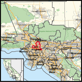
West Los Angeles is an area within the city of Los Angeles, California, United States. The residential and commercial neighborhood is divided by the Interstate 405 freeway, and each side is sometimes treated as a distinct neighborhood, mapped differently by different sources. Each lies within the larger Westside region of Los Angeles County.

Westlake, also known as the Westlake District, is a residential and commercial neighborhood in Central Los Angeles, California, United States. It was developed in the 1920s. Many of its elegant mansions have been turned into apartments and many new multiple-occupancy buildings have been constructed.

Larchmont is a half-square-mile neighborhood in the central region of the City of Los Angeles, California. It has three schools and one small park. It has been the site of early and recent motion picture shoots.
Carthay is a half-square-mile neighborhood in Central Los Angeles, California. It contains Carthay Circle, Carthay Square and South Carthay. There are three Los Angeles Historic Preservation Overlay Zones in Carthay.

East Hollywood is a densely populated neighborhood with approximately 78,000 residents that is part of the Hollywood area of the central region of Los Angeles, California. Among the sites located within it are the Los Angeles City College, Barnsdall Park, and a hospital district. There are seven public and five private schools, a Los Angeles Public Library branch, and three hospitals. Almost two-thirds of the people living there were born outside the United States, and 90% were renters. According to the 2000 census, the neighborhood had high percentages of people who had never married and single parents.

Wilshire Boulevard (['wɪɫ.ʃɚ]) is a prominent 15.83 mi (25.48 km) boulevard in the Los Angeles area of Southern California, extending from Ocean Avenue in the city of Santa Monica east to Grand Avenue in the Financial District of downtown Los Angeles. One of the principal east–west arterial roads of Los Angeles, it is also one of the major city streets through the city of Beverly Hills. Wilshire Boulevard runs roughly parallel to Santa Monica Boulevard from Santa Monica to the west boundary of Beverly Hills. From the east boundary, it runs a block south of Sixth Street to its terminus.
Mid-Wilshire is a neighborhood in the central region of Los Angeles, California. It is known for the Los Angeles County Museum of Art, the Petersen Automotive Museum, and the Miracle Mile shopping district.

Wilshire Park is a neighborhood in the Central Los Angeles region of Los Angeles, California.

Olympic Boulevard is a major arterial road in Los Angeles, California. It stretches from Ocean Avenue on the western end of Santa Monica to East Los Angeles—farther than Wilshire Boulevard and most other streets.
Pico Boulevard is a major Los Angeles street that runs from the Pacific Ocean at Appian Way in Santa Monica to Central Avenue in downtown Los Angeles, California, United States. It is named after Pío Pico, the last Mexican governor of Alta California.
California's 34th congressional district is a U.S. congressional district in California. Located in Los Angeles County, the district is represented by Democrat Jimmy Gomez. Its previous U.S. representative, Democrat Xavier Becerra of Los Angeles, resigned January 24, 2017, to become attorney general of California. Representative Gomez won a special election on June 6, 2017, beating fellow Democrat Robert Lee Ahn to replace Becerra. He was later sworn in as the district's U.S. representative on July 11, 2017.
Mid-City West is an area in the western part of Central Los Angeles that is served by the Mid City West Neighborhood Council. It contains the neighborhoods of Beverly–Fairfax, Beverly Grove, Burton Way, Carthay Circle, Melrose, Miracle Mile and Park La Brea.

Wilshire Center is a neighborhood in the Wilshire region of Los Angeles, California.

Northwest Los Angeles or Northwest of Downtown is a group of neighborhoods near the central area of Los Angeles, California that are north and west of the city center of Los Angeles, California. This name for the area has been in use off and on for over 100 years, originally applying to Angelino Heights and gradually shifting northwesterly as those areas were built out.

Los Angeles's 10th City Council district is one of the fifteen districts in the Los Angeles City Council. It is currently represented by Democrat Heather Hutt since 2022, after previous member Herb Wesson was barred from serving on an interim basis in place of suspended member Mark Ridley-Thomas.

Beverly Grove is an area within the Beverly–Fairfax neighborhood in the Mid-City West region of Los Angeles, California.
