City Terrace, California

Last updated

City Terrace, California
View from City Terrace.png
City Terrace
LA County Incorporated Areas City Terrace highlighted.svg
Location within Los Angeles County
USA Los Angeles Metropolitan Area location map.svg
Red pog.svg
City Terrace, California
Location within the state of California
Coordinates: 34°3′0″N118°10′55″W / 34.05000°N 118.18194°W / 34.05000; -118.18194
Country United States
State California
County Los Angeles
Time zone UTC-8 (Pacific (PST))
  Summer (DST) UTC-7 (PDT)
ZIP codes
90063
Area code 213/323

City Terrace is an unincorporated area of East Los Angeles, in Los Angeles County, California, east of Downtown Los Angeles. It contains City Terrace Elementary School, Robert F. Kennedy Elementary School, Esteban Torres High School, Harrison Elementary School, William R. Anton Elementary School, Hammel Street Elementary School, Anthony Quinn Library, City Terrace Library, and City Terrace Park. It is part of the Census-designated place of East Los Angeles. [1] [2]

Contents

Community description

City Terrace Streets City Terrace homes.jpg
City Terrace Streets

City Terrace is located atop the southeastern San Rafael Hills. The district's steep, winding streets are lined with generally well-preserved Spanish Colonial Revival style houses.

Alvarez Bakery in City Terrace. Alvarez Bakery.jpg
Alvarez Bakery in City Terrace.

Transportation

Light rail service to Los Angeles is provided by the Metro E Line's Eastside Extension, which opened in 2009. Los Angeles County Metropolitan Transportation Authority (Metro) provides bus service from City Terrace. to throughout the Los Angeles area. In addition, local shuttle service is provided by the El Sol (City Terrace and East Los Angeles Shuttle) and LADOT DASH (City Terrace and El Sereno). [3]

Geography

City Terrace is bounded by the city limits of Los Angeles on the north and west, Floral Drive, on the south the city limits of Los Angeles. Monterey Park and East Los Angeles on the East. Boyle Heights is on the West, Lincoln Heights, El Sereno, University Hills, California State University, Los Angeles is to the Northwest, and City of Commerce are to the south. Major thoroughfares include Medford st, Eastern Ave., 3rd Street, 4th Street, Evergreen Ave and City Terrace DR. The community is part of ZIP code 90063 and area code 323.

History and culture of art

Record Avenue & Hammel Street Record Ave. & Hammel St..jpg
Record Avenue & Hammel Street

City Terrace is a neighborhood saturated with art. The Goez Art Studio was co-founded by David Rivas Botello, Jose-Luis Gonzalez and Juan Gonzalez in 1969. In 1975, Botello and Wayne Alaniz Healy co-founded Los Dos Streetscapers, later adding Charles Solares, Fabian Debora, George Yepes, Paul Botello, Ricardo Duffy, Rich Raya, and Rudy Calderon to their ranks and renaming themselves East Los Streetscapers. [4] The ceramic mural at the City Terrace Branch Library, Ofrenda Maya 1, was created by Goez Studios' Jose Luis Gonzalez. Another mural created in 1994 by George Yepes, a member of the East Los Streetscapers who is known for creating the cover art for Los Lobos' 1988 album, is seen on one of the walls at City Terrace Elementary.

City Terrace Park Mural 20090922-CityTerrace1.jpg
City Terrace Park Mural

Park

City Terrace Park City Terrace Park.jpg
City Terrace Park

City Terrace Park was developed in 1933 by Works Progress Administration crews. It occupied a piece of 3.5 acres (1.4 ha) terrace that was formed after crews hacked a rugged and barren hill. In 1957, 600,000 cubic yards (460,000 m³) of soil that had been removed from the construction of the Los Angeles Civic Center was transported to the City Terrace County Park. The soil filled a ravine, tripling the park's original acreage. It has swimming, basketball and tennis, plus a playground, a splash pad, picnic areas and a gymnasium. In addition, City Terrace Park hosts many activities for youth and Teens such as cheer, basketball and computer club, as well as activities for adults and families such as ceramics classes and aquatics programs. [5]

Library

City Terrace Library Mural City Terrace Library Mural.png
City Terrace Library Mural

The County of Los Angeles Public Library operates the City Terrace Library. The library has been in its current location since 1979 and was refurbished in 2009. The library offers homework help for children and teens, internet resources such as downloadable audio books, and occasionally hosts seminars for the community. [6]

Other infrastructure

The Los Angeles County Department of Health Services operates the Central Health Center in Downtown Los Angeles, serving City Terrace. [7]

Government

City Terrace is in the:

• 34th US congressional district, represented by Rep. Jimmy Gomez (D) [8]

• 51st State Assembly district, represented by Assembly Member Wendy Carrillo [9]

• 5th District Los Angeles County Unified School District, represented by Board Member Jackie Goldberg [10]

Education

The Los Angeles Unified School District serves City Terrace. The district operates City Terrace Elementary School, Robert F. Kennedy Elementary School, William R. Anton Elementary School, Harrison Elementary School Belvedere Middle School and Esteban Torres High School. [11]

Notable people

Related Research Articles

<span class="mw-page-title-main">Hollywood, Los Angeles</span> Neighborhood in Los Angeles, California, US

Hollywood is a neighborhood in the central region of Los Angeles County, California, mostly within the city of Los Angeles. Its name has come to be a shorthand reference for the U.S. film industry and the people associated with it. Many notable film studios, such as Columbia Pictures, Walt Disney Studios, Paramount Pictures, Warner Bros., and Universal Pictures, are located near or in Hollywood.
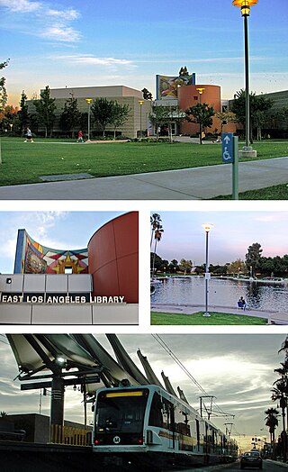
<span class="mw-page-title-main">East Los Angeles, California</span> Unincorporated neighborhood in California, United States

East Los Angeles, or East L.A., often referred to by locals as "East Los", is an unincorporated area in Los Angeles County, California, United States. For statistical purposes, the United States Census Bureau regards East Los Angeles as a census-designated place (CDP). As of the 2020 census it had a population of 118,786, a drop of 6.1% from 2010, when the population was 126,496.
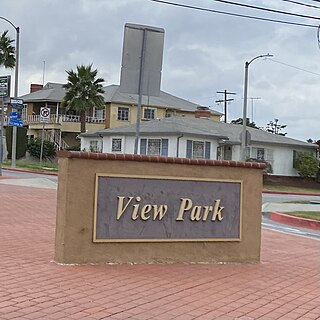
<span class="mw-page-title-main">View Park–Windsor Hills, California</span> Unincorporated community in California, United States

View Park−Windsor Hills is an unincorporated community in Los Angeles County, California. The View Park neighborhood is the community surrounding Angeles Vista Boulevard and the Windsor Hills neighborhood is on the southern end to the north of Slauson Avenue.

<span class="mw-page-title-main">San Pedro, Los Angeles</span> Neighborhood of Los Angeles in California, United States

San Pedro is a neighborhood within the City of Los Angeles, California. Formerly a separate city, it consolidated with Los Angeles in 1909. The Port of Los Angeles, a major international seaport, is partially located within San Pedro. The district has grown from being dominated by the fishing industry, to a working-class community within the city of Los Angeles, to a rapidly gentrifying community.

<span class="mw-page-title-main">Westchester, Los Angeles</span> Neighborhood of Los Angeles in the United States

Westchester is a neighborhood in the City of Los Angeles and the Westside Region of Los Angeles County, California.

<span class="mw-page-title-main">Mar Vista, Los Angeles</span> Neighborhood of Los Angeles in California, United States of America

Mar Vista is a neighborhood on the Westside of Los Angeles, California. In 1927, Mar Vista became the 70th community to be annexed to Los Angeles. It was designated as an official city neighborhood in 2006.
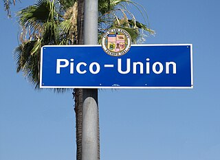
<span class="mw-page-title-main">Pico-Union, Los Angeles</span> Neighborhood of Los Angeles in California, United States of America

Pico-Union is a neighborhood in Central Los Angeles, California. The name "Pico-Union" refers to the neighborhood that surrounds the intersection of Pico Boulevard and Union Avenue. Located immediately west of Downtown Los Angeles, it is home to over 40,000 residents.

<span class="mw-page-title-main">Eastside Los Angeles</span> Eastside Los Angeles

The Eastside is an urban region in Los Angeles County, California. It includes the Los Angeles City neighborhoods east of the Los Angeles River—that is, Boyle Heights, El Sereno, and Lincoln Heights—as well as unincorporated East Los Angeles.

<span class="mw-page-title-main">El Sereno, Los Angeles</span> Neighborhood of Los Angeles in California, United States

El Sereno is a Los Angeles neighborhood in the Eastside Los Angeles region of Los Angeles County, California.

<span class="mw-page-title-main">Los Angeles Department of Transportation</span>

The Los Angeles Department of Transportation, commonly referred to as LADOT, is a municipal agency that oversees transportation planning, design, construction, maintenance and operations within the city of Los Angeles. LADOT was created by city ordinance, and is run by a general manager appointed by the Mayor of Los Angeles, under the oversight of a citizens' commission also appointed by the mayor. LADOT is best known for providing public transportation to the City of Los Angeles. It currently operates the second-largest fleet in Los Angeles County next to Metro. It consist of over 300 vehicles, serving nearly 30 million passengers a year and operating over 800,000 hours.

<span class="mw-page-title-main">Harbor Gateway, Los Angeles</span> Neighborhood of Los Angeles in California, United States

The Harbor Gateway is a 5.14-square-mile residential and industrial area (13.3 km2) in the Los Angeles Harbor Region, in the southern part of the city. The neighborhood is narrow and long, running along a north-south axis. Its unusual shape has given it the alternative name of "the Shoestring Strip". The northern limit of the neighborhood is Imperial Highway, a city street just north of I-105.

<span class="mw-page-title-main">Garfield High School (California)</span> Public school in East Los Angeles, California, United States

James A. Garfield High School is a public, year-round high school founded in 1925 in East Los Angeles, an unincorporated section of Los Angeles County, California. The proportion of advanced placement by students at Garfield is 38%. Students who are in unfavorable circumstances, with regard to financial or social opportunities, comprise about 93% of the student population. The minority comprehensive admission is 100%. Garfield is one out of 254 high schools in the Los Angeles Unified School District as of 2020. The magnet program in the high school focuses on serving students who plan to study in the Computer Science field. The school was made famous by the film Stand and Deliver about the teacher Jaime Escalante and the HBO film Walkout. The homecoming football game known as the East LA Classic has taken place since 1925.

East Los Streetscapers Public Art Studios is a muralist art collective and fine art studio based in East Los Angeles, California. Its members have executed over twenty murals and large-scale public artworks, primarily in the Los Angeles area.

<span class="mw-page-title-main">Historic South Central Los Angeles</span> Neighborhood of Los Angeles in California, United States

Historic South Central Los Angeles is a 2.25-square-mile neighborhood in Los Angeles, California, within the South Los Angeles region. It is the site of the Bob Hope Patriotic Hall.

Esteban Torres High School is a public high school, it opened in 2010 in East Los Angeles, an unincorporated section of Los Angeles County, California.

<span class="mw-page-title-main">Vermont Vista, Los Angeles</span> Neighborhood of Los Angeles in California, United States

Vermont Vista is a neighborhood in Los Angeles, California, within the South Los Angeles area.
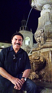
<span class="mw-page-title-main">Jose Luis Gonzalez (artist)</span> American sculptor

Jose Luis Gonzalez is a restorer, designer, painter, muralist, sculptor, ceramist, appraiser, importer, and arts administrator.

Sherwood Forest is a residential neighborhood in the San Fernando Valley region of the City of Los Angeles, California.

References

  1. "East Los Angeles, California (CA) profile: population, maps, real estate, averages, homes, statistics, relocation, travel, jobs, hospitals, schools, crime, moving, houses, news, sex offenders". www.city-data.com.
  2. Bureau, U.S. Census. "American FactFinder - Search". factfinder.census.gov. Archived from the original on February 16, 2020. Retrieved April 24, 2018.
  3. "LADOT DASH el Sereno/City Terrace - Transit.Wiki".
  4. "East Los Streetscapers - Mural Conservancy of Los Angeles". muralconservancy.org. May 12, 2021.
  5. "Los Angeles County Department of Parks and Recreation-Parks-Full List of Parks-City Terrace Park1". Archived from the original on March 27, 2015. Retrieved April 30, 2015.
  6. "City Terrace Library - County of Los Angeles Public Library". www.colapublib.org. Archived from the original on April 25, 2018. Retrieved April 30, 2015.
  7. "Central Health Center." Los Angeles County Department of Health Services. Retrieved on March 18, 2010.
  8. "Whoismyrepresentative.com". whoismyrepresentative.com.
  9. "Assembly Democratic Caucus". Assembly Democratic Caucus. Archived from the original on January 11, 2013. Retrieved April 30, 2015.
  10. "Sign In". achieve.lausd.net.
  11. "City Terrace Elementary School: Home Page". cityterrace-lausd-ca.schoolloop.com.