
Los Angeles County, officially the County of Los Angeles, and sometimes abbreviated as L.A. County, is the most populous county in the United States, with 9,861,224 residents estimated in 2022. Its population is greater than that of 40 individual U.S. states. Comprising 88 incorporated cities and many unincorporated areas within a total area of 4,083 square miles (10,570 km2), it is home to more than a quarter of Californians and is one of the most ethnically diverse U.S. counties. The county's seat, Los Angeles, is the second most populous city in the United States and the most populous city in California, with 3,822,238 residents estimated in 2022. It is also known for being the home of the American film and television industry, a distinction it has held since the early 20th century which has given the county global prominence.

Avocado Heights is an unincorporated census-designated place (CDP) in the San Gabriel Valley of Los Angeles County, California, United States. It is almost entirely surrounded by the City of Industry with only a small strip of unincorporated Los Angeles County separating it from South El Monte. It is in close proximity to both the Pomona (SR-60) and San Gabriel (I-605) freeways. To the west is the San Gabriel River and the California Country Club. Avocado Heights is approximately 15 miles (24 km) from the downtown Los Angeles Civic Center. The population was 15,411 at the 2010 census, up from 15,148 at the 2000 census.

The City of Industry is a city in the San Gabriel Valley, in eastern Los Angeles County, California, United States. The city is almost entirely industrial, containing over 3,000 businesses employing 67,000 people, with only 264 residents as of the 2020 census, making it the third least populous city in the state. It was incorporated on June 18, 1957, and has become the economic hub for the San Gabriel Valley.

La Puente is a city in Los Angeles County, California, United States. The city had a population of 39,816 at the 2010 census and is approximately 20 miles (32 km) east of downtown Los Angeles.

Rowland Heights is an unincorporated area in and below the Puente Hills in the San Gabriel Valley, in Los Angeles County, California, United States. The population was 48,231 at the 2020 census. Rowland Heights is in the Los Angeles metropolitan area and represented by the County of Los Angeles and is the largest census designated place in Los Angeles County by area and the county's fourth largest CDP by population. The area has a high Taiwanese population and was known as “Little Taipei” in the 1980s and 1990s, when it saw an influx of wealthy immigrants from Taiwan.

Walnut is a city in the eastern part of Los Angeles County in the U.S. state of California. According to the 2010 census, the city had a population of 29,172, and the population was estimated to be 29,685 in 2019.

West Puente Valley is an unincorporated community and census-designated place in Los Angeles County, California, USA, northwest of La Puente. The population was 22,636 at the 2010 census, up from 22,589 at the 2000 census. The community is probably named for its location related to the city of La Puente.

Hacienda Heights is an unincorporated suburban community in Los Angeles County, California, United States. As of the 2020 census, the community had a total population of 54,191, up from 54,038 at the 2010 census. For statistical purposes, the Census Bureau has defined Hacienda Heights as a census designated place (CDP). It is the second largest CDP in Los Angeles County by area, behind Topanga, and the county's fourth largest CDP by population.

The San Gabriel Valley, often referred to by its initials as SGV, is one of the principal valleys of Southern California, with the city of Los Angeles directly bordering it to the west, and occupying the vast majority of the southeastern part of Los Angeles County. Surrounding landforms and other features include the following:
The Puente Hills are a chain of hills, one of the lower Transverse Ranges, in an unincorporated area in eastern Los Angeles County, California, in the United States. The western end of the range is often referred to locally as the Whittier Hills.
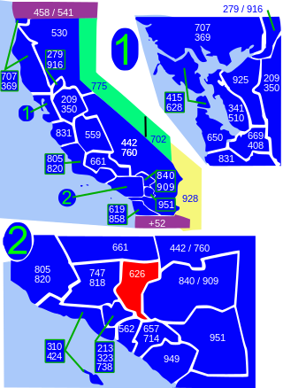
Area code 626 is a telephone area code in the North American Numbering Plan for most of the San Gabriel Valley in the U.S. state of California. The numbering plan area also comprises nearby areas in the northeastern portion of Los Angeles County, California, including Arcadia, Monrovia, El Monte, most of Pasadena and West Covina. The numbering plan area was split from that of area code 818 on June 14, 1997.

California's 38th congressional district is a congressional district in the U.S. state of California based in suburban eastern Los Angeles County and Orange County, California. The district is currently represented by Democrat Linda Sánchez.
The Hacienda La Puente Unified School District (HLPUSD) is a school district located in Southern California. It is the largest school district in the east San Gabriel Valley in terms of student population, serving 20,000 students from the unincorporated community of Hacienda Heights, portions of the cities of Industry, La Puente and West Covina and portions of the unincorporated communities of Avocado Heights, Valinda and West Puente Valley. The district's headquarters are located in the city of Industry.
The Workman–Temple family relates to the pioneer interconnected Workman and Temple families that were prominent in: the history of colonial Pueblo de Los Angeles and American Los Angeles; the Los Angeles Basin and San Gabriel Valley regions; and Southern California from 1830 to 1930 in Mexican Alta California and the subsequent state of California, United States.

Rancho La Puente was a ranch in the southern San Gabriel Valley that measured just under 49,000 acres (200 km2), and remained intact from its establishment in the late 1700s as an outpost of Mission San Gabriel until about 1870. By modern landmarks, the ranch extended from San Gabriel River on the west to just west of the 57 Freeway on the east and from Ramona Boulevard/San Bernardino Road on the north to the Puente Hills on the south. All but 40 acres (160,000 m2), which fall within Orange County, are within Los Angeles County. The present communities of Avocado Heights, Bassett, Baldwin Park, San Dimas, Rowland Heights, Hacienda Heights, City of Industry, La Puente, Walnut, Covina, West Covina, and small sections of South El Monte and Irwindale are contained within the old boundaries of Rancho La Puente.
John A. Rowland, commonly known in Spanish as Don Juan Rowland, was an American-Mexican settler and ranchero in the San Gabriel Valley of California before it became part of the United States. Born in Maryland, Rowland moved west with his family to Ohio. As a young man, he immigrated to the Mexican territory of Santa Fe de Nuevo México. There he became a naturalized Mexican citizen and married María Encarnación Martínez, his first wife.
Rancho La Habra was a 6,698-acre (27.11 km2) Mexican land grant in present-day Los Angeles County and Orange County, California given in 1839 by Governor Juan Alvarado to Mariano Reyes Roldan. The name refers to the "Pass Through the Hills", the natural pass to the north between the Chino Hills and Puente Hills into the San Gabriel Valley, first discovered by Spanish explorers in 1769. The La Habra grant was shaped like a wedge pointed south. The rancho lands included the present day cities of La Habra and La Habra Heights.
Hillgrove is an unincorporated community located in the southern San Gabriel Valley of eastern Los Angeles County, California. The population in 1960 was 14,669.
The Bassett Unified School District is a California public unified school district based in the La Puente Valley of the eastern region of the San Gabriel Valley in Los Angeles County, California, United States.


