
There are 88 cities in Los Angeles County, California . Each city has a mayor and a city council.
There are 88 cities in Los Angeles County, California . Each city has a mayor and a city council.
| City | Date incorporated | Population as of (2020 Census) |
|---|---|---|
| Agoura Hills | December 8, 1982 | 20,299 |
| Alhambra | July 11, 1903 | 82,868 |
| Arcadia | August 5, 1903 | 56,681 |
| Artesia | May 29, 1959 | 16,395 |
| Avalon | June 26, 1913 | 3,460 |
| Azusa | December 29, 1898 | 50,000 |
| Baldwin Park | January 25, 1956 | 72,176 |
| Bell | November 7, 1927 | 33,559 |
| Bell Gardens | August 1, 1961 | 39,501 |
| Bellflower | September 3, 1957 | 79,190 |
| Beverly Hills | October 22, 1906 | 32,701 |
| Bradbury | July 26, 1957 | 921 |
| Burbank | July 8, 1911 | 107,337 |
| Calabasas | April 5, 1991 | 23,241 |
| Carson | February 20, 1968 | 95,558 |
| Cerritos | April 24, 1956 | 49,578 |
| Claremont | October 3, 1907 | 37,266 |
| Commerce | January 28, 1960 | 12,378 |
| Compton | May 11, 1888 | 95,740 |
| Covina | August 14, 1901 | 51,268 |
| Cudahy | November 10, 1960 | 22,811 |
| Culver City | September 20, 1917 | 40,779 |
| Diamond Bar | April 18, 1989 | 55,072 |
| Downey | December 17, 1956 | 114,355 |
| Duarte | August 22, 1957 | 21,727 |
| El Monte | November 18, 1912 | 109,450 |
| El Segundo | January 18, 1917 | 17,272 |
| Gardena | September 11, 1930 | 61,027 |
| Glendale | February 15, 1906 | 196,543 |
| Glendora | November 13, 1911 | 52,558 |
| Hawaiian Gardens | April 9, 1964 | 14,149 |
| Hawthorne | July 12, 1922 | 88,083 |
| Hermosa Beach | January 10, 1907 | 19,728 |
| Hidden Hills | October 19, 1961 | 1,725 |
| Huntington Park | September 1, 1906 | 54,883 |
| Industry | June 18, 1957 | 264 |
| Inglewood | February 14, 1908 | 107,762 |
| Irwindale | August 6, 1957 | 1,472 |
| La Cañada Flintridge | December 8, 1976 | 20,573 |
| La Habra Heights | December 4, 1978 | 5,682 |
| La Mirada | March 23, 1960 | 48,008 |
| La Puente | August 1, 1956 | 38,062 |
| La Verne | September 11, 1906 | 31,334 |
| Lakewood | April 16, 1954 | 82,496 |
| Lancaster | November 22, 1977 | 173,516 |
| Lawndale | December 28, 1959 | 31,807 |
| Lomita | June 30, 1964 | 20,921 |
| Long Beach | December 13, 1897 | 466,742 |
| Los Angeles | April 4, 1850 | 3,898,747 |
| Lynwood | July 16, 1921 | 67,265 |
| Malibu | March 28, 1991 | 10,654 |
| Manhattan Beach | December 7, 1912 | 35,506 |
| Maywood | September 2, 1924 | 25,138 |
| Monrovia | December 15, 1887 | 37,931 |
| Montebello | October 15, 1920 | 62,640 |
| Monterey Park | May 29, 1916 | 61,096 |
| Norwalk | August 26, 1957 | 102,773 |
| Palmdale | August 24, 1962 | 169,450 |
| Palos Verdes Estates | December 20, 1939 | 13,347 |
| Paramount | January 30, 1957 | 53,733 |
| Pasadena | June 19, 1886 | 138,699 |
| Pico Rivera | January 29, 1958 | 62,088 |
| Pomona | January 6, 1888 | 151,713 |
| Rancho Palos Verdes | September 7, 1973 | 42,287 |
| Redondo Beach | April 29, 1892 | 71,576 |
| Rolling Hills | September 18, 1957 | 1,739 |
| Rolling Hills Estates | January 24, 1957 | 8,280 |
| Rosemead | August 4, 1959 | 51,185 |
| San Dimas | August 4, 1960 | 34,924 |
| San Fernando | August 31, 1911 | 23,946 |
| San Gabriel | April 24, 1913 | 39,568 |
| San Marino | April 25, 1913 | 12,513 |
| Santa Clarita | December 15, 1987 | 228,673 |
| Santa Fe Springs | May 15, 1957 | 19,219 |
| Santa Monica | December 9, 1886 | 93,076 |
| Sierra Madre | February 7, 1907 | 11,268 |
| Signal Hill | April 22, 1924 | 11,848 |
| South El Monte | July 30, 1958 | 19,567 |
| South Gate | January 15, 1923 | 92,726 |
| South Pasadena | February 29, 1888 | 26,943 |
| Temple City | May 25, 1960 | 36,494 |
| Torrance | May 12, 1921 | 147,067 |
| Vernon | September 22, 1905 | 222 |
| Walnut | January 19, 1959 | 28,430 |
| West Covina | February 17, 1923 | 109,501 |
| West Hollywood | November 29, 1984 | 35,757 |
| Westlake Village | December 11, 1981 | 8,029 |
| Whittier | February 28, 1898 | 87,306 |

Los Angeles, often referred to by its initials L.A., and officially the City of Los Angeles, is the most populous city in the state of California. With roughly 3.9 million residents within the city limits as of 2020, Los Angeles is the second-most populous city in the United States, behind only New York City, and is the commercial, financial, and cultural center of the Southern California region. Los Angeles has a Mediterranean climate, an ethnically and culturally diverse population, and a sprawling metropolitan area.

Orange County, often known by its initials O.C., is a county located in the Los Angeles metropolitan area in Southern California, United States. As of the 2020 census, the population was 3,186,989, making it the third-most-populous county in California, the sixth-most-populous in the United States, and more populous than 19 American states and Washington, D.C. Although largely suburban, it is the second-most-densely-populated county in the state behind San Francisco County. The county's three most-populous cities are Anaheim, Santa Ana, and Irvine, each of which has a population exceeding 300,000. Santa Ana is also the county seat. Six cities in Orange County are on the Pacific coast: Seal Beach, Huntington Beach, Newport Beach, Laguna Beach, Dana Point, and San Clemente.

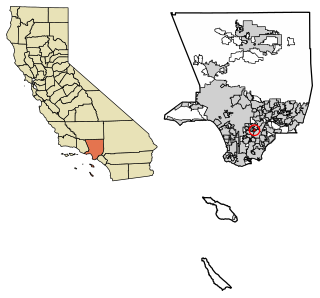
Los Angeles County, officially the County of Los Angeles, and sometimes abbreviated as L.A. County, is the most populous county in the United States, with 9,861,224 residents estimated in 2022. Its population is greater than that of 40 individual U.S. states. Comprising 88 incorporated cities and many unincorporated areas within a total area of 4,083 square miles (10,570 km2), it is home to more than a quarter of Californians and is one of the most ethnically diverse U.S. counties. The county's seat, Los Angeles, is the second most populous city in the United States, with about 3.9 million residents. Being the home of the U.S. motion-picture industry, since its inception in the early 20th century, has given the county global prominence.

Greater Los Angeles is the second-largest metropolitan area in the United States, with a population of 18.5 million in 2021, encompassing six counties in Southern California extending from Ventura County in the west to San Bernardino County and Riverside County in the east, with Los Angeles County in the center, Kern County in the North, and Orange County to the southeast. According to the U.S. Census Bureau, the Los Angeles–Anaheim–Riverside combined statistical area covers 33,954 square miles (87,940 km2), making it the largest metropolitan region in the United States by land area. Of this, the contiguous urban area is 2,281 square miles (5,910 km2), the remainder mostly consisting of mountain and desert areas. In addition to being the nexus of the global entertainment industry, Greater Los Angeles is also an important center of international trade, education, media, business, tourism, technology, and sports. It is the 3rd largest metropolitan area by nominal GDP in the world with an economy exceeding $1 trillion in output.
Bell Gardens is a city in the U.S. state of California in the Los Angeles metropolitan area. Located in Los Angeles County, the city's population was 42,072 at the 2010 census, down from 44,054 at the 2000 census. Bell Gardens is part of the Gateway Cities Region, a largely urbanized region located in southeastern Los Angeles County.
Compton is a city in southern Los Angeles County, California, United States, situated south of downtown Los Angeles. Compton is one of the oldest cities in the county and, on May 11, 1888, was the eighth city in Los Angeles County to incorporate. As of the 2010 United States Census, the city had a total population of 96,456. It is known as the "Hub City" due to its geographic centrality in Los Angeles County. Neighborhoods in Compton include Sunny Cove, Leland, downtown Compton, and Richland Farms.

Cudahy is a city located in southeastern Los Angeles County, California, United States. In area, Cudahy is the second smallest city in Los Angeles County after Hawaiian Gardens but with one of the highest population densities of any incorporated city in the United States. It is part of the Gateway Cities region and had a population of 23,805 as of the 2010 U.S. Census.
East Los Angeles, or East L.A., often referred to by locals as "East Los", is an unincorporated area in Los Angeles County, California, United States. For statistical purposes, the United States Census Bureau regards East Los Angeles as a census-designated place (CDP). As of the 2020 census it had a population of 118,786, a drop of 6.1% from 2010, when the population was 126,496.
Huntington Park is a city located in the south central region of Los Angeles County, California.

Ladera Heights is a community and unincorporated area in Los Angeles County, California. The population was 6,634 at the 2020 census. Culver City lies to its west, the Baldwin Hills neighborhood to its north, the View Park-Windsor Hills community to its east, the Westchester neighborhood to its south and southwest and the city of Inglewood to its southeast. With an average household income of $132,824, Ladera Heights ranks third amongst the ten wealthiest Black communities in the United States.

Pomona is a city in eastern Los Angeles County, California, United States. Pomona is located in the Pomona Valley, between the Inland Empire and the San Gabriel Valley. At the 2020 census, the city's population was 151,713. The main campus of California State Polytechnic University, Pomona, also known as Cal Poly Pomona, lies partially within Pomona's city limits, with the rest being located in the neighboring unincorporated community of Ramona.
San Fernando is a general-law city in the San Fernando Valley region of Los Angeles County, California, in the Los Angeles metropolitan area. It is bordered on all sides by the City of Los Angeles. As of the 2020 census the population of San Fernando was 23,946.
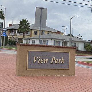
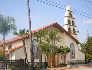
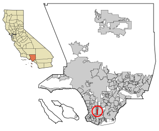
View Park−Windsor Hills is an unincorporated community in Los Angeles County, California. The View Park neighborhood is the community surrounding Angeles Vista Boulevard and the Windsor Hills neighborhood is on the southern end to the north of Slauson Avenue.

West Athens is a census-designated place (CDP) in Los Angeles County, California. The population was 9,393 at the 2020 census. It is an unincorporated community within the 2nd Supervisorial District of Los Angeles County. West Athens is served by the Los Angeles County Sheriff's Department, operating out of the South Los Angeles Station. The approximate boundaries for West Athens are: 87th Street to the north, Vermont Avenue to the east, El Segundo Boulevard to the south, and approximately Western Avenue to Van Ness Avenue to the west. West Athens is predominantly residential, with commercial uses along its main corridors. Los Angeles Southwest Community College lies within the West Athens neighborhood and city limits.
West Carson is an unincorporated community in Los Angeles County, California. The population was 21,699 at the 2010 census, up from 21,138 at the 2000 census. For statistical purposes, the United States Census Bureau has defined West Carson as a census-designated place (CDP).
California is the most populated U.S. state, with an estimated population of 39.2 million as of January 1, 2022. It has people from a wide variety of ethnic, racial, national, and religious backgrounds.

South Los Angeles, also known as South Central Los Angeles or simply South Central, is a region in southwestern Los Angeles County, lying mostly within the city limits of Los Angeles, south of downtown. It is "defined on Los Angeles city maps as a 16-square-mile rectangle with two prongs at the south end.” In 2003, the Los Angeles City Council renamed this area "South Los Angeles".

Lynwood is a city in Los Angeles County, California, United States. At the 2010 census, the city had a total population of 69,772, down from 69,845 at the 2000 census. Lynwood is located near South Gate and Compton in the central portion of the Los Angeles Basin. Incorporated in 1921, Lynwood was named after the Lynwood Dairy and Creamery, from which the local station of the Pacific Electric Railway had been named.
Hispanic and Latino Californians are residents of the state of California who are of Hispanic or Latino ancestry. As of the 2020 U.S. Census, Hispanics and Latinos of any race were 39.4% of the state's population, making it the largest ethnicity in California.
White Californians are white Americans living in California who currently make up 41.2% of the state's population according to the official 2020 census.
